 |
|
Fayette Rgnl Air Center Airport |
Coordinates: 29°54′29″N 096°57′00″W / 29.90806°N 96.95°W / 29.90806; -96.95
| Fayette Regional Air Center |
| IATA: none – ICAO: none – FAA LID: 3T5 |
| Summary |
| Airport type |
Public |
| Owner |
Fayette County |
| Location |
La Grange, Texas |
| Elevation AMSL |
324 ft / 99 m |
| Website |
www.co.fayette.tx.us/frac/ |
| Runways |
| Direction |
Length |
Surface |
| ft |
m |
| 16/34 |
5,001 |
1,524 |
Asphalt |
| Statistics (2007) |
| Aircraft operations |
9,000 |
| Based aircraft |
30 |
| Sources: airport web site and FAA |
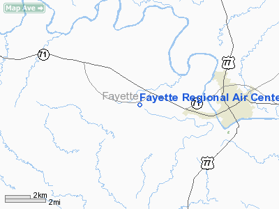
Fayette Regional Air Center (FAA LID: 3T5) is a county-owned public-use airport in unincorporated Fayette County, Texas, United States, located two miles (3 kilometers) west of the central business district of the City of La Grange.
Facilities and aircraft
Fayette Regional Air Center covers an area of 195 acres (79 ha) which contains one runway designated 16/34 with a 5,001 x 75 ft (1,524 x 23 m) asphalt surface. For the 12-month period ending June 5, 2007, the airport had 9,000 general aviation aircraft operations, an average of 24 per day. There are 30 aircraft based at this airport: 83% single-engine, 13% multi-engine and 3% jet.
The above content comes from Wikipedia and is published under free licenses – click here to read more.
Location & QuickFacts
| FAA Information Effective: | 2008-09-25 |
| Airport Identifier: | 3T5 |
| Airport Status: | Operational |
| Longitude/Latitude: | 096-57-00.0460W/29-54-28.6980N
-96.950013/29.907972 (Estimated) |
| Elevation: | 324 ft / 98.76 m (Surveyed) |
| Land: | 195 acres |
| From nearest city: | 2 nautical miles W of La Grange, TX |
| Location: | Fayette County, TX |
| Magnetic Variation: | 06E (2000) |
Owner & Manager
| Ownership: | Publicly owned |
| Owner: | Fayette County |
| Address: | County Courthouse
La Grange, TX 78945 |
| Phone number: | 979-968-6469 |
| Manager: | Joseph (skip) Caldwell |
| Address: | 850 Airport Road
La Grange, TX 78945 |
| Phone number: | 979-242-4056
AFTER HOURS PHONE 979-966-9139. |
Airport Operations and Facilities
| Airport Use: | Open to public |
| Wind indicator: | Yes |
| Segmented Circle: | Yes |
| Control Tower: | No |
| Lighting Schedule: | DUSK-DAWN
MIRL RY 16/34 PRESET LOW INTST; TO INCR INTST ACTVT CTAF. |
| Beacon Color: | Clear-Green (lighted land airport) |
| Sectional chart: | Houston |
| Region: | ASW - Southwest |
| Boundary ARTCC: | ZHU - Houston |
| Tie-in FSS: | CXO - Montgomery County |
| FSS on Airport: | No |
| FSS Toll Free: | 1-800-WX-BRIEF |
| NOTAMs Facility: | 3T5 (NOTAM-d service avaliable) |
| Federal Agreements: | NGY |
Airport Communications
| CTAF: | 122.700 |
| Unicom: | 122.700 |
Airport Services
| Fuel available: | 100LLA
FUEL AVBL 24 HRS WITH CREDIT CARD. |
| Airframe Repair: | MINOR |
| Power Plant Repair: | MINOR |
Runway Information
Runway 16/34
| Dimension: | 5001 x 75 ft / 1524.3 x 22.9 m |
| Surface: | ASPH, Good Condition |
| Weight Limit: | Single wheel: 30000 lbs. |
| Edge Lights: | Medium |
| |
Runway 16 |
Runway 34 |
| Longitude: | 096-57-08.6020W | 096-56-51.4920W |
| Latitude: | 29-54-52.3420N | 29-54-05.0970N |
| Elevation: | 308.00 ft | 322.00 ft |
| Alignment: | 127 | 127 |
| Traffic Pattern: | Left | Left |
| Markings: | Non-precision instrument, Good Condition | Non-precision instrument, Fair Condition |
| Crossing Height: | 35.00 ft | 25.00 ft |
| VASI: | 2-light PAPI on left side | 2-light PAPI on left side |
| Visual Glide Angle: | 3.00° | 3.00° |
| Runway End Identifier: | Yes | Yes |
| Obstruction: | 39 ft trees, 1285.0 ft from runway, 160 ft left of centerline, 27:1 slope to clear | 49 ft tree, 1425.0 ft from runway, 357 ft left of centerline, 25:1 slope to clear |
|
Radio Navigation Aids
| ID |
Type |
Name |
Ch |
Freq |
Var |
Dist |
| GYB | NDB | Lee County | | 385.00 | 07E | 15.8 nm |
| BNH | NDB | Brenham | | 362.00 | 06E | 35.4 nm |
| OKT | NDB | Yoakum | | 350.00 | 06E | 37.2 nm |
| ELA | VOR/DME | Eagle Lake | 111X | 116.40 | 08E | 36.2 nm |
| IDU | VORTAC | Industry | 039X | 110.20 | 08E | 20.4 nm |
| CWK | VORTAC | Centex | 075X | 112.80 | 06E | 41.3 nm |
Remarks
- GCO AVBL ON FREQ 121.725 THRU HOUSTON ARTCC & FLT SVCS.
- PRVDD MEASURES ARE TAKEN TO CLOSE OR RELOCATE ROADWAYS THAT MAY PREVENT ADEQUATE DESIGN CLEARANCES & THAT GUENTHER FLD ARPT CLOSES TO AERONAUTICAL OPNS PRIOR TO ANY FLIGHT ACTVITY AT THIS FACILITY.
Images and information placed above are from
http://www.airport-data.com/airport/3T5/
We thank them for the data!
| General Info
|
| Country |
United States
|
| State |
TEXAS
|
| FAA ID |
3T5
|
| Latitude |
29-54-28.698N
|
| Longitude |
096-57-00.046W
|
| Elevation |
324 feet
|
| Near City |
LA GRANGE
|
We don't guarantee the information is fresh and accurate. The data may
be wrong or outdated.
For more up-to-date information please refer to other sources.
|
|


