 |
|
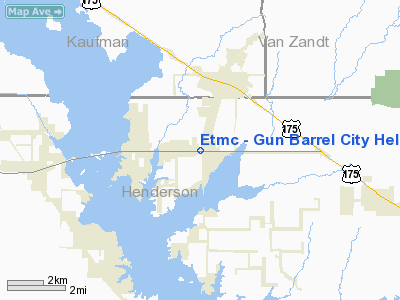
Etmc - Gun Barrel City Heliport |
Location & QuickFacts
| FAA Information Effective: | 2008-09-25 |
| Airport Identifier: | TS72 |
| Airport Status: | Operational |
| Longitude/Latitude: | 096-06-48.9000W/32-19-52.8100N
-96.113583/32.331336 (Estimated) |
| Elevation: | 385 ft / 117.35 m (Estimated) |
| Land: | 0 acres |
| From nearest city: | 2 nautical miles E of Gun Barrel City, TX |
| Location: | Henderson County, TX |
| Magnetic Variation: | () |
Owner & Manager
| Ownership: | Privately owned |
| Owner: | East Texas Medical Center |
| Address: | 100 Municipal Dr
Gun Barrel City, TX 75156 |
| Phone number: | 903-676-1191 |
| Manager: | Steve Lowe |
| Address: | 100 Municipal Dr
Gun Barrel City, TX 75156 |
| Phone number: | 903-676-1151 |
Airport Operations and Facilities
| Airport Use: | Private
MEDICAL. |
| Control Tower: | No |
| Lighting Schedule: | PHONE REQ
FOR PERIMETER LGTS CALL 903-676-1151. |
| Sectional chart: | Dallas-ft Worth |
| Region: | ASW - Southwest |
| Boundary ARTCC: | ZFW - Fort Worth |
| Tie-in FSS: | FTW - Fort Worth |
| FSS Phone: | 817-541-3474 |
| FSS Toll Free: | 1-800-WX-BRIEF |
Runway Information
Helipad H1
| Dimension: | 100 x 100 ft / 30.5 x 30.5 m |
| Surface: | CONC, |
| |
Runway H1 |
Runway |
| Traffic Pattern: | Left | Left |
|
Radio Navigation Aids
| ID |
Type |
Name |
Ch |
Freq |
Var |
Dist |
| AHX | NDB | Athens | | 269.00 | 06E | 17.7 nm |
| CSZ | NDB | Crossroads | | 215.00 | 08E | 17.9 nm |
| LIQ | NDB | Lochridge Ranch | | 335.00 | 09E | 20.9 nm |
| CGQ | NDB | Powell | | 344.00 | 06E | 22.7 nm |
| CRS | NDB | Corsicana | | 396.00 | 06E | 23.2 nm |
| AVZ | NDB | Travis | | 260.00 | 06E | 26.7 nm |
| PYF | NDB | Pyramid | | 418.00 | 06E | 28.5 nm |
| JUG | NDB | Jecca | | 388.00 | 06E | 29.3 nm |
| TY | NDB | Tyler | | 320.00 | 06E | 33.1 nm |
| LNC | NDB | Lancaster | | 239.00 | 06E | 34.2 nm |
| PQF | NDB | Mesquite | | 248.00 | 06E | 35.6 nm |
| SYW | NDB | Cash | | 428.00 | 05E | 39.2 nm |
| PSN | NDB | Palestine | | 375.00 | 04E | 39.2 nm |
| MII | NDB | Caddo Mills | | 316.00 | 06E | 43.2 nm |
| RBD | NDB | Redbird | | 287.00 | 06E | 43.7 nm |
| LXY | NDB | Mexia | | 329.00 | 07E | 46.3 nm |
| XQH | NDB | Cedar Hill | | 353.00 | 08E | 46.5 nm |
| MJF | TACAN | Arvilla | 033X | | 05E | 44.3 nm |
| FZT | VOR/DME | Frankston | 051X | 111.40 | 06E | 33.4 nm |
| TYR | VOR/DME | Tyler | 089X | 114.20 | 06E | 36.1 nm |
| CQY | VORTAC | Cedar Creek | 095X | 114.80 | 06E | 10.2 nm |
| DAL | VOT | Dallas Love Field | | 113.30 | | 48.6 nm |
Images and information placed above are from
http://www.airport-data.com/airport/TS72/
We thank them for the data!
| General Info
|
| Country |
United States
|
| State |
TEXAS
|
| FAA ID |
TS72
|
| Latitude |
33-08-57.432N
|
| Longitude |
097-29-46.086W
|
| Elevation |
900 feet
|
| Near City |
RHOME
|
We don't guarantee the information is fresh and accurate. The data may
be wrong or outdated.
For more up-to-date information please refer to other sources.
|
|


