|
|
 |
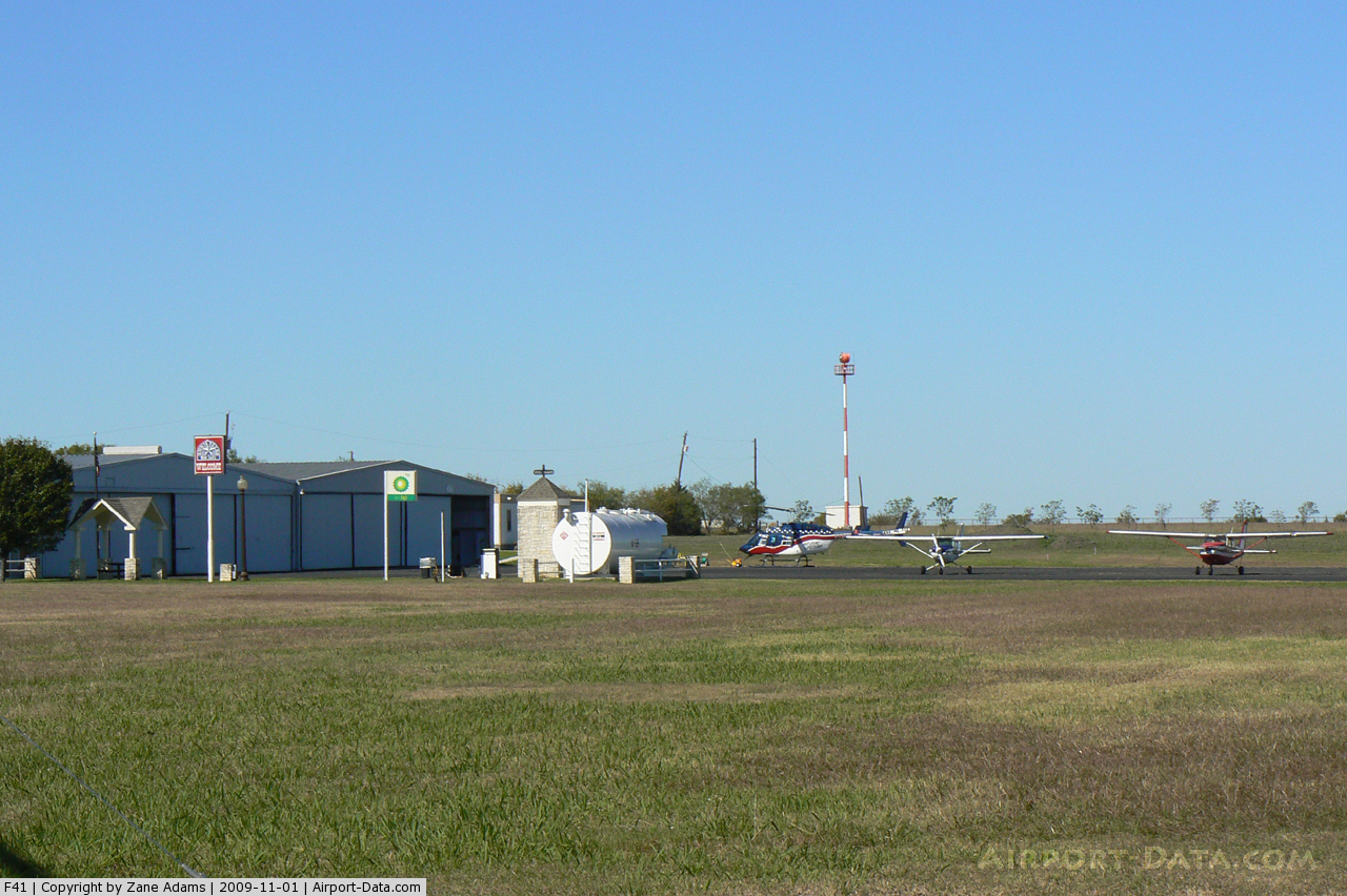
(Click on the photo to enlarge) |
 |
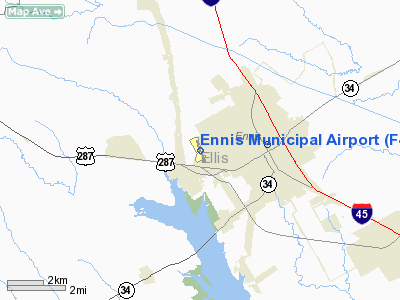
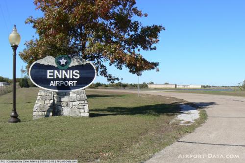
(Click on the photo to enlarge) |
Location & QuickFacts
| FAA Information Effective: | 2008-09-25 |
| Airport Identifier: | F41 |
| Airport Status: | Operational |
| Longitude/Latitude: | 096-39-50.0000W/32-19-46.9000N
-96.663889/32.329694 (Estimated) |
| Elevation: | 500 ft / 152.40 m (Surveyed) |
| Land: | 30 acres |
| From nearest city: | 2 nautical miles W of Ennis, TX |
| Location: | Ellis County, TX |
| Magnetic Variation: | 06E (1985) |
Owner & Manager
| Ownership: | Publicly owned |
| Owner: | City Of Ennis |
| Address: | Po Box 220
Ennis, TX 75120-0220 |
| Phone number: | 972-875-1234 |
| Manager: | Steve Howerton, City Mgr |
| Address: | 115 W Brown Street
Ennis, TX 75119 |
| Phone number: | 972-878-1234
EMERGENCY PHONE: 972-875-4462. |
Airport Operations and Facilities
| Airport Use: | Open to public |
| Wind indicator: | Yes |
| Segmented Circle: | Yes |
| Control Tower: | No |
| Lighting Schedule: | DUSK-DAWN
MIRL RY 15/33 PRESET LOW INTST; TO INCR INTST & ACTVT REIL & PAPI RYS 15 & 33 - CTAF. |
| Beacon Color: | Clear-Green (lighted land airport) |
| Landing fee charge: | No |
| Sectional chart: | Dallas-ft Worth |
| Region: | ASW - Southwest |
| Boundary ARTCC: | ZFW - Fort Worth |
| Tie-in FSS: | FTW - Fort Worth |
| FSS on Airport: | No |
| FSS Phone: | 817-541-3474 |
| FSS Toll Free: | 1-800-WX-BRIEF |
| NOTAMs Facility: | FTW (NOTAM-d service avaliable) |
| Federal Agreements: | NGY |
Airport Communications
Airport Services
| Fuel available: | 100LLA
FUEL AVBL 24 HRS WITH MAJOR CREDIT CARD. |
| Airframe Repair: | MAJOR |
| Power Plant Repair: | MAJOR |
| Bottled Oxygen: | NONE |
| Bulk Oxygen: | NONE |
Runway Information
Runway 15/33
| Dimension: | 3999 x 50 ft / 1218.9 x 15.2 m |
| Surface: | ASPH, Good Condition |
| Weight Limit: | Single wheel: 18000 lbs. |
| Edge Lights: | Medium |
| |
Runway 15 |
Runway 33 |
| Longitude: | 096-39-57.4390W | 096-39-42.6412W |
| Latitude: | 32-20-05.6790N | 32-19-28.1570N |
| Elevation: | 500.00 ft | 477.00 ft |
| Alignment: | 127 | 127 |
| Traffic Pattern: | Right | Left |
| Markings: | Basic, Good Condition | Basic, Good Condition |
| Crossing Height: | 35.00 ft | 35.00 ft |
| Displaced threshold: | 0.00 ft | 255.00 ft
THLD DSPLCD 749 FT INDEFLY. |
| VASI: | 2-light PAPI on left side | 2-light PAPI on left side |
| Visual Glide Angle: | 3.00° | 3.00° |
| Runway End Identifier: | Yes | Yes |
| Obstruction: | 43 ft tree, 780.0 ft from runway, 200 ft right of centerline, 13:1 slope to clear
+3 FT PLYWOOD BOARDS IN FRONT OF REILS 35 FT FM END OF RY 95 FT LEFT AND RIGHT. | 35 ft tree, 850.0 ft from runway, 75 ft right of centerline, 18:1 slope to clear
APCH SLOPE 25:1 AT DSPLD THLD.
6-8 FT TREES & BRUSH 0-145 FT FM END OF RY 0B. |
|
Radio Navigation Aids
| ID |
Type |
Name |
Ch |
Freq |
Var |
Dist |
| LNC | NDB | Lancaster | | 239.00 | 06E | 15.2 nm |
| CGQ | NDB | Powell | | 344.00 | 06E | 20.0 nm |
| JUG | NDB | Jecca | | 388.00 | 06E | 21.4 nm |
| XQH | NDB | Cedar Hill | | 353.00 | 08E | 22.3 nm |
| CRS | NDB | Corsicana | | 396.00 | 06E | 22.7 nm |
| RBD | NDB | Redbird | | 287.00 | 06E | 23.4 nm |
| PQF | NDB | Mesquite | | 248.00 | 06E | 29.6 nm |
| AVZ | NDB | Travis | | 260.00 | 06E | 33.3 nm |
| PYF | NDB | Pyramid | | 418.00 | 06E | 36.8 nm |
| CSZ | NDB | Crossroads | | 215.00 | 08E | 39.3 nm |
| LIQ | NDB | Lochridge Ranch | | 335.00 | 09E | 40.9 nm |
| LXY | NDB | Mexia | | 329.00 | 07E | 42.2 nm |
| AHX | NDB | Athens | | 269.00 | 06E | 43.6 nm |
| MII | NDB | Caddo Mills | | 316.00 | 06E | 47.6 nm |
| SYW | NDB | Cash | | 428.00 | 05E | 49.5 nm |
| NFW | TACAN | Nas Jrb Fort Worth | 024X | | 07E | 47.4 nm |
| CVE | VOR/DME | Cowboy | 109X | 116.20 | 06E | 35.8 nm |
| TTT | VOR/DME | Maverick | 078X | 113.10 | 06E | 37.6 nm |
| GNL | VOR/DME | Groesbeck | 025X | 108.80 | 05E | 45.4 nm |
| CQY | VORTAC | Cedar Creek | 095X | 114.80 | 06E | 24.3 nm |
| FUZ | VORTAC | Ranger | 104X | 115.70 | 06E | 42.6 nm |
| DAL | VOT | Dallas Love Field | | 113.30 | | 32.5 nm |
| FTW | VOT | Fort Worth Meacham | | 108.20 | | 45.8 nm |
Remarks
- WATCH FOR BIRDS AT SOUTH END OF AIRPORT
- BUMPS NORTH END OF RY 15.
Images and information placed above are from
http://www.airport-data.com/airport/F41/
We thank them for the data!
| General Info
|
| Country |
United States
|
| State |
TEXAS
|
| FAA ID |
F41
|
| Latitude |
32-19-46.900N
|
| Longitude |
096-39-50.000W
|
| Elevation |
500 feet
|
| Near City |
ENNIS
|
We don't guarantee the information is fresh and accurate. The data may
be wrong or outdated.
For more up-to-date information please refer to other sources.
|
|