 |
|
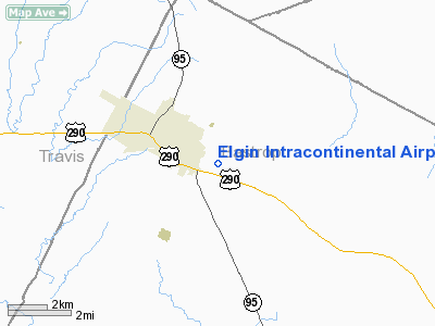
Elgin Intracontinental Airport |
Location & QuickFacts
| FAA Information Effective: | 2008-09-25 |
| Airport Identifier: | 56TS |
| Airport Status: | Operational |
| Longitude/Latitude: | 097-21-00.9810W/30-20-15.7520N
-97.350273/30.337709 (Estimated) |
| Elevation: | 558 ft / 170.08 m (Estimated) |
| Land: | 20 acres |
| From nearest city: | 2 nautical miles E of Elgin, TX |
| Location: | Bastrop County, TX |
| Magnetic Variation: | 07E (1985) |
Owner & Manager
| Ownership: | Privately owned |
| Owner: | William E. Sowell |
| Address: | Rt 5 Box 25
Elgin, TX 78621 |
| Phone number: | 512-285-4091 |
| Manager: | William E. Sowell |
| Address: | Rt 5 Box 25
Elgin, TX 78621 |
| Phone number: | 512-281-4091 |
Airport Operations and Facilities
| Airport Use: | Private |
| Wind indicator: | Yes |
| Segmented Circle: | No |
| Control Tower: | No |
| Sectional chart: | San Antonio |
| Region: | ASW - Southwest |
| Boundary ARTCC: | ZHU - Houston |
| Tie-in FSS: | SJT - San Angelo |
| FSS Toll Free: | 1-800-WX-BRIEF |
Runway Information
Runway 02/20
| Dimension: | 650 x 25 ft / 198.1 x 7.6 m |
| Surface: | TURF, |
| |
Runway 02 |
Runway 20 |
| Traffic Pattern: | Right | Right |
| Obstruction: | 5 ft fence | 5 ft fence |
|
Runway 11/29
| Dimension: | 1050 x 40 ft / 320.0 x 12.2 m |
| Surface: | TURF, |
| |
Runway 11 |
Runway 29 |
| Traffic Pattern: | Left | Left |
| Obstruction: | 35 ft trees | |
|
Runway 17/35
| Dimension: | 850 x 40 ft / 259.1 x 12.2 m |
| Surface: | TURF, |
| |
Runway 17 |
Runway 35 |
| Traffic Pattern: | Right | Right |
| Obstruction: | | 50 ft trees |
|
Helipad H1
| Dimension: | 75 x 50 ft / 22.9 x 15.2 m |
| Surface: | TURF, |
| |
Runway H1 |
Runway |
| Traffic Pattern: | Left | Left |
|
Helipad H2
| Dimension: | 75 x 50 ft / 22.9 x 15.2 m |
| Surface: | TURF, |
| |
Runway H2 |
Runway |
| Traffic Pattern: | Left | Left |
|
Radio Navigation Aids
| ID |
Type |
Name |
Ch |
Freq |
Var |
Dist |
| GYB | NDB | Lee County | | 385.00 | 07E | 21.8 nm |
| GUO | NDB | Georgetown | | 332.00 | 06E | 26.9 nm |
| IL | NDB | Iresh | | 278.00 | 07E | 45.2 nm |
| GRK | VOR/DME | Gray | 055X | 111.80 | 07E | 48.2 nm |
| CWK | VORTAC | Centex | 075X | 112.80 | 06E | 9.6 nm |
| IDU | VORTAC | Industry | 039X | 110.20 | 08E | 46.9 nm |
Images and information placed above are from
http://www.airport-data.com/airport/56TS/
We thank them for the data!
| General Info
|
| Country |
United States
|
| State |
TEXAS
|
| FAA ID |
56TS
|
| Latitude |
30-20-15.752N
|
| Longitude |
097-21-00.981W
|
| Elevation |
558 feet
|
| Near City |
ELGIN
|
We don't guarantee the information is fresh and accurate. The data may
be wrong or outdated.
For more up-to-date information please refer to other sources.
|
|


