 |
|
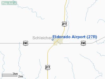
Location & QuickFacts
| FAA Information Effective: | 2008-09-25 |
| Airport Identifier: | 27R |
| Airport Status: | Operational |
| Longitude/Latitude: | 100-36-39.1790W/30-51-43.9880N
-100.610883/30.862219 (Estimated) |
| Elevation: | 2448 ft / 746.15 m (Estimated) |
| Land: | 70 acres |
| From nearest city: | 1 nautical miles W of Eldorado, TX |
| Location: | Schleicher County, TX |
| Magnetic Variation: | 08E (1985) |
Owner & Manager
| Ownership: | Publicly owned |
| Owner: | Schleicher County |
| Address: | County Courthouse
Eldorado, TX 76936 |
| Phone number: | 325-853-2766 |
| Manager: | J F Griffin /co Judge/ |
| Address: | Schleicher Co. Courthouse
Eldorado, TX 76936 |
| Phone number: | 325-853-2766 |
Airport Operations and Facilities
| Airport Use: | Open to public |
| Wind indicator: | Yes |
| Segmented Circle: | No |
| Control Tower: | No |
| Lighting Schedule: | DUSK-DAWN |
| Beacon Color: | Clear-Green (lighted land airport) |
| Landing fee charge: | No |
| Sectional chart: | San Antonio |
| Region: | ASW - Southwest |
| Boundary ARTCC: | ZHU - Houston |
| Responsible ARTCC: | ZFW - Fort Worth |
| Tie-in FSS: | SJT - San Angelo |
| FSS on Airport: | No |
| FSS Toll Free: | 1-800-WX-BRIEF |
| NOTAMs Facility: | SJT (NOTAM-d service avaliable) |
Airport Communications
| CTAF: | 123.000 |
| Unicom: | 123.000 |
Airport Services
| Fuel available: | 100LL
FOR FUEL CALL 325-853-2036/2737. |
| Airframe Repair: | NONE |
| Power Plant Repair: | NONE |
Runway Information
Runway 17/35
| Dimension: | 4300 x 60 ft / 1310.6 x 18.3 m |
| Surface: | ASPH, Good Condition |
| Weight Limit: | Single wheel: 12500 lbs. |
| Edge Lights: | Medium |
| |
Runway 17 |
Runway 35 |
| Traffic Pattern: | Right | Left |
| Markings: | Non-precision instrument, Good Condition | Non-precision instrument, Good Condition |
| Crossing Height: | 40.00 ft | 40.00 ft |
| VASI: | 2-light PAPI on left side | 2-light PAPI on left side |
| Visual Glide Angle: | 3.00° | 3.00° |
| Obstruction: | 10 ft tree, 525.0 ft from runway, 89 ft left of centerline, 32:1 slope to clear | 15 ft road, 263.0 ft from runway, 4:1 slope to clear |
|
Radio Navigation Aids
| ID |
Type |
Name |
Ch |
Freq |
Var |
Dist |
| SOA | NDB | Sonora | | 371.00 | 08E | 17.0 nm |
| SJT | VORTAC | San Angelo | 098X | 115.10 | 10E | 31.8 nm |
| JCT | VORTAC | Junction | 107X | 116.00 | 08E | 44.0 nm |
Images and information placed above are from
http://www.airport-data.com/airport/27R/
We thank them for the data!
| General Info
|
| Country |
United States
|
| State |
TEXAS
|
| FAA ID |
27R
|
| Latitude |
30-51-39.628N
|
| Longitude |
100-36-36.347W
|
| Elevation |
2441 feet
|
| Near City |
ELDORADO
|
We don't guarantee the information is fresh and accurate. The data may
be wrong or outdated.
For more up-to-date information please refer to other sources.
|
|


