 |
|
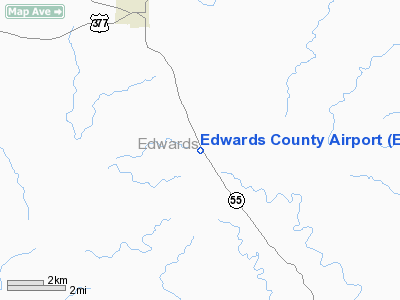
Location & QuickFacts
| FAA Information Effective: | 2008-09-25 |
| Airport Identifier: | ECU |
| Airport Status: | Operational |
| Longitude/Latitude: | 100-10-25.8768W/29-56-48.9105N
-100.173855/29.946920 (Estimated) |
| Elevation: | 2372 ft / 722.99 m (Surveyed) |
| Land: | 100 acres |
| From nearest city: | 4 nautical miles SE of Rocksprings, TX |
| Location: | Edwards County, TX |
| Magnetic Variation: | 07E (2000) |
Owner & Manager
| Ownership: | Publicly owned |
| Owner: | County Of Edwards |
| Address: | Edwards Cty Courthouse
Rocksprings, TX 78880 |
| Phone number: | 830-683-6122 |
| Manager: | Nick Gallegos
COUNTY JUDGE. |
| Address: | Box 348
Rocksprings, TX 78880 |
| Phone number: | 830-683-6122 |
Airport Operations and Facilities
| Airport Use: | Open to public |
| Wind indicator: | Yes |
| Segmented Circle: | Yes |
| Control Tower: | No |
| Lighting Schedule: | DUSK-DAWN |
| Beacon Color: | Clear-Green (lighted land airport) |
| Landing fee charge: | No |
| Sectional chart: | San Antonio |
| Region: | ASW - Southwest |
| Boundary ARTCC: | ZHU - Houston |
| Tie-in FSS: | SJT - San Angelo |
| FSS on Airport: | No |
| FSS Toll Free: | 1-800-WX-BRIEF |
| NOTAMs Facility: | ECU (NOTAM-d service avaliable) |
Airport Communications
Airport Services
| Airframe Repair: | NONE |
| Power Plant Repair: | NONE |
Runway Information
Runway 14/32
| Dimension: | 4050 x 50 ft / 1234.4 x 15.2 m |
| Surface: | ASPH, Good Condition |
| Weight Limit: | Single wheel: 13000 lbs. |
| Edge Lights: | Medium |
| |
Runway 14 |
Runway 32 |
| Longitude: | 100-10-39.0073W | 100-10-12.7475W |
| Latitude: | 29-57-05.3708N | 29-56-32.4498N |
| Elevation: | 2367.00 ft | 2369.00 ft |
| Alignment: | 127 | 127 |
| Traffic Pattern: | Left | Left |
| Markings: | Non-precision instrument, Good Condition | Basic, Good Condition |
| Displaced threshold: | 278.00 ft
NIGHTTIME OPERATION DSPLCD THLD LGTS ARE SET 288 FT FM RY END. | 0.00 ft |
| Obstruction: | 21 ft trees, 280.0 ft from runway, 3:1 slope to clear
APCH RATIO 21:1 FM DSPLCD THLD TO +15 FT ROAD 325 FT FM DSPLCD THLD ACROSS CNTRLN.
+5' FENCE 80' FM THR; +8' FENCE POST 40' FM THR 204' RIGHT OF CNTRLN; +15' TREES 125' FM THR 25' RIGHT OF CNTRLN. | 30 ft trees, 230.0 ft from runway, 245 ft left of centerline, 1:1 slope to clear |
|
Radio Navigation Aids
| ID |
Type |
Name |
Ch |
Freq |
Var |
Dist |
| SOA | NDB | Sonora | | 371.00 | 08E | 45.4 nm |
| PFO | NDB | Spofford | | 356.00 | 08E | 50.0 nm |
| RSG | VORTAC | Rocksprings | 049X | 111.20 | 10E | 7.7 nm |
| JCT | VORTAC | Junction | 107X | 116.00 | 08E | 43.3 nm |
| DLF | VORTAC | Laughlin | 091X | 114.40 | 07E | 47.1 nm |
| CSI | VORTAC | Center Point | 122X | 117.50 | 08E | 50.0 nm |
Images and information placed above are from
http://www.airport-data.com/airport/ECU/
We thank them for the data!
| General Info
|
| Country |
United States
|
| State |
TEXAS
|
| FAA ID |
ECU
|
| Time |
UTC-6(-5DT)
|
| Latitude |
29.946919
29° 56' 48.91" N
|
| Longitude |
-100.173856
100° 10' 25.88" W
|
| Elevation |
2372 feet
723 meters
|
| Type |
Civil
|
| Magnetic Variation |
006° E (01/06)
|
| Beacon |
Yes
|
| Operating Agency |
U.S.CIVIL AIRPORT WHEREIN PERMIT COVERS USE BY TRANSIT MILITARY AIRCRAFT
|
| Near City |
Rocksprings
|
| Operating Hours |
SEE REMARKS FOR OPERATING HOURS OR COMMUNICATIONS FOR POSSIBLE HOURS
|
| Daylight Saving Time |
Second Sunday in March at 0200 to first Sunday in November at 0200 local time (Exception Arizona and that portion of Indiana in the Eastern Time Zone)
|
We don't guarantee the information is fresh and accurate. The data may
be wrong or outdated.
For more up-to-date information please refer to other sources.
|
|


