 |
|
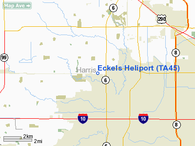
Location & QuickFacts
| FAA Information Effective: | 2008-09-25 |
| Airport Identifier: | TA45 |
| Airport Status: | Operational |
| Longitude/Latitude: | 095-39-18.8050W/29-49-53.8170N
-95.655224/29.831616 (Estimated) |
| Elevation: | 110 ft / 33.53 m (Estimated) |
| Land: | 0 acres |
| From nearest city: | 0 nautical miles N of Houston, TX |
| Location: | Harris County, TX |
| Magnetic Variation: | 06E (1985) |
Owner & Manager
| Ownership: | Privately owned |
| Owner: | R. Y. Eckels |
| Address: | 4035 Trey Drive
Houston, TX 77084 |
| Phone number: | 409-885-4564 |
| Manager: | Bob Eckels |
| Address: | 712 Bartlett
Sealy, TX 77474 |
| Phone number: | 409-885-4564 |
Airport Operations and Facilities
| Airport Use: | Private |
| Wind indicator: | Yes |
| Segmented Circle: | Yes |
| Control Tower: | No |
| Landing fee charge: | No |
| Sectional chart: | Houston |
| Region: | ASW - Southwest |
| Boundary ARTCC: | ZHU - Houston |
| Tie-in FSS: | CXO - Montgomery County |
| FSS on Airport: | No |
| FSS Toll Free: | 1-800-WX-BRIEF
FOR FP FILING CALL CXO FSS 1-800-833-5602. |
Runway Information
Helipad H1
| Dimension: | 100 x 100 ft / 30.5 x 30.5 m |
| Surface: | ASPH, |
| |
Runway H1 |
Runway |
| Traffic Pattern: | Left | Left |
|
Radio Navigation Aids
| ID |
Type |
Name |
Ch |
Freq |
Var |
Dist |
| LYD | NDB | Lakeside | | 249.00 | 05E | 1.5 nm |
| EYQ | NDB | Weiser | | 286.00 | 06E | 6.2 nm |
| SGR | NDB | Hull | | 388.00 | 05E | 12.0 nm |
| DWH | NDB | David Hooks | | 521.00 | 05E | 18.3 nm |
| SYG | NDB | Sandy Point | | 402.00 | 05E | 22.1 nm |
| BVP | NDB | Nixin | | 326.00 | 05E | 24.9 nm |
| JPA | NDB | Sanjac | | 347.00 | 05E | 32.1 nm |
| ARM | NDB | Wharton | | 245.00 | 06E | 43.3 nm |
| BNH | NDB | Brenham | | 362.00 | 06E | 44.1 nm |
| EFD | TACAN | Ellington | 031X | | 05E | 29.2 nm |
| HUB | VOR/DME | Hobby | 118X | 117.10 | 05E | 22.4 nm |
| ELA | VOR/DME | Eagle Lake | 111X | 116.40 | 08E | 36.0 nm |
| IAH | VORTAC | Humble | 113X | 116.60 | 05E | 17.8 nm |
| TNV | VORTAC | Navasota | 106X | 115.90 | 08E | 34.6 nm |
| IDU | VORTAC | Industry | 039X | 110.20 | 08E | 47.9 nm |
| HOU | VOT | Houston Wm P Hobby | | 108.40 | | 22.6 nm |
Remarks
- E111 PRVDD HELI RMNS PVT USE. CAUTION HELI NEAR LAKESIDE ARPT & LIES BNTH LAKESIDE ARPT TFC PAT; CTC LAKESIDE UNICOM (122.8) FOR TFC ADZY.
Images and information placed above are from
http://www.airport-data.com/airport/TA45/
We thank them for the data!
| General Info
|
| Country |
United States
|
| State |
TEXAS
|
| FAA ID |
TA45
|
| Latitude |
29-49-53.817N
|
| Longitude |
095-39-18.805W
|
| Elevation |
110 feet
|
| Near City |
HOUSTON
|
We don't guarantee the information is fresh and accurate. The data may
be wrong or outdated.
For more up-to-date information please refer to other sources.
|
|


