 |
|
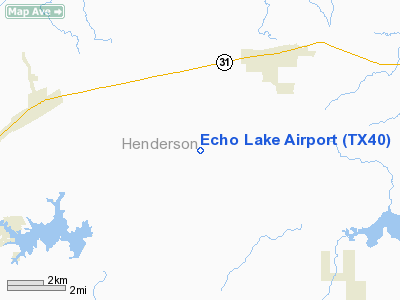
Location & QuickFacts
| FAA Information Effective: | 2008-09-25 |
| Airport Identifier: | TX40 |
| Airport Status: | Operational |
| Longitude/Latitude: | 095-39-20.8600W/32-15-15.5410N
-95.655794/32.254317 (Estimated) |
| Elevation: | 450 ft / 137.16 m (Estimated) |
| Land: | 0 acres |
| From nearest city: | 3 nautical miles SW of Brownsboro, TX |
| Location: | Henderson County, TX |
| Magnetic Variation: | 06E (1985) |
Owner & Manager
| Ownership: | Privately owned |
| Owner: | Echo Lake Property Owners Assn |
| Address: | Po Box 278
Brownsboro, TX 75756 |
| Phone number: | 903-852-3064 |
| Manager: | Dr. Michael Jackson
ECHO LAKE PILOTS ASSOCIATION. |
| Address: | Po Box 278
Brownsboro, TX 75756 |
| Phone number: | 682-472-9919 |
Airport Operations and Facilities
| Airport Use: | Private |
| Wind indicator: | Yes |
| Segmented Circle: | No |
| Control Tower: | No |
| Landing fee charge: | No |
| Sectional chart: | Dallas-ft Worth |
| Region: | ASW - Southwest |
| Boundary ARTCC: | ZFW - Fort Worth |
| Tie-in FSS: | FTW - Fort Worth |
| FSS on Airport: | No |
| FSS Phone: | 817-541-3474 |
| FSS Toll Free: | 1-800-WX-BRIEF |
Airport Services
| Airframe Repair: | NONE |
| Power Plant Repair: | NONE |
Runway Information
Runway 16/34
| Dimension: | 2600 x 40 ft / 792.5 x 12.2 m |
| Surface: | TRTD-DIRT,
OILED HARD |
| Edge Lights: | Non-standard lighting system
THREE SOLAR POWERED WHITE LGTS AT EACH END OF THE RY: 1 ON THE CNTRLN AND 1 AT EACH CORNER OF THE RY. THERE ARE ALSO RED REFLECTORS AT THE SAME LOCATIONS FUNCTIONING AS THE THLD LGTS AND WHITE REFLECTORS FUNCTIONING AS THE EDGE LGTS AND ARE SPACED AT 100 FT INTERVALS. |
| |
Runway 16 |
Runway 34 |
| Traffic Pattern: | Left | Left |
| Obstruction: | 30 ft trees, 400.0 ft from runway | 30 ft trees, 400.0 ft from runway |
|
Radio Navigation Aids
| ID |
Type |
Name |
Ch |
Freq |
Var |
Dist |
| AHX | NDB | Athens | | 269.00 | 06E | 10.6 nm |
| TY | NDB | Tyler | | 320.00 | 06E | 13.5 nm |
| CSZ | NDB | Crossroads | | 215.00 | 08E | 19.2 nm |
| LIQ | NDB | Lochridge Ranch | | 335.00 | 09E | 21.0 nm |
| PSN | NDB | Palestine | | 375.00 | 04E | 28.6 nm |
| JSO | NDB | Cherokee County | | 263.00 | 05E | 32.2 nm |
| ABG | NDB | Ambassador | | 404.00 | 07E | 34.0 nm |
| PYF | NDB | Pyramid | | 418.00 | 06E | 36.3 nm |
| CRS | NDB | Corsicana | | 396.00 | 06E | 40.0 nm |
| HNO | NDB | Henderson | | 371.00 | 06E | 40.6 nm |
| CGQ | NDB | Powell | | 344.00 | 06E | 40.9 nm |
| AVZ | NDB | Travis | | 260.00 | 06E | 42.8 nm |
| SYW | NDB | Cash | | 428.00 | 05E | 48.4 nm |
| FZT | VOR/DME | Frankston | 051X | 111.40 | 06E | 12.5 nm |
| TYR | VOR/DME | Tyler | 089X | 114.20 | 06E | 14.2 nm |
| UIM | VOR/DME | Quitman | 087X | 114.00 | 08E | 40.4 nm |
| CQY | VORTAC | Cedar Creek | 095X | 114.80 | 06E | 28.9 nm |
| GGG | VORTAC | Gregg County | 070X | 112.30 | 07E | 46.9 nm |
Remarks
- SIGNED LIABILITY REQUIRED PRIOR TO LNDG CALL AMGR 682-472-9919.
- LGTD CELL TOWER 3.5 NM NORTH OF ARPT.
- WILDLIFE ON RY & INVOF ARPT.
- DO NOT FLY OVER THE LAKE.
Images and information placed above are from
http://www.airport-data.com/airport/TX40/
We thank them for the data!
| General Info
|
| Country |
United States
|
| State |
TEXAS
|
| FAA ID |
TX40
|
| Latitude |
32-15-15.541N
|
| Longitude |
095-39-20.860W
|
| Elevation |
450 feet
|
| Near City |
BROWNSBORO
|
We don't guarantee the information is fresh and accurate. The data may
be wrong or outdated.
For more up-to-date information please refer to other sources.
|
|


