|
|
| Easterwood Airport

|
 |
| IATA: CLL – ICAO: KCLL – FAA LID: CLL |
| Summary |
| Airport type |
Public |
| Operator |
Texas A&M University |
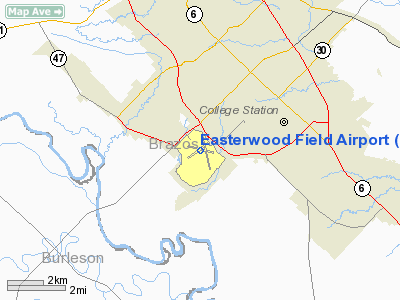
| Location |
College Station, Texas |
| Elevation AMSL |
321 ft / 97.8 m |
| Coordinates |
30°35′19″N 96°21′50″W / 30.58861°N 96.36389°W / 30.58861; -96.36389 |
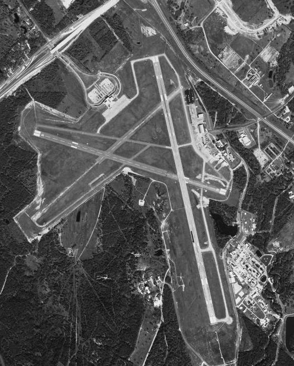
| Runways |
| Direction |
Length |
Surface |
| ft |
m |
| 4/22 |
5,149 |
1,569 |
Concrete |
| 10/28 |
5,159 |
1,572 |
Asphalt |
| 16/34 |
7,000 |
2,134 |
Asphalt/Concrete |
| Statistics (2005) |
| Aircraft operations |
60,395 |
| Based aircraft |
48 |
| Sources: airport web site and FAA |
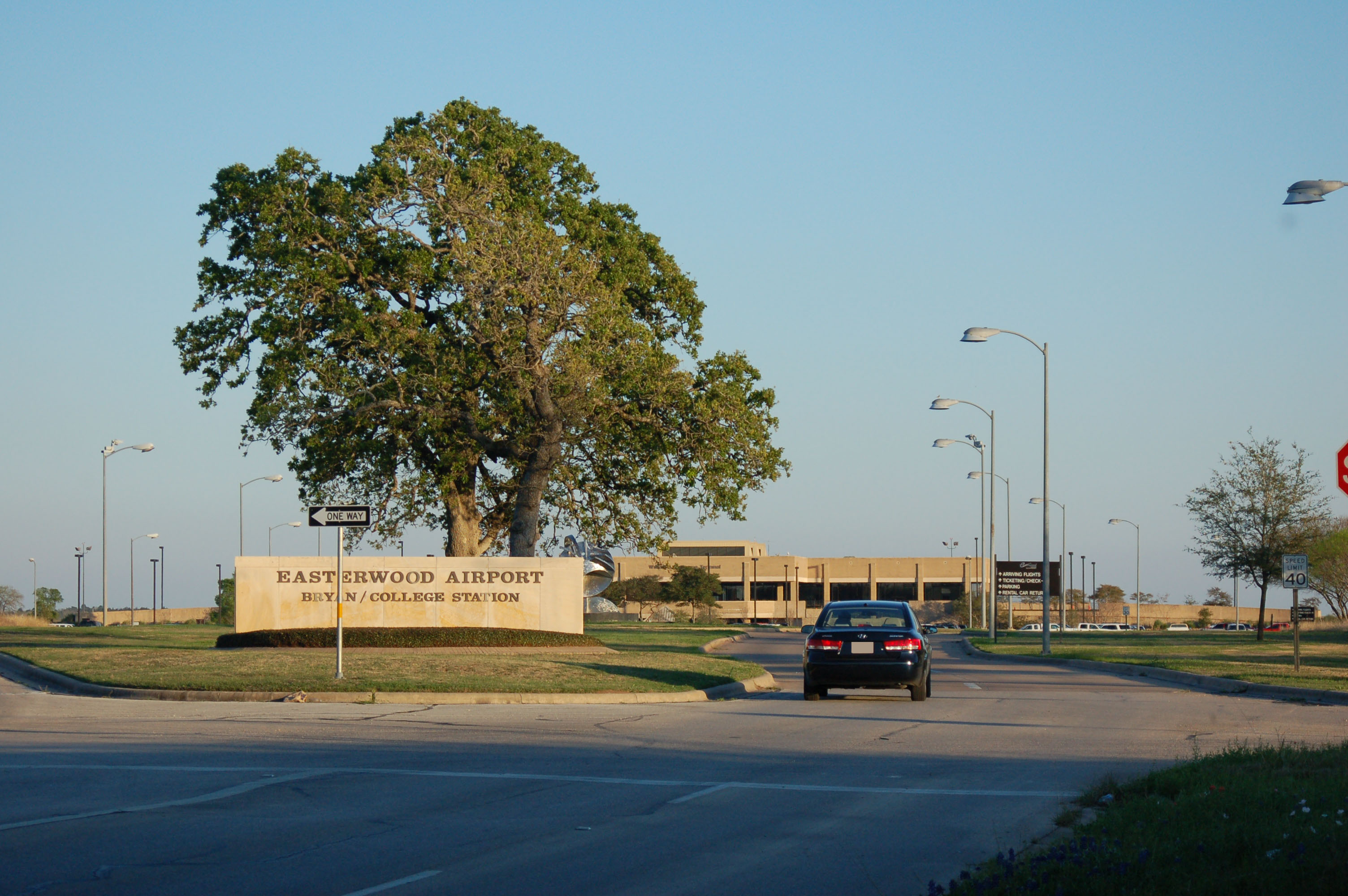
Easterwood Airport (IATA: CLL, ICAO: KCLL, FAA LID: CLL), also known as Easterwood Field, is the regional airport for Texas A&M University, Bryan-College Station and Brazos County, Texas, USA. The airport is owned by Texas A&M University. Easily accessible from Farm-To-Market Road 60 West (Raymond Stotzer Parkway), it is located three miles (5 km) southwest of College Station and 0.25 miles from Texas A&M University.
The William A. McKenzie Terminal at Easterwood Airport provides daily flights within Texas to Dallas and Houston. The terminal offers complimentary 2 hour visitor parking as well as drop off areas on the upper level and shuttle/taxi pick up areas on the lower level.
Within the terminal the airline ticket counters, TSA security checkpoint, and boarding areas are located on the upper level. Baggage claim and rental car agencies are located on the lower level of the terminal. History
In 1938, the Board of Directors of the Texas A&M College authorized the development of an airport at the existing site. The University applied to the Civil Aeronautics Authority (CAA) for certification as a primary flight training school under provisions of the Civilian Pilot Training Program.
In May 1940, the airport was opened and formally named for Navy Lt. Jesse L. Easterwood. Easterwood was a former student of the college who enlisted in the British Royal Naval Air Service in 1917. After being commissioned as Ensign, he was later promoted to Lieutenant in the Naval Air Service and was the second American to qualify as Naval Aviation Pilot. He served with the Royal Flying Corps in 1918 and had to his credit sixteen successful raids behind German lines. He served in three foreign countries and was killed in an airplane accident in the Canal Zone May 19, 1919. He was awarded the Navy Cross posthumously "for distinguished and heroic service as an aviator."
The original facility in 1940 consisted of one hangar and a turf landing strip and taxiway which were eventually paved through funding provided by the CAA, the Works Projects Administration (WPA), and Texas A&M.
In 1948 a large hangar was relocated to the airfield from a US Army flying field near Corsicana, Texas. The FAA established a Flight Service Station (FSS) at the Airport in 1951 and Pioneer Airlines began scheduled air service in that same year. Many changes have occurred over the years including moving the Flight Service Station to Montgomery County and Colgan Air (operating as Continental Connection) and American Eagle now provide scheduled air service.
The first control tower was erected at the Airport in 1952 and a commercial passenger terminal was constructed in 1957. Work began on an extension of Runway 16-34 to its present 7,001 foot length in 1984. At the same time the associated parallel taxiway to Runway 16-34 was also extended.
In 1988, work began on improvements to the Airport access road and initial construction of a new passenger terminal began. The new McKenzie Terminal became operational in 1990. Upon completion of the McKenzie Terminal, plans were made to convert the old passenger terminal into a general aviation terminal to meet the needs of these passengers and pilots, including corporate operators that use the Airport. The old passenger facility was remodeled to meet the needs of this segment of the aviation community and re-opened for service in 1994 as a modern general aviation facility, housing line service and support personnel as well as flight operations.
Facilities and aircraft
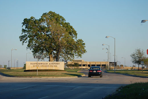 | |
Entrance of airport |
The airport is equipped with two 5,150 foot runways, one 7,000 foot paved, all weather runway, an approach lighting system, an FAA control tower, FAA radio communication and an OmniRange-ILS Navigation Aid.
For the 12-month period ending March 1, 2005, the airport had 60,395 aircraft operations, an average of 165 per day: 61% general aviation, 28% military, 11% air taxi and <1% scheduled commercial. At that time there were 48 aircraft based at this airport: 81% single-engine and 19% multi-engine.
Airlines and destinations
| Airlines |
Destinations |
| American Eagle |
Dallas/Fort Worth |
| Continental Connection operated by Colgan Air |
Houston-Intercontinental |
The above content comes from Wikipedia and is published under free licenses – click here to read more.
Location & QuickFacts
| FAA Information Effective: | 2008-09-25 |
| Airport Identifier: | CLL |
| Airport Status: | Operational |
| Longitude/Latitude: | 096-21-49.8000W/30-35-18.9000N
-96.363833/30.588583 (Estimated) |
| Elevation: | 321 ft / 97.84 m (Surveyed) |
| Land: | 700 acres |
| From nearest city: | 3 nautical miles SW of College Station, TX |
| Location: | Brazos County, TX |
| Magnetic Variation: | 06E (1985) |
Owner & Manager
| Ownership: | Publicly owned |
| Owner: | Texas A&m University |
| Address: | 1 Mckenzie Terminal Blvd Ste 112
College Station, TX 77845 |
| Phone number: | 979-845-5103 |
| Manager: | John H. Happ |
| Address: | 1 Mckenzie Terminal Blvd Ste 112
College Station, TX 77845 |
| Phone number: | 979-845-5103 |
Airport Operations and Facilities
| Airport Use: | Open to public |
| Wind indicator: | Yes |
| Segmented Circle: | Yes |
| Control Tower: | Yes |
| Lighting Schedule: | DUSK-DAWN
WHEN ATCT CLSD ACTVT HIRL RY 16/34 & MALSR RY 34 - CTAF. MIRL RY 10/28 & REIL RY 28 PRESET LOW INTST ONLY. |
| Beacon Color: | Clear-Green (lighted land airport) |
| Landing fee charge: | No |
| Sectional chart: | Houston |
| Region: | ASW - Southwest |
| Boundary ARTCC: | ZHU - Houston |
| Tie-in FSS: | CXO - Montgomery County |
| FSS on Airport: | No |
| FSS Toll Free: | 1-800-WX-BRIEF
FOR FP FILING CALL CXO FSS 1-800-833-5602 |
| NOTAMs Facility: | CLL (NOTAM-d service avaliable) |
| Certification type/date: | I A S 07/1973
CLSD TO UNSKED ACR OPNS WITH MORE THAN 30 PSGR SEATS EXCP 24 HRS PPR CALL AMGR 979-845-4811. |
| Federal Agreements: | NGY3 |
Airport Communications
| CTAF: | 118.500 |
| Unicom: | 122.950 |
Airport Services
| Fuel available: | 100LLA
FOR FUEL AFT HRS PPR CALL 979-845-4811 OR CTC TEXAS A & M UNIVERSITY POLICE 979-845-2345; LATE NIGHT FEE. |
| Airframe Repair: | MAJOR |
| Power Plant Repair: | MAJOR |
Runway Information
Runway 04/22
| Dimension: | 5149 x 150 ft / 1569.4 x 45.7 m |
| Surface: | CONC, Good Condition
FIRST 1850 FT RY 34 CONC. |
| Weight Limit: | Single wheel: 27000 lbs.
Dual wheel: 50000 lbs.
Dual tandem wheel: 87000 lbs. |
| |
Runway 04 |
Runway 22 |
| Longitude: | 096-22-23.1310W | 096-21-38.1737W |
| Latitude: | 30-35-07.0695N | 30-35-40.0054N |
| Elevation: | 307.00 ft | 318.00 ft |
| Alignment: | 50 | 127 |
| Traffic Pattern: | Left | Left |
| Markings: | Basic, Fair Condition | Basic, Good Condition |
| Obstruction: | 49 ft tree, 2000.0 ft from runway, 100 ft left of centerline, 36:1 slope to clear | 35 ft tree, 1066.0 ft from runway, 105 ft left of centerline, 24:1 slope to clear |
| Decleard distances: | Take off run available 5149.00 ft
Take off distance available 5149.00 ft
Actual stop distance available 5149.00 ft
Landing distance available 5149.00 ft
| Take off run available 5149.00 ft
Take off distance available 5149.00 ft
Actual stop distance available 5149.00 ft
Landing distance available 5149.00 ft
|
|
Runway 10/28
| Dimension: | 5159 x 150 ft / 1572.5 x 45.7 m |
| Surface: | ASPH, Good Condition
FIRST 1850 FT RY 34 CONC. |
| Surface Treatment: | Saw-cut or plastic Grooved |
| Weight Limit: | Single wheel: 27000 lbs.
Dual wheel: 50000 lbs.
Dual tandem wheel: 87000 lbs. |
| Edge Lights: | Medium |
| |
Runway 10 |
Runway 28 |
| Longitude: | 096-22-22.0616W | 096-21-26.1863W |
| Latitude: | 30-35-29.2977N | 30-35-12.8578N |
| Elevation: | 320.00 ft | 312.00 ft |
| Alignment: | 109 | 127 |
| Traffic Pattern: | Left | Left |
| Markings: | Non-precision instrument, Good Condition | Non-precision instrument, Good Condition |
| Crossing Height: | 50.00 ft | 54.00 ft |
| VASI: | 4-box on left side | 4-box on left side |
| Visual Glide Angle: | 3.00° | 3.00° |
| Runway End Identifier: | | Yes
REIL OTS INDEFLY. |
| Obstruction: | 40 ft tree, 1180.0 ft from runway, 400 ft right of centerline, 24:1 slope to clear | 18 ft tree, 500.0 ft from runway, 230 ft left of centerline, 17:1 slope to clear |
| Decleard distances: | Take off run available 5159.00 ft
Take off distance available 5159.00 ft
Actual stop distance available 5159.00 ft
Landing distance available 5159.00 ft
| Take off run available 5159.00 ft
Take off distance available 5159.00 ft
Actual stop distance available 5159.00 ft
Landing distance available 5159.00 ft
|
|
Runway 16/34
| Dimension: | 7000 x 150 ft / 2133.6 x 45.7 m |
| Surface: | ASPH-CONC,
FIRST 1850 FT RY 34 CONC. |
| Surface Treatment: | Saw-cut or plastic Grooved |
| Weight Limit: | Single wheel: 70000 lbs.
Dual wheel: 90000 lbs.
Dual tandem wheel: 150000 lbs. |
| Edge Lights: | High |
| |
Runway 16 |
Runway 34 |
| Longitude: | 096-21-46.2769W | 096-21-30.8341W |
| Latitude: | 30-35-47.9018N | 30-34-39.9243N |
| Elevation: | 321.00 ft | 305.00 ft |
| Alignment: | 127 | 127 |
| ILS Type: | | ILS/DME
|
| Traffic Pattern: | Left | Left |
| Markings: | Precision instrument, Good Condition | Precision instrument, Good Condition |
| Crossing Height: | 51.00 ft | 0.00 ft |
| VASI: | 4-box on right side | |
| Visual Glide Angle: | 3.00° | 0.00° |
| Approach lights: | | MALSR |
| Obstruction: | 42 ft tree, 500.0 ft from runway, 480 ft right of centerline, 7:1 slope to clear | , 50:1 slope to clear |
| Decleard distances: | Take off run available 7000.00 ft
Take off distance available 7000.00 ft
Actual stop distance available 7000.00 ft
Landing distance available 7000.00 ft
| Take off run available 7000.00 ft
Take off distance available 7000.00 ft
Actual stop distance available 7000.00 ft
Landing distance available 7000.00 ft
|
|
Radio Navigation Aids
| ID |
Type |
Name |
Ch |
Freq |
Var |
Dist |
| BNH | NDB | Brenham | | 362.00 | 06E | 22.0 nm |
| GYB | NDB | Lee County | | 385.00 | 07E | 40.6 nm |
| UTS | NDB | Huntsville | | 308.00 | 06E | 41.0 nm |
| DWH | NDB | David Hooks | | 521.00 | 05E | 49.9 nm |
| CLL | VORTAC | College Station | 080X | 113.30 | 08E | 3.1 nm |
| TNV | VORTAC | Navasota | 106X | 115.90 | 08E | 24.0 nm |
| LOA | VORTAC | Leona | 045X | 110.80 | 08E | 38.1 nm |
| IDU | VORTAC | Industry | 039X | 110.20 | 08E | 39.4 nm |
Remarks
- LNDG FEE SKED FAR 135 & ALL FAR 121 OPERATIONS.
- ITNRNT ACFT PARK IN FRONT OF TWR; OVERNIGHT PARKING FEE.
- RY 04/22 & TWY E SOUTH OF RY 10/28 NOT AVBL FOR ACR ACFT WITH OVER 30 PSGR SEATS.
- RY 04/22 DAY VFR OPNS ONLY.
- PAEW ADJ ALL TWYS 0600-1600.
- TWY H CLSD SOUTH OF RY 10/28 INDEFLY.
- RY 10/28 SAFETY AREA REDUCED TO 400 FT.
Images and information placed above are from
http://www.airport-data.com/airport/CLL/
We thank them for the data!
| General Info
|
| Country |
United States
|
| State |
TEXAS
|
| FAA ID |
CLL
|
| Latitude |
30-35-18.922N
|
| Longitude |
096-21-49.767W
|
| Elevation |
321 feet
|
| Near City |
COLLEGE STATION
|
We don't guarantee the information is fresh and accurate. The data may
be wrong or outdated.
For more up-to-date information please refer to other sources.
|
|