 |
|
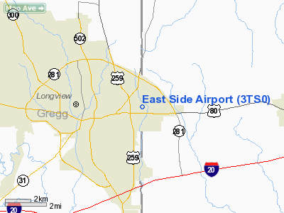
Location & QuickFacts
| FAA Information Effective: | 2008-09-25 |
| Airport Identifier: | 3TS0 |
| Airport Status: | Operational |
| Longitude/Latitude: | 094-42-00.7540W/32-30-30.5330N
-94.700209/32.508481 (Estimated) |
| Elevation: | 373 ft / 113.69 m (Estimated) |
| Land: | 35 acres |
| From nearest city: | 2 nautical miles E of Longview, TX |
| Location: | Harrison County, TX |
| Magnetic Variation: | 05E (1985) |
Owner & Manager
| Ownership: | Privately owned |
| Owner: | T. J. Long |
| Address: | Po Box 2429
Longview, TX 75606 |
| Phone number: | 214-758-4194 |
| Manager: | T. J. Long |
| Address: | Po Box 2429
Longview, TX 75606 |
| Phone number: | 214-758-4194 |
Airport Operations and Facilities
| Airport Use: | Private |
| Wind indicator: | Yes |
| Segmented Circle: | No |
| Control Tower: | No |
| Landing fee charge: | Yes |
| Sectional chart: | Memphis |
| Region: | ASW - Southwest |
| Boundary ARTCC: | ZFW - Fort Worth |
| Tie-in FSS: | FTW - Fort Worth |
| FSS on Airport: | No |
| FSS Phone: | 817-541-3474 |
| FSS Toll Free: | 1-800-WX-BRIEF |
Airport Services
| Airframe Repair: | NONE |
| Power Plant Repair: | NONE |
| Bottled Oxygen: | NONE |
| Bulk Oxygen: | NONE |
Runway Information
Runway 08/26
| Dimension: | 2025 x 50 ft / 617.2 x 15.2 m |
| Surface: | TURF, Fair Condition |
| |
Runway 08 |
Runway 26 |
| Traffic Pattern: | Left | Left |
| Markings: | None, | None, |
| Runway End Identifier: | No | No |
| Centerline Lights: | No | No |
| Touchdown Lights: | No | No |
| Obstruction: | 4 ft fence | 4 ft fence, 0.0 ft from runway |
|
Runway 13/31
| Dimension: | 2400 x 75 ft / 731.5 x 22.9 m |
| Surface: | TURF, Fair Condition |
| |
Runway 13 |
Runway 31 |
| Traffic Pattern: | Left | Left |
| Markings: | None, | None, |
| Runway End Identifier: | No | No |
| Centerline Lights: | No | No |
| Touchdown Lights: | No | No |
| Obstruction: | 30 ft trees, 40 ft right of centerline | 4 ft fence, 0.0 ft from runway |
|
Radio Navigation Aids
| ID |
Type |
Name |
Ch |
Freq |
Var |
Dist |
| HNO | NDB | Henderson | | 371.00 | 06E | 20.9 nm |
| ABG | NDB | Ambassador | | 404.00 | 07E | 21.4 nm |
| LST | NDB | Lone Star | | 305.00 | 05E | 25.3 nm |
| RPF | NDB | Carthage | | 332.00 | 04E | 28.5 nm |
| TY | NDB | Tyler | | 320.00 | 06E | 39.4 nm |
| VIV | NDB | Vivian | | 284.00 | 06E | 40.8 nm |
| ATA | NDB | Atlanta | | 347.00 | 04E | 44.1 nm |
| JSO | NDB | Cherokee County | | 263.00 | 05E | 46.5 nm |
| CZJ | NDB | Amason | | 341.00 | 04E | 49.2 nm |
| DTN | VOR | Downtown | | 108.60 | 07E | 48.6 nm |
| TYR | VOR/DME | Tyler | 089X | 114.20 | 06E | 36.8 nm |
| UIM | VOR/DME | Quitman | 087X | 114.00 | 08E | 40.5 nm |
| FZT | VOR/DME | Frankston | 051X | 111.40 | 06E | 49.6 nm |
| GGG | VORTAC | Gregg County | 070X | 112.30 | 07E | 6.1 nm |
| EIC | VORTAC | Belcher | 121X | 117.40 | 07E | 47.8 nm |
| SHV | VOT | Shreveport Regional | | 108.20 | | 44.2 nm |
Remarks
- +30' TREES ALONG RWY EDGES VIOLATE PRIM SFC.
- RWY 31 +30' TREE 100' FROM THR 40' LEFT.
- RWY 26 +30' TREES 10' FROM THR ACROSS APCH.
- PRE DATES THE ACT.
Images and information placed above are from
http://www.airport-data.com/airport/3TS0/
We thank them for the data!
| General Info
|
| Country |
United States
|
| State |
TEXAS
|
| FAA ID |
3TS0
|
| Latitude |
32-30-30.533N
|
| Longitude |
094-42-00.754W
|
| Elevation |
373 feet
|
| Near City |
LONGVIEW
|
We don't guarantee the information is fresh and accurate. The data may
be wrong or outdated.
For more up-to-date information please refer to other sources.
|
|


