 |
|
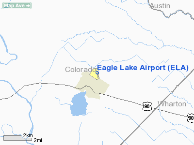
Location & QuickFacts
| FAA Information Effective: | 2008-09-25 |
| Airport Identifier: | ELA |
| Airport Status: | Operational |
| Longitude/Latitude: | 096-19-19.0000W/29-36-02.0000N
-96.321944/29.600556 (Estimated) |
| Elevation: | 184 ft / 56.08 m (Surveyed) |
| Land: | 215 acres |
| From nearest city: | 1 nautical miles NE of Eagle Lake, TX |
| Location: | Colorado County, TX |
| Magnetic Variation: | 06E (1985) |
Owner & Manager
| Ownership: | Publicly owned |
| Owner: | City Of Eagle Lake |
| Address: | Po Box 38
Eagle Lake, TX 77434 |
| Phone number: | 979-234-2640 |
| Manager: | Ron Holland
CITY MGR. |
| Address: | Po Box 38
Eagle Lake, TX 77434 |
| Phone number: | 979-234-7707 |
Airport Operations and Facilities
| Airport Use: | Open to public |
| Wind indicator: | Yes |
| Segmented Circle: | Yes |
| Control Tower: | No |
| Lighting Schedule: | DUSK-DAWN
MIRL RY 17/35 PRESET LOW; TO INCR INTST ACTVT - CTAF. |
| Beacon Color: | Clear-Green (lighted land airport) |
| Landing fee charge: | No |
| Sectional chart: | Houston |
| Region: | ASW - Southwest |
| Boundary ARTCC: | ZHU - Houston |
| Tie-in FSS: | CXO - Montgomery County |
| FSS on Airport: | No |
| FSS Toll Free: | 1-800-WX-BRIEF
FOR FP FILING CALL CXO FSS 1-800-833-5602 |
| NOTAMs Facility: | CXO (NOTAM-d service avaliable) |
| Federal Agreements: | N |
Airport Communications
Airport Services
| Fuel available: | 100LLA MOGAS |
| Airframe Repair: | MAJOR |
| Power Plant Repair: | MAJOR |
| Bottled Oxygen: | NONE |
| Bulk Oxygen: | NONE |
Runway Information
Runway 17/35
| Dimension: | 3801 x 60 ft / 1158.5 x 18.3 m |
| Surface: | ASPH, Good Condition |
| Weight Limit: | Single wheel: 12500 lbs. |
| Edge Lights: | Medium |
| |
Runway 17 |
Runway 35 |
| Longitude: | 096-19-22.6720W | 096-19-16.1380W |
| Latitude: | 29-36-21.0240N | 29-35-43.8310N |
| Elevation: | 184.00 ft | 184.00 ft |
| Alignment: | 127 | 127 |
| Traffic Pattern: | Left | Left |
| Markings: | Non-precision instrument, Good Condition | Non-precision instrument, Good Condition |
| Crossing Height: | 15.00 ft | 15.00 ft |
| VASI: | 2-light PAPI on left side | 2-light PAPI on left side |
| Visual Glide Angle: | 3.00° | 3.00° |
| Obstruction: | 16 ft tree, 620.0 ft from runway, 107 ft right of centerline, 26:1 slope to clear | 15 ft tree, 305.0 ft from runway, 250 ft right of centerline, 7:1 slope to clear
3 FT BRUSH FROM THLD TO 200 FT, 240 FT RIGHT OF EXTENDED CNTRLN. |
|
Radio Navigation Aids
| ID |
Type |
Name |
Ch |
Freq |
Var |
Dist |
| ARM | NDB | Wharton | | 245.00 | 06E | 22.6 nm |
| SGR | NDB | Hull | | 388.00 | 05E | 34.9 nm |
| LYD | NDB | Lakeside | | 249.00 | 05E | 36.1 nm |
| BNH | NDB | Brenham | | 362.00 | 06E | 37.5 nm |
| EYQ | NDB | Weiser | | 286.00 | 06E | 40.8 nm |
| BYY | NDB | Bay City | | 344.00 | 06E | 44.9 nm |
| SYG | NDB | Sandy Point | | 402.00 | 05E | 45.0 nm |
| OKT | NDB | Yoakum | | 350.00 | 06E | 46.1 nm |
| GYB | NDB | Lee County | | 385.00 | 07E | 48.4 nm |
| ELA | VOR/DME | Eagle Lake | 111X | 116.40 | 08E | 3.7 nm |
| IDU | VORTAC | Industry | 039X | 110.20 | 08E | 24.8 nm |
| TNV | VORTAC | Navasota | 106X | 115.90 | 08E | 43.6 nm |
Remarks
- RY 17/35 UNMARKED.
- PREDATES ACT.
Images and information placed above are from
http://www.airport-data.com/airport/ELA/
We thank them for the data!
| General Info
|
| Country |
United States
|
| State |
TEXAS
|
| FAA ID |
ELA
|
| Latitude |
29-36-10.850N
|
| Longitude |
096-19-20.944W
|
| Elevation |
184 feet
|
| Near City |
EAGLE LAKE
|
We don't guarantee the information is fresh and accurate. The data may
be wrong or outdated.
For more up-to-date information please refer to other sources.
|
|


