 |
|
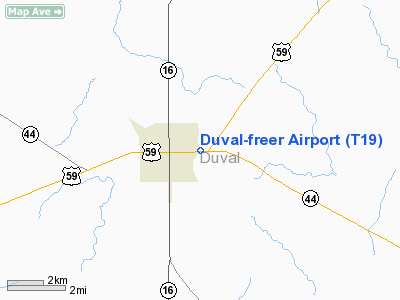
Location & QuickFacts
| FAA Information Effective: | 2008-09-25 |
| Airport Identifier: | T19 |
| Airport Status: | Operational |
| Longitude/Latitude: | 098-36-01.0530W/27-53-01.0670N
-98.600293/27.883630 (Estimated) |
| Elevation: | 564 ft / 171.91 m (Surveyed) |
| Land: | 66 acres |
| From nearest city: | 1 nautical miles NE of Freer, TX |
| Location: | Duval County, TX |
| Magnetic Variation: | 07E (1985) |
Owner & Manager
| Ownership: | Publicly owned |
| Owner: | Duval Co - City Of Freer |
| Address: | Duval Co Courthouse
San Diego, TX 78384 |
| Phone number: | 361-279-3322 |
| Manager: | Arnoldo Cantu
MAYOR. |
| Address: | P.o. Drawer N
Freer, TX 78357 |
| Phone number: | 361-394-6912 |
Airport Operations and Facilities
| Airport Use: | Open to public |
| Wind indicator: | Yes
WIND INDICATOR LIGHTS OTS INDEFLY. |
| Segmented Circle: | Yes |
| Control Tower: | No |
| Lighting Schedule: | DUSK-DAWN |
| Beacon Color: | Clear-Green (lighted land airport)
ROTG BCN OTS INDEFLY. |
| Landing fee charge: | No |
| Sectional chart: | Brownsville |
| Region: | ASW - Southwest |
| Boundary ARTCC: | ZHU - Houston |
| Tie-in FSS: | SJT - San Angelo |
| FSS on Airport: | No |
| FSS Toll Free: | 1-800-WX-BRIEF |
| NOTAMs Facility: | SJT (NOTAM-d service avaliable) |
Airport Communications
Airport Services
| Airframe Repair: | NONE |
| Power Plant Repair: | NONE |
Runway Information
Runway 14/32
| Dimension: | 3200 x 60 ft / 975.4 x 18.3 m |
| Surface: | ASPH, Fair Condition |
| Weight Limit: | Single wheel: 24000 lbs. |
| Edge Lights: | Low |
| |
Runway 14 |
Runway 32 |
| Traffic Pattern: | Left | Left |
| Markings: | Basic, Poor Condition
14/32; APRON & TWY MARKINGS ARE FADING. | Basic, Poor Condition |
| Obstruction: | 10 ft brush, 360.0 ft from runway, 16:1 slope to clear | 35 ft pline, 762.0 ft from runway, 200 ft left of centerline, 16:1 slope to clear |
|
Radio Navigation Aids
| ID |
Type |
Name |
Ch |
Freq |
Var |
Dist |
| TKB | NDB | Kleberg County | | 347.00 | 06E | 32.0 nm |
| HBV | NDB | Hebbronville | | 266.00 | 06E | 32.7 nm |
| BKS | NDB | Brooks County | | 353.00 | 06E | 48.0 nm |
| NOG | TACAN | Orange Grove | 063X | | 09E | 29.6 nm |
| NQI | TACAN | Kingsville | 125X | | 09E | 48.2 nm |
| ALI | VOR | Alice | | 114.50 | 06E | 32.0 nm |
| COT | VORTAC | Cotulla | 105X | 115.80 | 09E | 44.3 nm |
| THX | VORTAC | Three Rivers | 051X | 111.40 | 08E | 44.3 nm |
| LRD | VORTAC | Laredo | 121X | 117.40 | 09E | 49.9 nm |
Remarks
- EXEMPT UNDER GRANDFATHER CLAUSE.
Images and information placed above are from
http://www.airport-data.com/airport/T19/
We thank them for the data!
| General Info
|
| Country |
United States
|
| State |
TEXAS
|
| FAA ID |
T19
|
| Latitude |
27-53-01.067N
|
| Longitude |
098-36-01.053W
|
| Elevation |
564 feet
|
| Near City |
FREER
|
We don't guarantee the information is fresh and accurate. The data may
be wrong or outdated.
For more up-to-date information please refer to other sources.
|
|


