 |
|
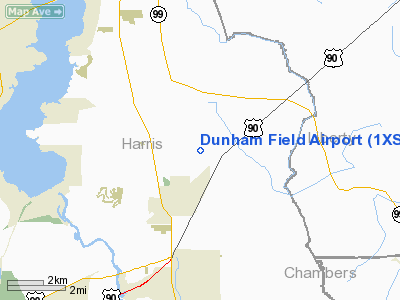
Location & QuickFacts
| FAA Information Effective: | 2008-09-25 |
| Airport Identifier: | 1XS1 |
| Airport Status: | Operational |
| Longitude/Latitude: | 095-02-47.7400W/29-56-17.7900N
-95.046594/29.938275 (Estimated) |
| Elevation: | 60 ft / 18.29 m (Estimated) |
| Land: | 10 acres |
| From nearest city: | 2 nautical miles NE of Crosby, TX |
| Location: | Harris County, TX |
| Magnetic Variation: | 05E (1995) |
Owner & Manager
| Ownership: | Privately owned |
| Owner: | Richard N. Dunham |
| Address: | 17806 Ramsey Road
Crosby, TX 77532 |
| Phone number: | 281-328-3024 |
| Manager: | Terry D. Dunham |
| Address: | 17818 Ramsey Road
Crosby, TX 77532 |
| Phone number: | 832-524-0383 |
Airport Operations and Facilities
| Airport Use: | Private |
| Wind indicator: | Yes |
| Segmented Circle: | No |
| Control Tower: | No |
| Lighting Schedule: | RDO-CTL
ACTVT LIRL RY 09/27 - 122.75. |
| Sectional chart: | Houston |
| Region: | ASW - Southwest |
| Boundary ARTCC: | ZHU - Houston |
| Tie-in FSS: | CXO - Montgomery County |
| FSS on Airport: | No |
| FSS Toll Free: | 1-800-WX-BRIEF |
Airport Communications
Airport Services
Runway Information
Runway 09/27
| Dimension: | 2800 x 100 ft / 853.4 x 30.5 m |
| Surface: | TURF, |
| Edge Lights: | Low |
| |
Runway 09 |
Runway 27 |
| Traffic Pattern: | Left | Left |
| Obstruction: | 40 ft trees | |
|
Radio Navigation Aids
| ID |
Type |
Name |
Ch |
Freq |
Var |
Dist |
| BVP | NDB | Nixin | | 326.00 | 05E | 9.4 nm |
| JPA | NDB | Sanjac | | 347.00 | 05E | 16.3 nm |
| CBC | NDB | Anahuac | | 413.00 | 05E | 22.3 nm |
| DWH | NDB | David Hooks | | 521.00 | 05E | 29.3 nm |
| EYQ | NDB | Weiser | | 286.00 | 06E | 31.0 nm |
| LYD | NDB | Lakeside | | 249.00 | 05E | 33.7 nm |
| SYG | NDB | Sandy Point | | 402.00 | 05E | 34.2 nm |
| SGR | NDB | Hull | | 388.00 | 05E | 36.7 nm |
| GLS | NDB | Galveston | | 206.00 | 08E | 39.4 nm |
| GDE | NDB | Goodhue | | 368.00 | 07E | 44.6 nm |
| HRD | NDB | Hardin County | | 524.00 | 04E | 47.4 nm |
| EFD | TACAN | Ellington | 031X | | 05E | 20.8 nm |
| HUB | VOR/DME | Hobby | 118X | 117.10 | 05E | 20.8 nm |
| MHF | VOR/DME | Trinity | 083X | 113.60 | 07E | 28.3 nm |
| IAH | VORTAC | Humble | 113X | 116.60 | 05E | 15.6 nm |
| DAS | VORTAC | Daisetta | 116X | 116.90 | 05E | 25.8 nm |
| VUH | VORTAC | Scholes | 077X | 113.00 | 06E | 41.3 nm |
| HOU | VOT | Houston Wm P Hobby | | 108.40 | | 21.4 nm |
Remarks
- ULTRALIGHT ACTIVITY ON ARPT.
- LND ON RY 27 & DEP ON RY 09.
Images and information placed above are from
http://www.airport-data.com/airport/1XS1/
We thank them for the data!
| General Info
|
| Country |
United States
|
| State |
TEXAS
|
| FAA ID |
1XS1
|
| Latitude |
29-56-17.790N
|
| Longitude |
095-02-47.740W
|
| Elevation |
60 feet
|
| Near City |
CROSBY
|
We don't guarantee the information is fresh and accurate. The data may
be wrong or outdated.
For more up-to-date information please refer to other sources.
|
|


