 |
|
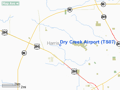
Location & QuickFacts
| FAA Information Effective: | 2008-09-25 |
| Airport Identifier: | TS07 |
| Airport Status: | Operational |
| Longitude/Latitude: | 095-41-08.2350W/29-59-10.7170N
-95.685621/29.986310 (Estimated) |
| Elevation: | 152 ft / 46.33 m (Estimated) |
| Land: | 25 acres |
| From nearest city: | 1 nautical miles NE of Cypress, TX |
| Location: | Harris County, TX |
| Magnetic Variation: | 06E (1985) |
Owner & Manager
| Ownership: | Privately owned |
| Owner: | Skinner Road Arpt Community Hoa |
| Address: | 14425 Dry Creek Dr.
Cypress, TX 77429 |
| Phone number: | 287-373-1098 |
| Manager: | Cleo Bickford |
| Address: | 14425 Dry Creek Dr.
Cypress, TX 77429 |
| Phone number: | 281-373-1098 |
Airport Operations and Facilities
| Airport Use: | Private |
| Wind indicator: | Yes |
| Segmented Circle: | No |
| Control Tower: | No |
| Lighting Schedule: | DUSK-DAWN
ACTVT ROTG BCN DURG DALGT IN INCLEMENT WEATHER - 122.9. |
| Beacon Color: | Clear-Green (lighted land airport) |
| Landing fee charge: | No |
| Sectional chart: | Houston |
| Region: | ASW - Southwest |
| Boundary ARTCC: | ZHU - Houston |
| Tie-in FSS: | CXO - Montgomery County |
| FSS on Airport: | No |
| FSS Toll Free: | 1-800-WX-BRIEF |
Airport Services
| Airframe Repair: | NONE |
| Power Plant Repair: | NONE |
Runway Information
Runway 17/35
| Dimension: | 3580 x 80 ft / 1091.2 x 24.4 m |
| Surface: | TURF, Good Condition |
| Edge Lights: | Medium |
| |
Runway 17 |
Runway 35 |
| Traffic Pattern: | Right | Left |
| Displaced threshold: | 450.00 ft
& RY 35 THLDS DSPLCD NIGHT ONLY. | 595.00 ft |
| VASI: | tri-color on right side | |
| Obstruction: | 42 ft pole, 416.0 ft from runway | 66 ft tree, 617.0 ft from runway, 11:1 slope to clear |
|
Radio Navigation Aids
| ID |
Type |
Name |
Ch |
Freq |
Var |
Dist |
| EYQ | NDB | Weiser | | 286.00 | 06E | 3.9 nm |
| LYD | NDB | Lakeside | | 249.00 | 05E | 10.2 nm |
| DWH | NDB | David Hooks | | 521.00 | 05E | 10.4 nm |
| SGR | NDB | Hull | | 388.00 | 05E | 21.3 nm |
| BVP | NDB | Nixin | | 326.00 | 05E | 24.5 nm |
| SYG | NDB | Sandy Point | | 402.00 | 05E | 31.2 nm |
| JPA | NDB | Sanjac | | 347.00 | 05E | 37.4 nm |
| BNH | NDB | Brenham | | 362.00 | 06E | 38.5 nm |
| UTS | NDB | Huntsville | | 308.00 | 06E | 45.6 nm |
| EFD | TACAN | Ellington | 031X | | 05E | 35.7 nm |
| HUB | VOR/DME | Hobby | 118X | 117.10 | 05E | 29.2 nm |
| ELA | VOR/DME | Eagle Lake | 111X | 116.40 | 08E | 38.3 nm |
| IAH | VORTAC | Humble | 113X | 116.60 | 05E | 17.8 nm |
| TNV | VORTAC | Navasota | 106X | 115.90 | 08E | 26.6 nm |
| IDU | VORTAC | Industry | 039X | 110.20 | 08E | 45.7 nm |
| HOU | VOT | Houston Wm P Hobby | | 108.40 | | 29.5 nm |
Images and information placed above are from
http://www.airport-data.com/airport/TS07/
We thank them for the data!
| General Info
|
| Country |
United States
|
| State |
TEXAS
|
| FAA ID |
TS07
|
| Latitude |
29-59-05.799N
|
| Longitude |
095-41-10.805W
|
| Elevation |
150 feet
|
| Near City |
CYPRESS
|
We don't guarantee the information is fresh and accurate. The data may
be wrong or outdated.
For more up-to-date information please refer to other sources.
|
|


