 |
|
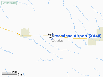
Location & QuickFacts
| FAA Information Effective: | 2008-09-25 |
| Airport Identifier: | XA48 |
| Airport Status: | Operational |
| Longitude/Latitude: | 097-18-54.0000W/33-38-30.0000N
-97.315000/33.641667 (Estimated) |
| Elevation: | 945 ft / 288.04 m (Estimated) |
| Land: | 5 acres |
| From nearest city: | 1 nautical miles N of Myra, TX |
| Location: | Cooke County, TX |
| Magnetic Variation: | () |
Owner & Manager
| Ownership: | Privately owned |
| Owner: | Dale W. Hendrickson |
| Address: | P. O. Box 514
Muenster, TX 76252 |
| Phone number: | 940-591-6604 |
| Manager: | Dale W. Hendrickson |
| Address: | P. O. Box 514
Muenster, TX 76252 |
| Phone number: | 940-591-6604 |
Airport Operations and Facilities
| Airport Use: | Private |
| Wind indicator: | Yes |
| Control Tower: | No |
| Sectional chart: | Dallas-ft Worth |
| Region: | ASW - Southwest |
| Boundary ARTCC: | ZFW - Fort Worth |
| Tie-in FSS: | FTW - Fort Worth |
| FSS Phone: | 817-541-3474 |
| FSS Toll Free: | 1-800-WX-BRIEF |
Runway Information
Runway 14/32
| Dimension: | 1800 x 40 ft / 548.6 x 12.2 m |
| Surface: | TURF, |
| |
Runway 14 |
Runway 32 |
| Traffic Pattern: | Left | Left |
|
Radio Navigation Aids
| ID |
Type |
Name |
Ch |
Freq |
Var |
Dist |
| GLE | NDB | Gainesville | | 330.00 | 06E | 7.4 nm |
| GMZ | NDB | Grindstone Mountain | | 356.00 | 07E | 23.0 nm |
| AUV | NDB | Arbuckle | | 284.00 | 07E | 32.0 nm |
| DNI | NDB | Denison | | 341.00 | 06E | 34.1 nm |
| DUA | NDB | Durant | | 359.00 | 05E | 49.2 nm |
| TTT | VOR/DME | Maverick | 078X | 113.10 | 06E | 48.4 nm |
| URH | VOR/DME | Texoma | 090X | 114.30 | 05E | 49.6 nm |
| CVE | VOR/DME | Cowboy | 109X | 116.20 | 06E | 49.7 nm |
| UKW | VORTAC | Bowie | 071X | 112.40 | 06E | 26.1 nm |
| ADM | VORTAC | Ardmore | 114X | 116.70 | 06E | 35.0 nm |
| FUZ | VORTAC | Ranger | 104X | 115.70 | 06E | 45.7 nm |
| FTW | VOT | Fort Worth Meacham | | 108.20 | | 49.6 nm |
Images and information placed above are from
http://www.airport-data.com/airport/XA48/
We thank them for the data!
|
|


