 |
|
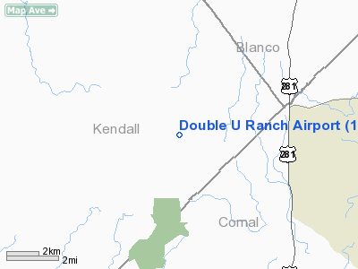
Location & QuickFacts
| FAA Information Effective: | 2008-09-25 |
| Airport Identifier: | 1XS0 |
| Airport Status: | Operational |
| Longitude/Latitude: | 098-28-51.0720W/29-55-20.7750N
-98.480853/29.922437 (Estimated) |
| Elevation: | 1170 ft / 356.62 m (Estimated) |
| Land: | 0 acres |
| From nearest city: | 5 nautical miles NW of Spring Branch, TX |
| Location: | Kendall County, TX |
| Magnetic Variation: | 07E (1985) |
Owner & Manager
| Ownership: | Privately owned |
| Owner: | J & V Guenther |
| Address: | 1 Ironwood
San Antonio, TX 78212 |
| Phone number: | 210-826-1649 |
| Manager: | Robbie Broyles |
| Address: | 1777 Ne Loop 410, Suite 1512
San Antonio, TX 78217 |
| Phone number: | 210-829-1800 |
Airport Operations and Facilities
| Airport Use: | Private |
| Wind indicator: | Yes |
| Segmented Circle: | No |
| Control Tower: | No |
| Landing fee charge: | No |
| Sectional chart: | San Antonio |
| Region: | ASW - Southwest |
| Boundary ARTCC: | ZHU - Houston |
| Tie-in FSS: | SJT - San Angelo |
| FSS on Airport: | No |
| FSS Toll Free: | 1-800-WX-BRIEF |
Airport Services
| Airframe Repair: | NONE |
| Power Plant Repair: | NONE |
Runway Information
Runway 16/34
| Dimension: | 3600 x 40 ft / 1097.3 x 12.2 m |
| Surface: | GRVL,
CALICHE |
| |
Runway 16 |
Runway 34 |
| Traffic Pattern: | Left | Left |
|
Radio Navigation Aids
| ID |
Type |
Name |
Ch |
Freq |
Var |
Dist |
| ER | NDB | Shein | | 263.00 | 08E | 27.5 nm |
| MFS | NDB | Horseshoe Bay Resort | | 403.00 | 07E | 36.7 nm |
| CVB | NDB | Castroville | | 338.00 | 08E | 39.6 nm |
| HMA | NDB | Hondo | | 329.00 | 08E | 48.9 nm |
| DHK | TACAN | Randolph | 036X | | 09E | 25.7 nm |
| KSY | TACAN | Kelly | 057X | | 07E | 32.3 nm |
| SSF | VOR | Stinson | | 108.40 | 09E | 40.0 nm |
| SAT | VORTAC | San Antonio | 115X | 116.80 | 08E | 16.8 nm |
| STV | VORTAC | Stonewall | 085X | 113.80 | 08E | 20.7 nm |
| RND | VORTAC | Randolph | 70X | 112.30 | 09E | 26.3 nm |
| CSI | VORTAC | Center Point | 122X | 117.50 | 08E | 38.2 nm |
| SAT | VOT | San Antonio Intl | | 110.40 | | 23.4 nm |
Remarks
- MAY BE EXEMPT UNDER GRANDFATHER CLAUSE.
Images and information placed above are from
http://www.airport-data.com/airport/1XS0/
We thank them for the data!
| General Info
|
| Country |
United States
|
| State |
TEXAS
|
| FAA ID |
1XS0
|
| Latitude |
29-55-20.775N
|
| Longitude |
098-28-51.072W
|
| Elevation |
1170 feet
|
| Near City |
SPRING BRANCH
|
We don't guarantee the information is fresh and accurate. The data may
be wrong or outdated.
For more up-to-date information please refer to other sources.
|
|


