 |
|
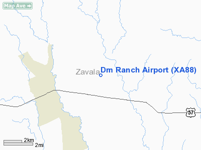
Location & QuickFacts
| FAA Information Effective: | 2008-09-25 |
| Airport Identifier: | XA88 |
| Airport Status: | Operational |
| Longitude/Latitude: | 099-33-47.0000W/28-58-42.0000N
-99.563056/28.978333 (Estimated) |
| Elevation: | 750 ft / 228.60 m (Estimated) |
| Land: | 650 acres |
| From nearest city: | 4 nautical miles NE of Batesville, TX |
| Location: | Zavala County, TX |
| Magnetic Variation: | () |
Owner & Manager
| Ownership: | Privately owned |
| Owner: | Green & Schweers Inc |
| Address: | 3052 Fm 187
Batesville, TX 78829 |
| Phone number: | 830-376-4493 |
| Manager: | Mark Schweers |
| Address: | 3052 Fm 187
Batesville, TX 78829 |
| Phone number: | 830-591-7443 |
Airport Operations and Facilities
| Airport Use: | Private |
| Wind indicator: | Yes |
| Control Tower: | No |
| Sectional chart: | San Antonio |
| Region: | ASW - Southwest |
| Boundary ARTCC: | ZHU - Houston |
| Tie-in FSS: | SJT - San Angelo |
| FSS Toll Free: | 1-800-WX-BRIEF |
Runway Information
Runway 06/24
| Dimension: | 2800 x 150 ft / 853.4 x 45.7 m |
| Surface: | TURF, Good Condition |
| |
Runway 06 |
Runway 24 |
| Traffic Pattern: | Left | Left |
|
Radio Navigation Aids
| ID |
Type |
Name |
Ch |
Freq |
Var |
Dist |
| UVA | NDB | Uvalde | | 281.00 | 07E | 14.7 nm |
| LKX | NDB | La Pryor | | 223.00 | 09E | 15.6 nm |
| CPZ | NDB | Chaparrosa Ranch | | 385.00 | 10E | 23.6 nm |
| DMD | NDB | Dimmit County | | 343.00 | 07E | 30.7 nm |
| HMA | NDB | Hondo | | 329.00 | 08E | 31.4 nm |
| HHH | NDB | Devine | | 359.00 | 07E | 34.2 nm |
| CVB | NDB | Castroville | | 338.00 | 08E | 43.5 nm |
| PFO | NDB | Spofford | | 356.00 | 08E | 46.5 nm |
| HDO | VOR/DME | Hondo | 31X | 109.40 | 08E | 30.1 nm |
| COT | VORTAC | Cotulla | 105X | 115.80 | 09E | 38.9 nm |
Images and information placed above are from
http://www.airport-data.com/airport/XA88/
We thank them for the data!
|
|


