 |
|
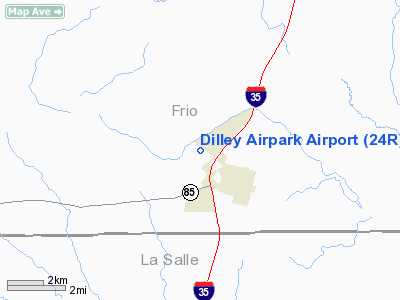
Location & QuickFacts
| FAA Information Effective: | 2008-09-25 |
| Airport Identifier: | 24R |
| Airport Status: | Operational |
| Longitude/Latitude: | 099-11-21.1210W/28-41-07.9250N
-99.189200/28.685535 (Estimated) |
| Elevation: | 542 ft / 165.20 m (Surveyed) |
| Land: | 46 acres |
| From nearest city: | 2 nautical miles NW of Dilley, TX |
| Location: | Frio County, TX |
| Magnetic Variation: | 08E (1985) |
Owner & Manager
| Ownership: | Publicly owned |
| Owner: | City Of Dilley |
| Address: | Po Box 230
Dilley, TX 78017 |
| Phone number: | 830-965-4177 |
| Manager: | Billy L Dillard
CHAIRMAN ARPT BOARD. |
| Address: | Po Drawer D
Dilley, TX 78017 |
| Phone number: | 830-965-1118 |
Airport Operations and Facilities
| Airport Use: | Open to public |
| Wind indicator: | Yes
WIND INDICATOR LGTS OTS INDEFLY. |
| Segmented Circle: | Yes |
| Control Tower: | No |
| Lighting Schedule: | DUSK-2300 |
| Beacon Color: | Clear-Green (lighted land airport) |
| Landing fee charge: | No |
| Sectional chart: | San Antonio |
| Region: | ASW - Southwest |
| Boundary ARTCC: | ZHU - Houston |
| Tie-in FSS: | SJT - San Angelo |
| FSS on Airport: | No |
| FSS Toll Free: | 1-800-WX-BRIEF |
| NOTAMs Facility: | SJT (NOTAM-d service avaliable) |
Airport Communications
Airport Services
Runway Information
Runway 12/30
| Dimension: | 3400 x 60 ft / 1036.3 x 18.3 m |
| Surface: | ASPH, Good Condition |
| Weight Limit: | Single wheel: 12500 lbs. |
| Edge Lights: | Low |
| |
Runway 12 |
Runway 30 |
| Traffic Pattern: | Left | Left |
| Markings: | Basic, Fair Condition | Basic, Good Condition |
| Obstruction: | 15 ft tree, 250.0 ft from runway, 105 ft right of centerline, 3:1 slope to clear
10 FT SHRUBS 100 FT FM THLD 120 FT RIGHT. | 60 ft sign, 1200.0 ft from runway, 150 ft right of centerline, 16:1 slope to clear
BRUSH 5 FT TALL, 150-200 FT FM END, 110 FT LEFT OF EXTENDED CNTRLN. |
|
Radio Navigation Aids
| ID |
Type |
Name |
Ch |
Freq |
Var |
Dist |
| HHH | NDB | Devine | | 359.00 | 07E | 30.2 nm |
| DMD | NDB | Dimmit County | | 343.00 | 07E | 35.1 nm |
| LKX | NDB | La Pryor | | 223.00 | 09E | 38.0 nm |
| PEZ | NDB | Pleasanton | | 275.00 | 07E | 38.9 nm |
| UVA | NDB | Uvalde | | 281.00 | 07E | 40.9 nm |
| HMA | NDB | Hondo | | 329.00 | 08E | 41.4 nm |
| CVB | NDB | Castroville | | 338.00 | 08E | 43.5 nm |
| CPZ | NDB | Chaparrosa Ranch | | 385.00 | 10E | 45.1 nm |
| HDO | VOR/DME | Hondo | 31X | 109.40 | 08E | 39.9 nm |
| COT | VORTAC | Cotulla | 105X | 115.80 | 09E | 13.9 nm |
Remarks
- 4 FT FENCE 250 FT FM RY 12 THLD BOTH SIDES OF CNTRLN.
- +15-30 FT TREES 150 FT EAST OF CNTRLN FROM 475 FT FROM RY 12 THLD ALONG EAST SIDE OF RY.
- TFC PAT LTD TO 1200MSL OR ABOVE.
Images and information placed above are from
http://www.airport-data.com/airport/24R/
We thank them for the data!
| General Info
|
| Country |
United States
|
| State |
TEXAS
|
| FAA ID |
24R
|
| Latitude |
28-41-07.925N
|
| Longitude |
099-11-21.121W
|
| Elevation |
542 feet
|
| Near City |
DILLEY
|
We don't guarantee the information is fresh and accurate. The data may
be wrong or outdated.
For more up-to-date information please refer to other sources.
|
|


