 |
|
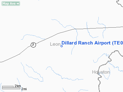
Location & QuickFacts
| FAA Information Effective: | 2008-09-25 |
| Airport Identifier: | TE01 |
| Airport Status: | Operational |
| Longitude/Latitude: | 095-47-47.8350W/31-18-17.6490N
-95.796621/31.304903 (Estimated) |
| Elevation: | 225 ft / 68.58 m (Estimated) |
| Land: | 10 acres |
| From nearest city: | 11 nautical miles E of Centerville, TX |
| Location: | Leon County, TX |
| Magnetic Variation: | 06E (1985) |
Owner & Manager
| Ownership: | Privately owned |
| Owner: | Wendell H. Dillard, Sr. |
| Address: | 1872 Cr 148
Centerville, TX 75833 |
| Phone number: | 903-536-7000 |
| Manager: | Bev Martin |
| Address: | 1872 Cr 148
Centerville, TX 75833 |
| Phone number: | 903-536-7000 |
Airport Operations and Facilities
| Airport Use: | Private |
| Wind indicator: | Yes |
| Segmented Circle: | No |
| Control Tower: | No |
| Sectional chart: | Houston |
| Region: | ASW - Southwest |
| Boundary ARTCC: | ZHU - Houston |
| Tie-in FSS: | CXO - Montgomery County |
| FSS Toll Free: | 1-800-WX-BRIEF
FOR FP FILING CALL CXO FSS 1-800-833-5602. |
Runway Information
Runway 06/24
| Dimension: | 3100 x 90 ft / 944.9 x 27.4 m |
| Surface: | TURF, |
| |
Runway 06 |
Runway 24 |
| Traffic Pattern: | Left | Left |
| Obstruction: | 50 ft trees, 100.0 ft from runway | 50 ft trees, 100.0 ft from runway |
|
Runway 16/34
| Dimension: | 1900 x 85 ft / 579.1 x 25.9 m |
| Surface: | TURF, |
| |
Runway 16 |
Runway 34 |
| Traffic Pattern: | Left | Left |
| Obstruction: | 50 ft trees, 150.0 ft from runway | 50 ft trees, 80.0 ft from runway |
|
Radio Navigation Aids
| ID |
Type |
Name |
Ch |
Freq |
Var |
Dist |
| PSN | NDB | Palestine | | 375.00 | 04E | 29.0 nm |
| UTS | NDB | Huntsville | | 308.00 | 06E | 35.5 nm |
| PYF | NDB | Pyramid | | 418.00 | 06E | 39.3 nm |
| LXY | NDB | Mexia | | 329.00 | 07E | 41.8 nm |
| LIQ | NDB | Lochridge Ranch | | 335.00 | 09E | 43.2 nm |
| JSO | NDB | Cherokee County | | 263.00 | 05E | 45.2 nm |
| CSZ | NDB | Crossroads | | 215.00 | 08E | 46.3 nm |
| GNL | VOR/DME | Groesbeck | 025X | 108.80 | 05E | 42.0 nm |
| FZT | VOR/DME | Frankston | 051X | 111.40 | 06E | 48.2 nm |
| LOA | VORTAC | Leona | 045X | 110.80 | 08E | 14.0 nm |
Images and information placed above are from
http://www.airport-data.com/airport/TE01/
We thank them for the data!
| General Info
|
| Country |
United States
|
| State |
TEXAS
|
| FAA ID |
TE01
|
| Latitude |
31-18-17.649N
|
| Longitude |
095-47-47.835W
|
| Elevation |
225 feet
|
| Near City |
CENTERVILLE
|
We don't guarantee the information is fresh and accurate. The data may
be wrong or outdated.
For more up-to-date information please refer to other sources.
|
|


