 |
|
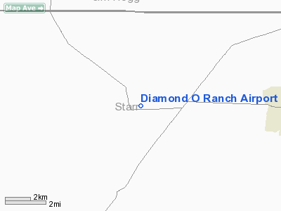
Location & QuickFacts
| FAA Information Effective: | 2008-09-25 |
| Airport Identifier: | XS93 |
| Airport Status: | Operational |
| Longitude/Latitude: | 098-33-31.0700W/26-43-01.2000N
-98.558631/26.717000 (Estimated) |
| Elevation: | 420 ft / 128.02 m (Estimated) |
| Land: | 0 acres |
| From nearest city: | 5 nautical miles SW of Santa Elena, TX |
| Location: | Starr County, TX |
| Magnetic Variation: | 07E (1990) |
Owner & Manager
| Ownership: | Privately owned |
| Owner: | W.b. Osborn, Jr. |
| Address: | Po Box 200
Santa Elena, TX 78591 |
| Phone number: | 210-481-3595
OWNERS OFFICE PHONE IN SAN ANTONIO 512-826-8654 |
| Manager: | D Alvarez, Ranch Foreman |
| Address: | Po Box 200
Santa Elena, TX 78591 |
| Phone number: | 210-481-3564 |
Airport Operations and Facilities
| Airport Use: | Private |
| Wind indicator: | Yes |
| Segmented Circle: | No |
| Control Tower: | No |
| Lighting Schedule: | PHONE REQ
FOR RWY LGTS & ROTG BCN CALL 512-481-3564 |
| Beacon Color: | Clear (unlighted land airport) |
| Landing fee charge: | No |
| Sectional chart: | Brownsville |
| Region: | ASW - Southwest |
| Boundary ARTCC: | ZHU - Houston |
| Tie-in FSS: | SJT - San Angelo |
| FSS on Airport: | No |
| FSS Toll Free: | 1-800-WX-BRIEF |
Airport Services
| Fuel available: | 100LLA
FUEL AVBL EMERG ONLY. |
| Airframe Repair: | NONE |
| Power Plant Repair: | NONE |
Runway Information
Runway 12/30
| Dimension: | 4250 x 100 ft / 1295.4 x 30.5 m |
| Surface: | ASPH, |
| Edge Lights: | Low |
| |
Runway 12 |
Runway 30 |
| Traffic Pattern: | Left | Left |
|
Radio Navigation Aids
| ID |
Type |
Name |
Ch |
Freq |
Var |
Dist |
| SNE | NDB | Santa Elena | | 260.00 | 07E | 1.0 nm |
| BKS | NDB | Brooks County | | 353.00 | 06E | 37.6 nm |
| HBV | NDB | Hebbronville | | 266.00 | 06E | 39.6 nm |
| REX | VOR | Reynosa | | 112.40 | 08E | 45.9 nm |
| MFE | VOR/DME | Mc Allen | 119X | 117.20 | 09E | 36.9 nm |
Remarks
- PER ARPT MANAGER 40K LB MAX LANDING WEIGHT ALLOWED
- EXISTED PRIOR TO 1959.
Images and information placed above are from
http://www.airport-data.com/airport/XS93/
We thank them for the data!
| General Info
|
| Country |
United States
|
| State |
TEXAS
|
| FAA ID |
XS93
|
| Latitude |
26-43-01.200N
|
| Longitude |
098-33-31.070W
|
| Elevation |
420 feet
|
| Near City |
SANTA ELENA
|
We don't guarantee the information is fresh and accurate. The data may
be wrong or outdated.
For more up-to-date information please refer to other sources.
|
|


