|
|
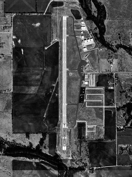
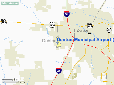
| Denton Municipal Airport |
 |
| USGS aerial image, 11 January 1996 |
| IATA: none – ICAO: KDTO – FAA LID: DTO |
| Summary |
| Airport type |
Public |
| Owner |
City of Denton |
| Serves |
Denton, Texas |
| Elevation AMSL |
642 ft / 196 m |
| Coordinates |
33°12′03″N 097°11′53″W / 33.20083°N 97.19806°W / 33.20083; -97.19806 |
| Runways |
| Direction |
Length |
Surface |
| ft |
m |
| 17/35 |
5,999 |
1,828 |
Asphalt |
| Statistics (2009) |
| Aircraft operations |
105,010 |
| Based aircraft |
179 |
| Source: Federal Aviation Administration |
Denton Municipal Airport (ICAO: KDTO, FAA LID: DTO), also known as Denton Airport, is a city-owned public-use airport located three nautical miles (6 km) west of the central business district of Denton, a city in Denton County, Texas, United States.
Although most U.S. airports use the same three-letter location identifier for the FAA and IATA, this airport is assigned DTO by the FAA but has no designation from the IATA. History
Established in 1942. During 1943 and 1944 was used by the United States Army Air Forces as a contract glider training airfield. Known as Denton Field. Harte Flying Service provided instruction. Used primarily C-47 Skytrains and Waco CG-4 unpowered Gliders. The mission of the school was to train glider pilot students in proficiency in operation of gliders in various types of towed and soaring flight, both day and night, and in servicing of gliders in the field.
Inactivated on late 1944 with the drawdown of AAFTC's pilot training program. Declared surplus and turned over to the Army Corps of Engineers on 30 September 1945. Eventually discharged to the War Assets Administration (WAA) and became a civil airport in December 1946.
Facilities and aircraft
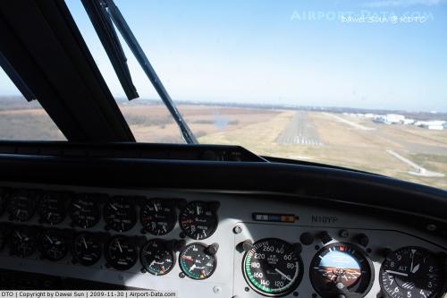
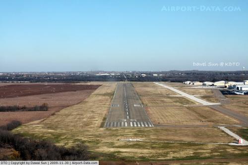
Denton Municipal Airport covers an area of 700 acres (283 ha) at an elevation of 642 feet (196 m) above mean sea level. It has one asphalt paved runway designated 17/35 which measures 5,999 by 150 feet (1,828 x 46 m).
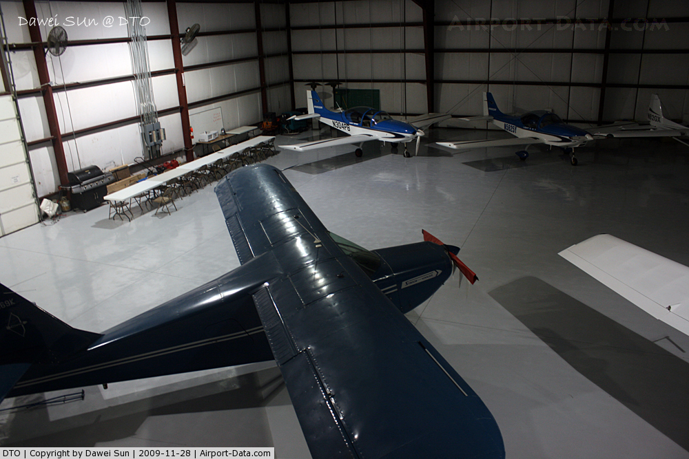
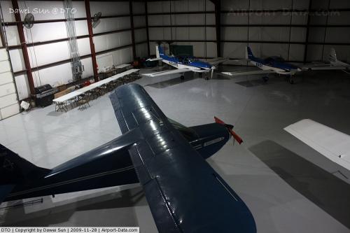
For the 12-month period ending March 7, 2009, the airport had 105,010 aircraft operations, an average of 287 per day: 99% general aviation, 1% air taxi and <1% military. At that time there were 179 aircraft based at this airport: 73% single-engine, 16% multi-engine, 6% jet, 4% helicopter and 1% glider.
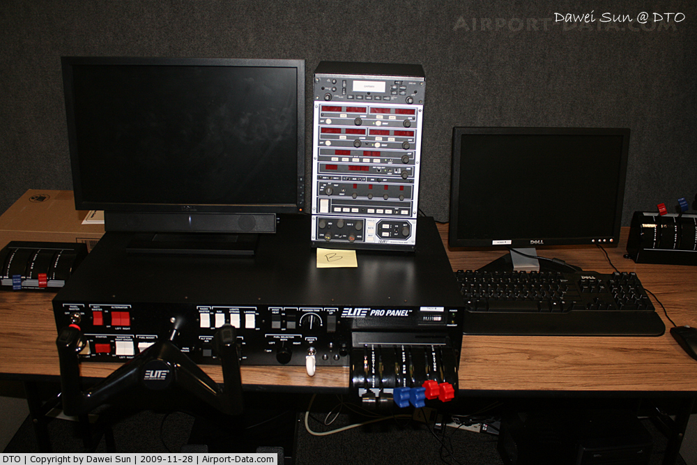
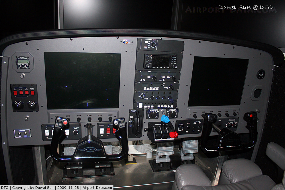
The Airport has 3 flight schools:
- US Flight Academy
- All American Helicopters
- Longhorn Helicopters
The above content comes from Wikipedia and is published under free licenses – click here to read more.
 |
(Click on the photo to enlarge) |
 |
(Click on the photo to enlarge) |
 |
(Click on the photo to enlarge) |
 |
(Click on the photo to enlarge) |
 |
(Click on the photo to enlarge) |
Location & QuickFacts
| FAA Information Effective: | 2008-09-25 |
| Airport Identifier: | DTO |
| Airport Status: | Operational |
| Longitude/Latitude: | 097-11-52.7181W/33-12-02.5982N
-97.197977/33.200722 (Estimated) |
| Elevation: | 642 ft / 195.68 m (Surveyed) |
| Land: | 700 acres |
| From nearest city: | 3 nautical miles W of Denton, TX |
| Location: | Denton County, TX |
| Magnetic Variation: | 07E (1985) |
Owner & Manager
| Ownership: | Publicly owned |
| Owner: | City Of Denton |
| Address: | 215 E. Mckinney
Denton, TX 76201 |
| Phone number: | 940-349-7744 |
| Manager: | Tim Whitman |
| Address: | 5000 Arpt Rd
Denton, TX 76205-0207 |
| Phone number: | 940-349-7744
ALSO 940-349-8535. |
Airport Operations and Facilities
| Airport Use: | Open to public |
| Wind indicator: | Yes |
| Segmented Circle: | Yes |
| Control Tower: | Yes |
| Lighting Schedule: | DUSK-DAWN
WHEN ATCT CLSD ACTVT MALSR RY 17 - CTAF. |
| Beacon Color: | Clear-Green (lighted land airport) |
| Landing fee charge: | No |
| Sectional chart: | Dallas-ft Worth |
| Region: | ASW - Southwest |
| Traffic Pattern Alt: | 800 ft |
| Boundary ARTCC: | ZFW - Fort Worth |
| Tie-in FSS: | FTW - Fort Worth |
| FSS on Airport: | No |
| FSS Phone: | 817-541-3474 |
| FSS Toll Free: | 1-800-WX-BRIEF |
| NOTAMs Facility: | DTO (NOTAM-d service avaliable) |
| Federal Agreements: | NGY3 |
Airport Communications
| CTAF: | 119.950 |
| Unicom: | 122.950 |
Airport Services
| Fuel available: | 100LLA |
| Airframe Repair: | MAJOR |
| Power Plant Repair: | MAJOR |
| Bottled Oxygen: | NONE |
| Bulk Oxygen: | NONE |
Runway Information
Runway 17/35
| Dimension: | 5999 x 150 ft / 1828.5 x 45.7 m |
| Surface: | ASPH, Good Condition |
| Weight Limit: | Single wheel: 70000 lbs.
Dual wheel: 100000 lbs. |
| Edge Lights: | Medium |
| |
Runway 17 |
Runway 35 |
| Longitude: | 097-11-52.0621W | 097-11-53.3739W |
| Latitude: | 33-12-32.2704N | 33-11-32.9260N |
| Elevation: | 640.00 ft | 627.00 ft |
| Alignment: | 127 | 1 |
| ILS Type: | ILS
| |
| Traffic Pattern: | Left | Left |
| Markings: | Precision instrument, Good Condition | Precision instrument, Good Condition |
| Crossing Height: | 53.00 ft | 26.00 ft |
| VASI: | 4-box on left side | 2-box on left side |
| Visual Glide Angle: | 3.00° | 4.00° |
| Approach lights: | MALSR | |
| Obstruction: | 26 ft trees, 1127.0 ft from runway, 75 ft right of centerline, 35:1 slope to clear | 22 ft trees, 474.0 ft from runway, 75 ft left of centerline, 12:1 slope to clear |
|
Radio Navigation Aids
| ID |
Type |
Name |
Ch |
Freq |
Var |
Dist |
| GLE | NDB | Gainesville | | 330.00 | 06E | 31.1 nm |
| RBD | NDB | Redbird | | 287.00 | 06E | 35.5 nm |
| GMZ | NDB | Grindstone Mountain | | 356.00 | 07E | 37.8 nm |
| XQH | NDB | Cedar Hill | | 353.00 | 08E | 38.3 nm |
| PQF | NDB | Mesquite | | 248.00 | 06E | 41.1 nm |
| LNC | NDB | Lancaster | | 239.00 | 06E | 44.5 nm |
| DNI | NDB | Denison | | 341.00 | 06E | 45.9 nm |
| JUG | NDB | Jecca | | 388.00 | 06E | 46.4 nm |
| MII | NDB | Caddo Mills | | 316.00 | 06E | 48.8 nm |
| NFW | TACAN | Nas Jrb Fort Worth | 024X | | 07E | 28.5 nm |
| TTT | VOR/DME | Maverick | 078X | 113.10 | 06E | 21.5 nm |
| CVE | VOR/DME | Cowboy | 109X | 116.20 | 06E | 23.8 nm |
| FUZ | VORTAC | Ranger | 104X | 115.70 | 06E | 18.7 nm |
| UKW | VORTAC | Bowie | 071X | 112.40 | 06E | 37.2 nm |
| MQP | VORTAC | Millsap | 124X | 117.70 | 09E | 49.4 nm |
| FTW | VOT | Fort Worth Meacham | | 108.20 | | 24.4 nm |
| DAL | VOT | Dallas Love Field | | 113.30 | | 27.5 nm |
Remarks
- RWY 17 DESIGNATED AS A CALM WIND RWY.
- ARPT CLSD TO ULTRALIGHTS AND GLIDERS.
- MOWING OPNS ON ARPT MAY-SEP.
Images and information placed above are from
http://www.airport-data.com/airport/DTO/
We thank them for the data!
| General Info
|
| Country |
United States
|
| State |
TEXAS
|
| FAA ID |
DTO
|
| Latitude |
33-12-02.598N
|
| Longitude |
097-11-52.718W
|
| Elevation |
642 feet
|
| Near City |
DENTON
|
We don't guarantee the information is fresh and accurate. The data may
be wrong or outdated.
For more up-to-date information please refer to other sources.
|
|