 |
|
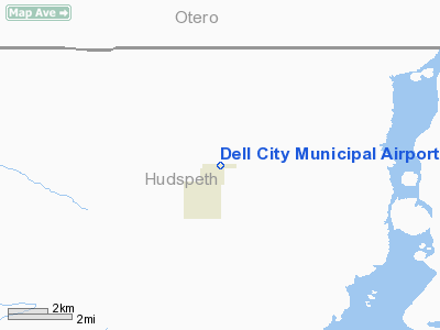
Location & QuickFacts
| FAA Information Effective: | 2008-09-25 |
| Airport Identifier: | 2E5 |
| Airport Status: | Operational |
| Longitude/Latitude: | 105-11-30.0400W/31-56-51.3000N
-105.191678/31.947583 (Estimated) |
| Elevation: | 3701 ft / 1128.06 m (Surveyed) |
| Land: | 75 acres |
| From nearest city: | 2 nautical miles N of Dell City, TX |
| Location: | Hudspeth County, TX |
| Magnetic Variation: | 10E (1985) |
Owner & Manager
| Ownership: | Publicly owned |
| Owner: | City Of Dell City |
| Address: | Po Box 125
Dell City, TX 79837 |
| Phone number: | 915-964-2344 |
| Manager: | Eddie Chacon
MAYOR PRO TEM/CITY COUNCILMAN. |
| Address: | Po Box 353
Dell City, TX 79837 |
| Phone number: | 915-964-2223 |
Airport Operations and Facilities
| Airport Use: | Open to public |
| Wind indicator: | Yes |
| Segmented Circle: | Yes |
| Control Tower: | No |
| Lighting Schedule: | DUSK-DAWN |
| Beacon Color: | Clear-Green (lighted land airport) |
| Landing fee charge: | No |
| Sectional chart: | El Paso |
| Region: | ASW - Southwest |
| Boundary ARTCC: | ZAB - Albuquerque |
| Tie-in FSS: | ABQ - Albuquerque |
| FSS on Airport: | No |
| FSS Toll Free: | 1-800-WX-BRIEF |
| NOTAMs Facility: | ABQ (NOTAM-d service avaliable) |
Airport Communications
Airport Services
| Airframe Repair: | NONE |
| Power Plant Repair: | NONE |
| Bottled Oxygen: | NONE |
| Bulk Oxygen: | NONE |
Runway Information
Runway 08/26
| Dimension: | 4685 x 55 ft / 1428.0 x 16.8 m |
| Surface: | ASPH, Good Condition |
| Weight Limit: | Single wheel: 12500 lbs. |
| Edge Lights: | Medium |
| |
Runway 08 |
Runway 26 |
| Traffic Pattern: | Left | Left |
| Markings: | Basic, Fair Condition | Basic, Fair Condition |
| Displaced threshold: | 0.00 ft | 400.00 ft
DISPLACED THRESHOLD BAR NOT PAINTED. |
| Obstruction: | 15 ft road, 550.0 ft from runway, 23:1 slope to clear | 12 ft bldg, 205.0 ft from runway, 65 ft right of centerline
APCH SLOPE 50:1 TO DSPLCD THR.
DIRT ROAD AT 150 FT ACRS APCH. 4 FT FENCE POSTS 145 FT FROM THLD 0B. |
|
Radio Navigation Aids
| ID |
Type |
Name |
Ch |
Freq |
Var |
Dist |
| PIO | VOR/DME | Pinon | 041X | 110.40 | 12E | 35.4 nm |
| SFL | VORTAC | Salt Flat | 077X | 113.00 | 12E | 13.1 nm |
| HUP | VORTAC | Hudspeth | 097X | 115.00 | 12E | 24.7 nm |
Images and information placed above are from
http://www.airport-data.com/airport/2E5/
We thank them for the data!
| General Info
|
| Country |
United States
|
| State |
TEXAS
|
| FAA ID |
2E5
|
| Latitude |
31-57-42.405N
|
| Longitude |
105-11-47.843W
|
| Elevation |
3701 feet
|
| Near City |
DELL CITY
|
We don't guarantee the information is fresh and accurate. The data may
be wrong or outdated.
For more up-to-date information please refer to other sources.
|
|


