 |
|
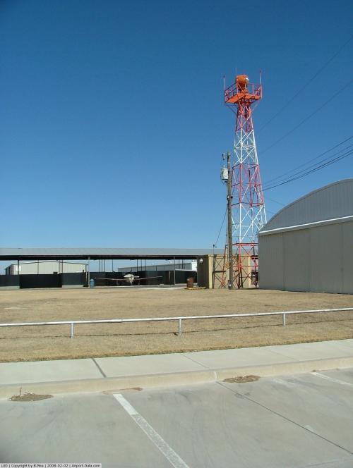 |
(Click on the photo to enlarge) |
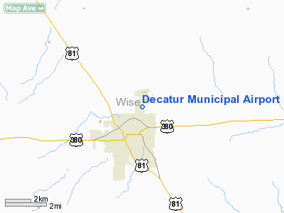
Location & QuickFacts
| FAA Information Effective: | 2008-09-25 |
| Airport Identifier: | LUD |
| Airport Status: | Operational |
| Longitude/Latitude: | 097-34-49.8000W/33-15-15.3000N
-97.580500/33.254250 (Estimated) |
| Elevation: | 1047 ft / 319.13 m (Surveyed) |
| Land: | 131 acres |
| From nearest city: | 2 nautical miles N of Decatur, TX |
| Location: | Wise County, TX |
| Magnetic Variation: | 09E (2000) |
Owner & Manager
| Ownership: | Publicly owned |
| Owner: | City Of Decatur |
| Address: | Po Box 1299
Decatur, TX 76234 |
| Phone number: | 940-627-2741 |
| Manager: | Michael Sayers |
| Address: | 351 Airport Road
Decatur, TX 76234 |
| Phone number: | 940-627-2855 |
Airport Operations and Facilities
| Airport Use: | Open to public |
| Wind indicator: | Yes |
| Segmented Circle: | Yes |
| Control Tower: | No |
| Lighting Schedule: | DUSK-DAWN
MIRL RY 17/35 PRESET LOW INTST; TO INCR INTST ACTVT - CTAF. |
| Beacon Color: | Clear-Green (lighted land airport) |
| Landing fee charge: | No |
| Sectional chart: | Dallas-ft Worth |
| Region: | ASW - Southwest |
| Boundary ARTCC: | ZFW - Fort Worth |
| Tie-in FSS: | FTW - Fort Worth |
| FSS on Airport: | No |
| FSS Phone: | 817-541-3474 |
| FSS Toll Free: | 1-800-WX-BRIEF |
| NOTAMs Facility: | LUD (NOTAM-d service avaliable) |
| Federal Agreements: | NY1 |
Airport Communications
| CTAF: | 122.800 |
| Unicom: | 122.800 |
Airport Services
| Fuel available: | 100LLA |
| Airframe Repair: | MAJOR |
| Power Plant Repair: | MAJOR |
| Bottled Oxygen: | HIGH/LOW |
| Bulk Oxygen: | NONE |
Runway Information
Runway 17/35
| Dimension: | 4200 x 60 ft / 1280.2 x 18.3 m |
| Surface: | ASPH, Good Condition |
| Weight Limit: | Single wheel: 12500 lbs.
Dual wheel: 17000 lbs. |
| Edge Lights: | Medium |
| |
Runway 17 |
Runway 35 |
| Longitude: | 097-34-53.0081W | 097-34-46.5092W |
| Latitude: | 33-15-35.8642N | 33-14-54.6700N |
| Elevation: | 1041.00 ft | 1037.00 ft |
| Alignment: | 127 | 127 |
| Traffic Pattern: | Left | Right |
| Markings: | Non-precision instrument, Fair Condition | Non-precision instrument, Fair Condition |
| Crossing Height: | 25.00 ft | 0.00 ft |
| VASI: | 2-light PAPI on left side | |
| Visual Glide Angle: | 3.50° | 0.00° |
| Obstruction: | , 50:1 slope to clear | 22 ft pline, 1078.0 ft from runway, 39:1 slope to clear |
|
Radio Navigation Aids
| ID |
Type |
Name |
Ch |
Freq |
Var |
Dist |
| GMZ | NDB | Grindstone Mountain | | 356.00 | 07E | 23.2 nm |
| GLE | NDB | Gainesville | | 330.00 | 06E | 33.8 nm |
| MWL | NDB | Mineral Wells | | 266.00 | 06E | 37.0 nm |
| GZV | NDB | Brazos River | | 280.00 | 07E | 45.7 nm |
| GHX | NDB | Graham | | 371.00 | 07E | 46.4 nm |
| RBD | NDB | Redbird | | 287.00 | 06E | 49.8 nm |
| NFW | TACAN | Nas Jrb Fort Worth | 024X | | 07E | 29.9 nm |
| TTT | VOR/DME | Maverick | 078X | 113.10 | 06E | 35.7 nm |
| CVE | VOR/DME | Cowboy | 109X | 116.20 | 06E | 40.5 nm |
| UKW | VORTAC | Bowie | 071X | 112.40 | 06E | 20.8 nm |
| FUZ | VORTAC | Ranger | 104X | 115.70 | 06E | 29.8 nm |
| MQP | VORTAC | Millsap | 124X | 117.70 | 09E | 38.1 nm |
| FTW | VOT | Fort Worth Meacham | | 108.20 | | 28.5 nm |
| DAL | VOT | Dallas Love Field | | 113.30 | | 44.1 nm |
Remarks
- GND DROPS SHARPLY 160 FT NORTH OF RY 17 THLD.
- GLIDER ACTIVITY ON WKENDS APR-OCT. GLIDER TFC PATTERN IS ON THE WEST SIDE OF ARPT. RIGHT TFC PAT FOR ALL POWERED ACFT ON RY 35.
Images and information placed above are from
http://www.airport-data.com/airport/LUD/
We thank them for the data!
| General Info
|
| Country |
United States
|
| State |
TEXAS
|
| FAA ID |
LUD
|
| Latitude |
33.254639
33° 15' 16.70" N
|
| Longitude |
-97.580556
097° 34' 50.00" W
|
| Elevation |
1047 feet
319 meters
|
| Magnetic Variation |
005° E (01/06)
|
| Beacon |
Yes
|
| Operating Agency |
MUNICIPAL
|
| Daylight Saving Time |
Second Sunday in March at 0200 to first Sunday in November at 0200 local time (Exception Arizona and that portion of Indiana in the Eastern Time Zone)
|
We don't guarantee the information is fresh and accurate. The data may
be wrong or outdated.
For more up-to-date information please refer to other sources.
|
|


