 |
|
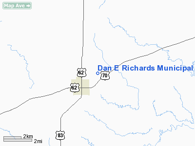
Dan E Richards Muni Airport |
Location & QuickFacts
| FAA Information Effective: | 2008-09-25 |
| Airport Identifier: | 3F6 |
| Airport Status: | Operational |
| Longitude/Latitude: | 100-16-55.2090W/34-01-39.4790N
-100.282002/34.027633 (Estimated) |
| Elevation: | 1860 ft / 566.93 m (Surveyed) |
| Land: | 35 acres |
| From nearest city: | 1 nautical miles E of Paducah, TX |
| Location: | Cottle County, TX |
| Magnetic Variation: | 10E (1965) |
Owner & Manager
| Ownership: | Publicly owned |
| Owner: | City Of Paducah & Cottle Co |
| Address: | Po Box 759
Paducah, TX 79248 |
| Phone number: | 806-492-3713 |
| Manager: | Judge D.n. Gregory
COUNTY JUDGE. |
| Address: | Po Box 729
Paducah, TX 79248 |
| Phone number: | 806-492-3613 |
Airport Operations and Facilities
| Airport Use: | Open to public |
| Wind indicator: | Yes |
| Segmented Circle: | Yes |
| Control Tower: | No |
| Lighting Schedule: | DUSK-DAWN
MIRL RY 17/35 PRESET LOW INTST; TO INCR INTST ACTVT - CTAF. |
| Beacon Color: | Clear-Green (lighted land airport)
ROTG BCN OTS INDEFLY. |
| Landing fee charge: | No |
| Sectional chart: | Dallas-ft Worth |
| Region: | ASW - Southwest |
| Boundary ARTCC: | ZFW - Fort Worth |
| Tie-in FSS: | FTW - Fort Worth |
| FSS on Airport: | No |
| FSS Phone: | 817-541-3474 |
| FSS Toll Free: | 1-800-WX-BRIEF |
| NOTAMs Facility: | FTW (NOTAM-d service avaliable) |
Airport Communications
Airport Services
| Bottled Oxygen: | NONE |
| Bulk Oxygen: | NONE |
Runway Information
Runway 17/35
| Dimension: | 3186 x 50 ft / 971.1 x 15.2 m |
| Surface: | ASPH, Good Condition
LOOSE GRAVEL AND GRASS ENCROACHMENT ON SURFACE. |
| Weight Limit: | Single wheel: 8500 lbs. |
| Edge Lights: | Medium |
| |
Runway 17 |
Runway 35 |
| Longitude: | 100-16-55.2420W | 100-16-55.2060W |
| Latitude: | 34-01-55.2730N | 34-01-23.7590N |
| Elevation: | 1859.00 ft | 1850.00 ft |
| Alignment: | 127 | 127 |
| Traffic Pattern: | Left | Left |
| Markings: | Non-precision instrument, Good Condition | Non-precision instrument, Good Condition |
| Obstruction: | 23 ft tree, 665.0 ft from runway, 130 ft right of centerline, 20:1 slope to clear
+4 FT FENCE 60 FT FM THR 100 FT RIGHT; FENCE AT THR 100 FT RIGHT. | 5 ft berm, 200.0 ft from runway, 90 ft left of centerline
5 FT BERM 90 FT LEFT AT THLD. |
|
Helipad H1
| Dimension: | 25 x 25 ft / 7.6 x 7.6 m |
| Surface: | ASPH, Poor Condition
LOOSE GRAVEL AND GRASS ENCROACHMENT ON SURFACE. |
| |
Runway H1 |
Runway |
| Traffic Pattern: | Left | Left |
| Markings: | Nonstandard,
MKD WITH A WHITE 'H' PAINTED ON THE PARKING RAMP 125 FT E OF RY CNTRLN. | ,
MKD WITH A WHITE 'H' PAINTED ON THE PARKING RAMP 125 FT E OF RY CNTRLN. |
|
Radio Navigation Aids
| ID |
Type |
Name |
Ch |
Freq |
Var |
Dist |
| GTH | VORTAC | Guthrie | 092X | 114.50 | 10E | 15.2 nm |
| CDS | VORTAC | Childress | 123X | 117.60 | 10E | 20.5 nm |
Remarks
- RY 17 HAS A 10 FT DROP OFF 60 FT FM THR.
Images and information placed above are from
http://www.airport-data.com/airport/3F6/
We thank them for the data!
| General Info
|
| Country |
United States
|
| State |
TEXAS
|
| FAA ID |
3F6
|
| Latitude |
34-01-39.479N
|
| Longitude |
100-16-55.209W
|
| Elevation |
1860 feet
|
| Near City |
PADUCAH
|
We don't guarantee the information is fresh and accurate. The data may
be wrong or outdated.
For more up-to-date information please refer to other sources.
|
|


