 |
|
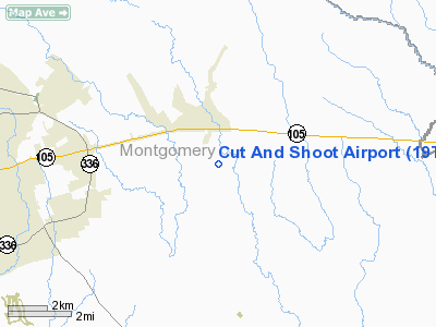
Location & QuickFacts
| FAA Information Effective: | 2008-09-25 |
| Airport Identifier: | 19TE |
| Airport Status: | Operational |
| Longitude/Latitude: | 095-20-00.7750W/30-19-00.7580N
-95.333549/30.316877 (Estimated) |
| Elevation: | 170 ft / 51.82 m (Estimated) |
| Land: | 63 acres |
| From nearest city: | 7 nautical miles E of Conroe, TX |
| Location: | Montgomery County, TX |
| Magnetic Variation: | 06E (1985) |
Owner & Manager
| Ownership: | Privately owned |
| Owner: | A.l. Schank |
| Address: | Rt 19, Box 5467
Conroe, TX 77303 |
| Phone number: | 409-264-1266 |
| Manager: | Travis W Schank |
| Address: | Rt 19, Box 5462
Conroe, TX 77303 |
| Phone number: | 409-264-2713 |
Airport Operations and Facilities
| Airport Use: | Private |
| Wind indicator: | Yes |
| Segmented Circle: | No |
| Control Tower: | No |
| Landing fee charge: | No |
| Sectional chart: | Houston |
| Region: | ASW - Southwest |
| Boundary ARTCC: | ZHU - Houston |
| Tie-in FSS: | CXO - Montgomery County |
| FSS on Airport: | No |
| FSS Toll Free: | 1-800-WX-BRIEF
FOR FP FILING CALL CXO FSS 1-800-833-5602. |
Airport Services
| Airframe Repair: | NONE |
| Power Plant Repair: | NONE |
Runway Information
Runway 17/35
| Dimension: | 2900 x 125 ft / 883.9 x 38.1 m |
| Surface: | TURF, |
| |
Runway 17 |
Runway 35 |
| Traffic Pattern: | Left | Left |
| Obstruction: | 12 ft poles, 62 ft right of centerline | , 50.0 ft from runway, 3:1 slope to clear |
|
Radio Navigation Aids
| ID |
Type |
Name |
Ch |
Freq |
Var |
Dist |
| DWH | NDB | David Hooks | | 521.00 | 05E | 16.7 nm |
| BVP | NDB | Nixin | | 326.00 | 05E | 20.4 nm |
| EYQ | NDB | Weiser | | 286.00 | 06E | 28.0 nm |
| UTS | NDB | Huntsville | | 308.00 | 06E | 28.8 nm |
| LYD | NDB | Lakeside | | 249.00 | 05E | 35.0 nm |
| JPA | NDB | Sanjac | | 347.00 | 05E | 41.3 nm |
| SGR | NDB | Hull | | 388.00 | 05E | 44.4 nm |
| CBC | NDB | Anahuac | | 413.00 | 05E | 47.8 nm |
| SYG | NDB | Sandy Point | | 402.00 | 05E | 49.5 nm |
| EFD | TACAN | Ellington | 031X | | 05E | 43.7 nm |
| HUB | VOR/DME | Hobby | 118X | 117.10 | 05E | 39.9 nm |
| IAH | VORTAC | Humble | 113X | 116.60 | 05E | 21.6 nm |
| DAS | VORTAC | Daisetta | 116X | 116.90 | 05E | 36.6 nm |
| TNV | VORTAC | Navasota | 106X | 115.90 | 08E | 37.6 nm |
| HOU | VOT | Houston Wm P Hobby | | 108.40 | | 40.5 nm |
Remarks
Images and information placed above are from
http://www.airport-data.com/airport/19TE/
We thank them for the data!
| General Info
|
| Country |
United States
|
| State |
TEXAS
|
| FAA ID |
19TE
|
| Latitude |
30-19-00.758N
|
| Longitude |
095-20-00.775W
|
| Elevation |
170 feet
|
| Near City |
CONROE
|
We don't guarantee the information is fresh and accurate. The data may
be wrong or outdated.
For more up-to-date information please refer to other sources.
|
|


