 |
|
Coordinates: 31°03′28″N 104°47′02″W / 31.05778°N 104.78389°W / 31.05778; -104.78389
| Culberson County Airport |
| IATA: VHN – ICAO: KVHN – FAA LID: VHN |
| Summary |
| Airport type |
Public |
| Owner |
Culberson County |
| Location |
Culberson County, near Van Horn, Texas |
| Elevation AMSL |
3,957 ft / 1,206 m |
| Runways |
| Direction |
Length |
Surface |
| ft |
m |
| 3/21 |
6,000 |
1,829 |
Asphalt |
| 7/25 |
5,353 |
1,632 |
Asphalt |
| Statistics (2007) |
| Aircraft operations |
500 |
| Source: Federal Aviation Administration |
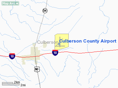
Culberson County Airport (IATA: VHN, ICAO: KVHN, FAA LID: VHN) is a county-owned public-use airport located three miles (5 km) northeast of the central business district of Van Horn, a town in Culberson County, Texas, United States. Facilities and aircraft
Culberson County Airport covers an area of 1,000 acres (405 ha) which contains two asphalt paved runways: 3/21 measuring 6,000 x 75 ft. (1,829 x 23 m) and 7/25 measuring 5,353 x 75 ft. (1,632 x 23 m). For the 12-month period ending April 27, 2007, the airport had 500 aircraft operations: 60% general aviation and 40% military.
History
During World War II the airfield was used by the United States Army Air Force
The above content comes from Wikipedia and is published under free licenses – click here to read more.
Location & QuickFacts
| FAA Information Effective: | 2008-09-25 |
| Airport Identifier: | VHN |
| Airport Status: | Operational |
| Longitude/Latitude: | 104-47-01.7000W/31-03-28.2390N
-104.783806/31.057844 (Estimated) |
| Elevation: | 3957 ft / 1206.09 m (Surveyed) |
| Land: | 1000 acres |
| From nearest city: | 3 nautical miles NE of Van Horn, TX |
| Location: | Culberson County, TX |
| Magnetic Variation: | 10E (1990) |
Owner & Manager
| Ownership: | Publicly owned |
| Owner: | Culberson County |
| Address: | County Courthouse
Van Horn, TX 79855 |
| Phone number: | 915-283-2059 |
| Manager: | Larry Simpson
COUNTY COMMISSIONER. |
| Address: | Box 583
Van Horn, TX 79855 |
| Phone number: | 915-283-2237 |
Airport Operations and Facilities
| Airport Use: | Open to public |
| Wind indicator: | Yes |
| Segmented Circle: | Yes |
| Control Tower: | No |
| Lighting Schedule: | DUSK-DAWN
MIRL RYS 03/21 & 07/25 PRESET LOW INTST SS-SR; TO INCR INTST ACTVT - CTAF. AFT SR ACTVT - CTAF. |
| Beacon Color: | Clear-Green (lighted land airport) |
| Landing fee charge: | No |
| Sectional chart: | El Paso |
| Region: | ASW - Southwest |
| Boundary ARTCC: | ZAB - Albuquerque |
| Tie-in FSS: | ABQ - Albuquerque |
| FSS on Airport: | No |
| FSS Toll Free: | 1-800-WX-BRIEF |
| NOTAMs Facility: | ABQ (NOTAM-d service avaliable) |
| Federal Agreements: | NGY3 |
Airport Communications
Airport Services
| Fuel available: | 100LLA1+
FOR FUEL CALL 432-283-2237/2664/2920/2003. |
| Bottled Oxygen: | NONE |
| Bulk Oxygen: | NONE |
Runway Information
Runway 03/21
| Dimension: | 6000 x 75 ft / 1828.8 x 22.9 m |
| Surface: | ASPH, |
| Weight Limit: | Single wheel: 15000 lbs. |
| Edge Lights: | Medium |
| |
Runway 03 |
Runway 21 |
| Longitude: | 104-47-28.5070W | 104-46-40.1400W |
| Latitude: | 31-03-15.0910N | 31-03-57.4130N |
| Elevation: | 3956.00 ft | 3918.00 ft |
| Alignment: | 45 | 127 |
| Traffic Pattern: | Left | Left |
| Markings: | Non-precision instrument, Good Condition | Non-precision instrument, Good Condition |
| Crossing Height: | 23.00 ft | 24.00 ft |
| VASI: | 2-box on right side | 2-box on left side |
| Visual Glide Angle: | 3.00° | 3.00° |
| Obstruction: | 5 ft brush, 275.0 ft from runway, 250 ft left of centerline, 15:1 slope to clear | , 50:1 slope to clear |
|
Runway 07/25
| Dimension: | 5353 x 75 ft / 1631.6 x 22.9 m |
| Surface: | ASPH, Good Condition |
| Weight Limit: | Single wheel: 15000 lbs. |
| Edge Lights: | Medium |
| |
Runway 07 |
Runway 25 |
| Longitude: | 104-47-29.3610W | 104-46-28.1260W |
| Latitude: | 31-03-16.6100N | 31-03-21.7620N |
| Elevation: | 3957.00 ft | 3911.00 ft |
| Alignment: | 84 | 127 |
| Traffic Pattern: | Left | Left |
| Markings: | Basic, Good Condition | Basic, Good Condition |
| Obstruction: | 5 ft brush, 275.0 ft from runway, 15:1 slope to clear | , 50:1 slope to clear |
|
Radio Navigation Aids
| ID |
Type |
Name |
Ch |
Freq |
Var |
Dist |
| VHN | NDB | Van Horn | | 233.00 | 10E | 0.3 nm |
| HUP | VORTAC | Hudspeth | 097X | 115.00 | 12E | 43.2 nm |
| SFL | VORTAC | Salt Flat | 077X | 113.00 | 12E | 44.3 nm |
Remarks
- GCO AVBL ON FREQ 121.725 THRU ABQ AFSS.
Images and information placed above are from
http://www.airport-data.com/airport/VHN/
We thank them for the data!
| General Info
|
| Country |
United States
|
| State |
TEXAS
|
| FAA ID |
VHN
|
| Latitude |
31-03-28.239N
|
| Longitude |
104-47-01.700W
|
| Elevation |
3957 feet
|
| Near City |
VAN HORN
|
We don't guarantee the information is fresh and accurate. The data may
be wrong or outdated.
For more up-to-date information please refer to other sources.
|
|


