 |
|
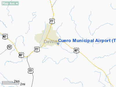
Location & QuickFacts
| FAA Information Effective: | 2008-09-25 |
| Airport Identifier: | T71 |
| Airport Status: | Operational |
| Longitude/Latitude: | 097-16-00.9630W/29-05-00.9170N
-97.266934/29.083588 (Estimated) |
| Elevation: | 214 ft / 65.23 m (Surveyed) |
| Land: | 75 acres |
| From nearest city: | 1 nautical miles E of Cuero, TX |
| Location: | De Witt County, TX |
| Magnetic Variation: | 07E (1985) |
Owner & Manager
| Ownership: | Publicly owned |
| Owner: | City Of Cuero |
| Address: | 201 E Main St
Cuero, TX 77954 |
| Phone number: | 361-275-6258 |
| Manager: | Pilar Ruiz |
| Address: | P O Box 660
Cuero, TX 77954 |
| Phone number: | 361-275-6114 |
Airport Operations and Facilities
| Airport Use: | Open to public |
| Wind indicator: | Yes |
| Segmented Circle: | Yes |
| Control Tower: | No |
| Lighting Schedule: | DUSK-DAWN |
| Beacon Color: | Clear-Green (lighted land airport) |
| Landing fee charge: | No |
| Sectional chart: | San Antonio |
| Region: | ASW - Southwest |
| Boundary ARTCC: | ZHU - Houston |
| Tie-in FSS: | CXO - Montgomery County |
| FSS on Airport: | No |
| FSS Toll Free: | 1-800-WX-BRIEF
FOR FP FILING CALL CXO FSS 1-800-833-5602 |
| NOTAMs Facility: | CXO (NOTAM-d service avaliable) |
| Federal Agreements: | NY1 |
Airport Communications
Airport Services
| Airframe Repair: | NONE |
| Power Plant Repair: | NONE |
| Bottled Oxygen: | NONE |
| Bulk Oxygen: | NONE |
Runway Information
Runway 14/32
| Dimension: | 2800 x 60 ft / 853.4 x 18.3 m |
| Surface: | ASPH, Good Condition |
| Weight Limit: | Single wheel: 11000 lbs. |
| Edge Lights: | Low |
| |
Runway 14 |
Runway 32 |
| Traffic Pattern: | Left | Left |
| Markings: | Basic, Good Condition | Basic, Good Condition |
| Displaced threshold: | 243.00 ft | 192.00 ft
THLD DSPLCD 202 FT AT NIGHT. |
| Obstruction: | 48 ft pole, 840.0 ft from runway, 125 ft right of centerline, 13:1 slope to clear
APCH RATIO 22:1 FM DSPLCD THLD. | 23 ft rr, 380.0 ft from runway, 143 ft left of centerline, 7:1 slope to clear
APCH SLOPE 8:1 TO DSPLCD THLD, TREES 35 FT ABOVE RY ELEVATION AT 310 FT FM DSPLCD THLD 155 FT RIGHT OF CENTERLINE. |
|
Radio Navigation Aids
| ID |
Type |
Name |
Ch |
Freq |
Var |
Dist |
| OKT | NDB | Yoakum | | 350.00 | 06E | 15.3 nm |
| PKV | NDB | Port Lavaca | | 515.00 | 05E | 40.3 nm |
| MNO | NDB | Mellon Ranch | | 375.00 | 06E | 48.4 nm |
| VCT | VOR/DME | Victoria | 027X | 109.00 | 06E | 18.7 nm |
Remarks
- DEER OR WILD HOGS ON & INVOF AIRPORT.
Images and information placed above are from
http://www.airport-data.com/airport/T71/
We thank them for the data!
| General Info
|
| Country |
United States
|
| State |
TEXAS
|
| FAA ID |
T71
|
| Latitude |
29-05-00.917N
|
| Longitude |
097-16-00.963W
|
| Elevation |
214 feet
|
| Near City |
CUERO
|
We don't guarantee the information is fresh and accurate. The data may
be wrong or outdated.
For more up-to-date information please refer to other sources.
|
|


