 |
|
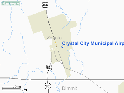
Crystal City Muni Airport |
Location & QuickFacts
| FAA Information Effective: | 2008-09-25 |
| Airport Identifier: | 20R |
| Airport Status: | Operational |
| Longitude/Latitude: | 099-49-04.1960W/28-41-51.9230N
-99.817832/28.697756 (Estimated) |
| Elevation: | 608 ft / 185.32 m (Surveyed) |
| Land: | 283 acres |
| From nearest city: | 1 nautical miles NE of Crystal City, TX |
| Location: | Zavala County, TX |
| Magnetic Variation: | 08E (1985) |
Owner & Manager
| Ownership: | Publicly owned |
| Owner: | City Of Crystal City |
| Address: | 101 E Dimmit St
Crystal City, TX 78839 |
| Phone number: | 830-374-3477 |
| Manager: | Diana Palacios |
| Address: | 101 E. Dimmit St
Crystal City, TX 78839 |
| Phone number: | 830-374-3477 |
Airport Operations and Facilities
| Airport Use: | Open to public |
| Wind indicator: | Yes
LIGHTING ON WIND SOCK OUT OF SERVICE INDEFINITELY. |
| Segmented Circle: | Yes |
| Control Tower: | No |
| Lighting Schedule: | DUSK-DAWN
ACTVT MIRL RY 13/31 - 123.5. |
| Beacon Color: | Clear-Green (lighted land airport)
ROTG BCN OTS INDEFLY. |
| Landing fee charge: | No |
| Sectional chart: | San Antonio |
| Region: | ASW - Southwest |
| Boundary ARTCC: | ZHU - Houston |
| Tie-in FSS: | SJT - San Angelo |
| FSS on Airport: | No |
| FSS Toll Free: | 1-800-WX-BRIEF |
| NOTAMs Facility: | SJT (NOTAM-d service avaliable) |
| Federal Agreements: | PS1 |
Airport Communications
Airport Services
| Fuel available: | 100LL |
| Airframe Repair: | NONE |
| Power Plant Repair: | NONE |
| Bottled Oxygen: | NONE |
| Bulk Oxygen: | NONE |
Runway Information
Runway 13/31
| Dimension: | 3550 x 100 ft / 1082.0 x 30.5 m |
| Surface: | ASPH, Poor Condition
; APRON & TWY BLOCK CRACKED WITH GRASS & LOOSE GRVL. |
| Weight Limit: | Single wheel: 21000 lbs. |
| Edge Lights: | Medium
MIRL OTS INDEFLY. |
| |
Runway 13 |
Runway 31 |
| Traffic Pattern: | Left | Left |
| Markings: | Basic, Poor Condition
RY 13/31 MARKINGS FADED & PEELING. | Basic, Poor Condition |
| Runway End Identifier: | No | No |
| Centerline Lights: | No | No |
| Touchdown Lights: | No | No |
| Obstruction: | 9 ft tree, 400.0 ft from runway, 140 ft right of centerline, 22:1 slope to clear
+3 FT FENCE ACROSS EXTDD CNTRLN 195 FT FM THLD. | 26 ft pline, 1476.0 ft from runway, 49:1 slope to clear |
|
Radio Navigation Aids
| ID |
Type |
Name |
Ch |
Freq |
Var |
Dist |
| DMD | NDB | Dimmit County | | 343.00 | 07E | 10.5 nm |
| LKX | NDB | La Pryor | | 223.00 | 09E | 14.1 nm |
| CPZ | NDB | Chaparrosa Ranch | | 385.00 | 10E | 16.1 nm |
| UVA | NDB | Uvalde | | 281.00 | 07E | 29.3 nm |
| PFO | NDB | Spofford | | 356.00 | 08E | 41.9 nm |
| COT | VORTAC | Cotulla | 105X | 115.80 | 09E | 39.5 nm |
Remarks
Images and information placed above are from
http://www.airport-data.com/airport/20R/
We thank them for the data!
| General Info
|
| Country |
United States
|
| State |
TEXAS
|
| FAA ID |
20R
|
| Latitude |
28-41-51.923N
|
| Longitude |
099-49-04.196W
|
| Elevation |
608 feet
|
| Near City |
CRYSTAL CITY
|
We don't guarantee the information is fresh and accurate. The data may
be wrong or outdated.
For more up-to-date information please refer to other sources.
|
|


