 |
|
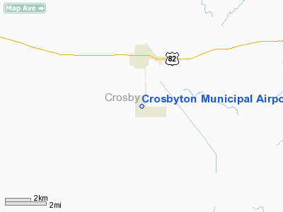
Location & QuickFacts
| FAA Information Effective: | 2008-09-25 |
| Airport Identifier: | 8F3 |
| Airport Status: | Operational |
| Longitude/Latitude: | 101-14-27.0558W/33-37-25.8109N
-101.240849/33.623836 (Estimated) |
| Elevation: | 3018 ft / 919.89 m (Surveyed) |
| Land: | 314 acres |
| From nearest city: | 2 nautical miles S of Crosbyton, TX |
| Location: | Crosby County, TX |
| Magnetic Variation: | 08E (1980) |
Owner & Manager
| Ownership: | Publicly owned |
| Owner: | City Of Crosbyton |
| Address: | 221 W Main
Crosbyton, TX 79322 |
| Phone number: | 806-675-2301 |
| Manager: | Margot Hardin |
| Address: | City Of Crosbyton, 221 W Main
Crosbyton, TX 79322 |
| Phone number: | 806-675-2301 |
Airport Operations and Facilities
| Airport Use: | Open to public |
| Wind indicator: | Yes |
| Segmented Circle: | Yes |
| Control Tower: | No |
| Lighting Schedule: | DUSK-DAWN
ACTIVATE MIRL RY 17/35 - CTAF; OPER ON STEP 1 ONLY. |
| Beacon Color: | Clear-Green (lighted land airport) |
| Landing fee charge: | No |
| Sectional chart: | Dallas-ft Worth |
| Region: | ASW - Southwest |
| Boundary ARTCC: | ZFW - Fort Worth |
| Tie-in FSS: | FTW - Fort Worth |
| FSS on Airport: | No |
| FSS Phone: | 817-541-3474 |
| FSS Toll Free: | 1-800-WX-BRIEF |
| NOTAMs Facility: | FTW (NOTAM-d service avaliable) |
| Federal Agreements: | 1Y |
Airport Communications
| CTAF: | 122.800 |
| Unicom: | 122.800 |
Airport Services
Runway Information
Runway 17/35
| Dimension: | 3600 x 60 ft / 1097.3 x 18.3 m |
| Surface: | ASPH, Good Condition |
| Weight Limit: | Single wheel: 12000 lbs. |
| Edge Lights: | Medium |
| |
Runway 17 |
Runway 35 |
| Longitude: | 101-14-27.0588W | 101-14-27.0528W |
| Latitude: | 33-37-43.6136N | 33-37-08.0082N |
| Elevation: | 3018.00 ft | 3013.00 ft |
| Alignment: | 127 | 127 |
| Traffic Pattern: | Left | Left |
| Markings: | Basic, Poor Condition
RY 17/35 MARKINGS BADLY FADED. | Non-precision instrument, Poor Condition |
| Crossing Height: | 0.00 ft | 23.00 ft |
| VASI: | 2-box on left side
VASI OTS INDEFLY. | 2-box on left side
VASI OTS INDEFLY. |
| Visual Glide Angle: | 0.00° | 4.00° |
| Obstruction: | 36 ft pline, 800.0 ft from runway, 266 ft right of centerline, 16:1 slope to clear
DIRT ROAD 165 FT FM THLD ACROSS APCH. | 12 ft trees, 420.0 ft from runway, 200 ft right of centerline, 18:1 slope to clear |
|
Radio Navigation Aids
| ID |
Type |
Name |
Ch |
Freq |
Var |
Dist |
| CZX | NDB | Crosbyton | | 332.00 | 09E | 0.1 nm |
| PVW | VOR/DME | Plainview | 076X | 112.90 | 11E | 39.0 nm |
| LBB | VORTAC | Lubbock | 029X | 109.20 | 11E | 34.0 nm |
| GTH | VORTAC | Guthrie | 092X | 114.50 | 10E | 46.2 nm |
Remarks
- WINDSOCK LGT OTS INDEFLY.
Images and information placed above are from
http://www.airport-data.com/airport/8F3/
We thank them for the data!
| General Info
|
| Country |
United States
|
| State |
TEXAS
|
| FAA ID |
8F3
|
| Latitude |
33-37-25.806N
|
| Longitude |
101-14-27.039W
|
| Elevation |
3017 feet
|
| Near City |
CROSBYTON
|
We don't guarantee the information is fresh and accurate. The data may
be wrong or outdated.
For more up-to-date information please refer to other sources.
|
|


