 |
|
| Cox Field |
 |
| USGS aerial image - 2 February 1995 |
| IATA: PRX – ICAO: KPRX – FAA LID: PRX |
| Summary |
| Airport type |
Public |
| Owner |
City of Paris |
| Serves |
Paris, Texas |
| Elevation AMSL |
547 ft / 167 m |
| Coordinates |
33°38′12″N 095°27′03″W / 33.63667°N 95.45083°W / 33.63667; -95.45083 |
| Runways |
| Direction |
Length |
Surface |
| ft |
m |
| 3/21 |
4,624 |
1,409 |
Concrete |
| 14/32 |
4,624 |
1,409 |
Concrete |
| 17/35 |
6,002 |
1,829 |
Asphalt |
| Helipads |
| Number |
Length |
Surface |
| ft |
m |
| H1 |
40 |
12 |
Concrete |
| Statistics (2007) |
| Aircraft operations |
8,050 |
| Based aircraft |
50 |
| Source: Federal Aviation Administration |
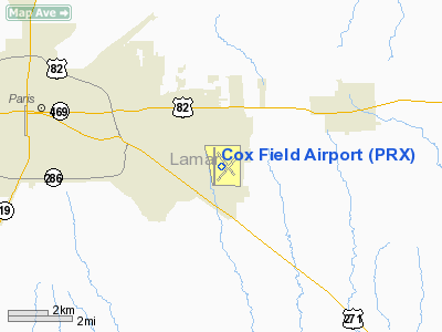
Cox Field (IATA: PRX, ICAO: KPRX, FAA LID: PRX) is a city-owned, public-use airport located six nautical miles (11 km) east of the central business district of Paris, a city in Lamar County, Texas, United States. It is owned by the city of Paris but is operated and maintained by J.R. Aviation, the airport's fixed base operator (FBO). History
The airport opened in August 1943 as Cox Army Airfield and was used by the United States Army Air Forces as a Air Technical Service Command aircraft maintenance and supply depot. At the end of the war the airfield was determined to be excess by the military and turned over to the local government for civil use.
Facilities and aircraft
Cox Field covers an area of 1,537 acres (622 ha) at an elevation of 547 feet (167 m) above mean sea level. It has three runways: 3/21 and 14/32 are both is 4,624 by 150 feet (1,409 x 46 m) with concrete surfaces and 17/35 is 6,002 by 150 feet (1,829 x 46 m) with an asphalt surface. It also has one helipad with a concrete surface measuring 40 by 40 feet (12 x 12 m).
For the 12-month period ending April 30, 2007, the airport had 8,050 aircraft operations, an average of 22 per day: 93% general aviation, 4% air taxi, and 3% military. At that time there were 50 aircraft based at this airport: 86% single-engine, 8% multi-engine, 4% jet and 2% helicopter.
The above content comes from Wikipedia and is published under free licenses – click here to read more.
Location & QuickFacts
| FAA Information Effective: | 2008-09-25 |
| Airport Identifier: | PRX |
| Airport Status: | Operational |
| Longitude/Latitude: | 095-27-02.7000W/33-38-11.8000N
-95.450750/33.636611 (Estimated) |
| Elevation: | 547 ft / 166.73 m (Surveyed) |
| Land: | 1537 acres |
| From nearest city: | 6 nautical miles E of Paris, TX |
| Location: | Lamar County, TX |
| Magnetic Variation: | 04E (2005) |
Owner & Manager
| Ownership: | Publicly owned |
| Owner: | City Of Paris |
| Address: | Box 9037
Paris, TX 75461 |
| Phone number: | 903-785-7511 |
| Manager: | Jerry Richey
FBO MANAGER. LISA WRIGHT, CITY AIRPORT DIRECTOR |
| Address: | Rt 7 Box 146a
Paris, TX 75460 |
| Phone number: | 903-784-4648 |
Airport Operations and Facilities
| Airport Use: | Open to public |
| Wind indicator: | Yes |
| Segmented Circle: | Yes |
| Control Tower: | No |
| Lighting Schedule: | DUSK-DAWN
MIRL RY 17/35 PRESET LOW INTST; TO INCR INTST & ACTVT VASI RY 35 - CTAF. |
| Beacon Color: | Clear-Green (lighted land airport) |
| Landing fee charge: | No |
| Sectional chart: | Dallas-ft Worth |
| Region: | ASW - Southwest |
| Boundary ARTCC: | ZFW - Fort Worth |
| Tie-in FSS: | FTW - Fort Worth |
| FSS on Airport: | No |
| FSS Phone: | 817-541-3474 |
| FSS Toll Free: | 1-800-WX-BRIEF |
| NOTAMs Facility: | PRX (NOTAM-d service avaliable) |
| Federal Agreements: | NGPY |
Airport Communications
| CTAF: | 122.975 |
| Unicom: | 122.975 |
Airport Services
| Fuel available: | 100LLA
JET A FUEL AVBL AT NIGHTS CALL 903-784-1071 OR 903-785-6176. 100LL AVBL 24 HR SELF SERVE WITH CREDIT CARD. |
| Airframe Repair: | MINOR |
| Power Plant Repair: | MINOR |
| Bottled Oxygen: | NONE |
| Bulk Oxygen: | NONE |
Runway Information
Runway 03/21
| Dimension: | 4624 x 150 ft / 1409.4 x 45.7 m |
| Surface: | CONC, Fair Condition |
| Weight Limit: | Single wheel: 26000 lbs. |
| |
Runway 03 |
Runway 21 |
| Longitude: | 095-27-10.8544W | 095-26-37.8124W |
| Latitude: | 33-37-49.0036N | 33-38-25.4568N |
| Elevation: | 530.00 ft | 546.00 ft |
| Alignment: | 37 | 127 |
| Traffic Pattern: | Left | Left |
| Markings: | Basic, Fair Condition
RY 03/21 MARKINGS FADED. | Basic, Fair Condition |
| Decleard distances: | Take off run available 4624.00 ft
Take off distance available 4624.00 ft
Actual stop distance available 4624.00 ft
Landing distance available 4624.00 ft
| Take off run available 4624.00 ft
Take off distance available 4624.00 ft
Actual stop distance available 4624.00 ft
Landing distance available 4624.00 ft
|
|
Runway 14/32
| Dimension: | 4624 x 150 ft / 1409.4 x 45.7 m |
| Surface: | CONC, Fair Condition |
| Weight Limit: | Single wheel: 26000 lbs. |
| |
Runway 14 |
Runway 32 |
| Longitude: | 095-27-11.6404W | 095-26-37.3483W |
| Latitude: | 33-38-34.4312N | 33-37-58.7933N |
| Elevation: | 540.00 ft | 547.00 ft |
| Alignment: | 127 | 127 |
| Traffic Pattern: | Left | Left |
| Markings: | Basic, Poor Condition
RY 14/32 MARKINGS FADED. | Basic, Poor Condition |
| Obstruction: | , 50:1 slope to clear
4 FT FENCE 1 FT FM END OF RY 247 FT LEFT OF CNTRLN. | 5 ft fence, 410.0 ft from runway, 42:1 slope to clear |
| Decleard distances: | Take off run available 4624.00 ft
Take off distance available 4624.00 ft
Actual stop distance available 4624.00 ft
Landing distance available 4624.00 ft
| Take off run available 4624.00 ft
Take off distance available 4624.00 ft
Actual stop distance available 4624.00 ft
Landing distance available 4624.00 ft
|
|
Runway 17/35
| Dimension: | 6002 x 150 ft / 1829.4 x 45.7 m |
| Surface: | ASPH, Fair Condition |
| Weight Limit: | Single wheel: 30000 lbs. |
| Edge Lights: | Medium |
| |
Runway 17 |
Runway 35 |
| Longitude: | 095-27-15.9519W | 095-27-14.9310W |
| Latitude: | 33-38-41.3526N | 33-37-41.9870N |
| Elevation: | 541.00 ft | 526.00 ft |
| Alignment: | 127 | 127 |
| Traffic Pattern: | Left | Left |
| Markings: | Non-precision instrument, Fair Condition | Non-precision instrument, Fair Condition |
| Crossing Height: | 0.00 ft | 53.00 ft |
| VASI: | 4-light PAPI on left side | 4-box on left side |
| Visual Glide Angle: | 3.00° | 3.00° |
| Obstruction: | 40 ft tree, 1150.0 ft from runway, 24:1 slope to clear | 51 ft tree, 1336.0 ft from runway, 22:1 slope to clear
20 FT TREE 100 FT FM END OF RY 280 FT LEFT OF CNTRLN. |
| Decleard distances: | Take off run available 6002.00 ft
Take off distance available 6002.00 ft
Actual stop distance available 6002.00 ft
Landing distance available 6002.00 ft
| Take off run available 6002.00 ft
Take off distance available 6002.00 ft
Actual stop distance available 6002.00 ft
Landing distance available 6002.00 ft
|
|
Helipad H1
| Dimension: | 40 x 40 ft / 12.2 x 12.2 m |
| Surface: | CONC, Fair Condition |
| |
Runway H1 |
Runway |
| Traffic Pattern: | Left | Left |
|
Radio Navigation Aids
| ID |
Type |
Name |
Ch |
Freq |
Var |
Dist |
| HHW | NDB | Hugo | | 323.00 | 05E | 24.6 nm |
| IBO | NDB | Idabel | | 271.00 | 03E | 34.4 nm |
| AEE | NDB | Antlers | | 391.00 | 05E | 34.8 nm |
| HJM | NDB | Rayburn | | 415.00 | 06E | 36.3 nm |
| MJF | TACAN | Arvilla | 033X | | 05E | 46.0 nm |
| PRX | VOR/DME | Paris | 083X | 113.60 | 07E | 5.7 nm |
| SLR | VOR/DME | Sulphur Springs | 027X | 109.00 | 08E | 26.7 nm |
| UIM | VOR/DME | Quitman | 087X | 114.00 | 08E | 45.6 nm |
| BYP | VORTAC | Bonham | 093X | 114.60 | 06E | 39.7 nm |
Remarks
- RYS 03/21 & 14/32 NOT AVBL FOR ACR OPNS WITH MORE THAN 30 PSGR SEATS.
- TWY A NORTH OF TWY A1 CLSD TO ACR OPNS.
- RY 14/32 NO LINE OF SIGHT BTN RY ENDS.
- +2 FT GRASS AROUND ALL RY SURFACES.
Images and information placed above are from
http://www.airport-data.com/airport/PRX/
We thank them for the data!
| General Info
|
| Country |
United States
|
| State |
TEXAS
|
| FAA ID |
PRX
|
| Latitude |
33-38-11.800N
|
| Longitude |
095-27-02.700W
|
| Elevation |
547 feet
|
| Near City |
PARIS
|
We don't guarantee the information is fresh and accurate. The data may
be wrong or outdated.
For more up-to-date information please refer to other sources.
|
|


