 |
|
| Coulter Field |
| IATA: CFD – ICAO: KCFD – FAA LID: CFD |
| Summary |
| Airport type |
Public |
| Owner |
City of Bryan |
| Serves |
Bryan, Texas |
| Elevation AMSL |
367 ft / 112 m |
| Coordinates |
30°42′56″N 096°19′53″W / 30.71556°N 96.33139°W / 30.71556; -96.33139 |
| Runways |
| Direction |
Length |
Surface |
| ft |
m |
| 14/32 |
4,000 |
1,219 |
Asphalt |
17/35
CLOSED |
1,330 |
405 |
Turf |
| Statistics (2008) |
| Aircraft operations |
16,200 |
| Based aircraft |
66 |
| Source: Federal Aviation Administration |
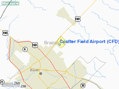
Coulter Field (IATA: CFD, ICAO: KCFD, FAA LID: CFD) is a public-use airport located three nautical miles (6 km) northeast of the central business district of Bryan, in Brazos County, Texas, United States. It is owned by the City of Bryan which is part of the Bryan-College Station area. The airport is used entirely for general aviation. History
Coulter Field has a long history with sport parachuting. With intentional parachute jumps having been conducted since the mid-1950s, skydiving at Coulter Field has continued through today. Ags Over Texas (AOT) was the home of the Texas A&M University skydiving team until its closure in 1999. In March 2002, Skydive Aggieland opened and is the current home of the Texas A&M University skydiving club. Texas Governor Rick Perry completed a successful static-line skydive at AOT while he was attending Texas A&M University in the 1970s and former President George H. W. Bush (41) completed a tandem skydive at Coulter Field in cooperation with Skydive Aggieland and the Golden Knights a day prior to completing his last jump at his Presidential Library on Texas A&M University main campus.
Facilities and aircraft
Coulter Field covers an area of 256 acres (104 ha) at an elevation of 367 feet (112 m) above mean sea level. It has one asphalt paved runway designated 14/32 which measures 4,000 by 75 feet (1,219 x 23 m). FAA records show it as Runway 15/33, but an aerial photo shows the runway marked as 14/32. A former turf runway designated 17/35 is permanently closed.
For the 12-month period ending July 16, 2008, the airport had 16,200 general aviation aircraft operations, an average of 44 per day. At that time there were 66 aircraft based at this airport: 82% single-engine, 15% multi-engine and 3% helicopter.
The above content comes from Wikipedia and is published under free licenses – click here to read more.
Location & QuickFacts
| FAA Information Effective: | 2008-09-25 |
| Airport Identifier: | CFD |
| Airport Status: | Operational |
| Longitude/Latitude: | 096-19-52.9000W/30-42-56.5000N
-96.331361/30.715694 (Estimated) |
| Elevation: | 367 ft / 111.86 m (Surveyed) |
| Land: | 256 acres |
| From nearest city: | 3 nautical miles NE of Bryan, TX |
| Location: | Brazos County, TX |
| Magnetic Variation: | 04E (2010) |
Owner & Manager
| Ownership: | Publicly owned |
| Owner: | City Of Bryan |
| Address: | P. O. Box 1000
Bryan, TX 77803 |
| Phone number: | 979-821-5930 |
| Manager: | Steve Discher |
| Address: | 6120 Sh 21e
Bryan, TX 77808 |
| Phone number: | 979-778-2963 |
Airport Operations and Facilities
| Airport Use: | Open to public |
| Wind indicator: | Yes |
| Segmented Circle: | Yes |
| Control Tower: | No |
| Lighting Schedule: | DUSK-DAWN
ACTVT MIRL RY 15/33 - CTAF. |
| Beacon Color: | Clear-Green (lighted land airport) |
| Landing fee charge: | No |
| Sectional chart: | Houston |
| Region: | ASW - Southwest |
| Boundary ARTCC: | ZHU - Houston |
| Tie-in FSS: | CXO - Montgomery County |
| FSS on Airport: | No |
| FSS Toll Free: | 1-800-WX-BRIEF
FOR FP FILING CALL CXO FSS 1-800-833-5602 |
| NOTAMs Facility: | CXO (NOTAM-d service avaliable) |
| Federal Agreements: | N |
Airport Communications
| CTAF: | 123.000 |
| Unicom: | 123.000 |
Airport Services
| Fuel available: | 100LLA |
| Airframe Repair: | MAJOR |
| Power Plant Repair: | MAJOR |
| Bottled Oxygen: | NONE |
| Bulk Oxygen: | NONE |
Runway Information
Runway 15/33
| Dimension: | 4000 x 75 ft / 1219.2 x 22.9 m |
| Surface: | ASPH, Good Condition |
| Edge Lights: | Medium |
| |
Runway 15 |
Runway 33 |
| Longitude: | 096-20-03.7420W | 096-19-41.9780W |
| Latitude: | 30-43-13.8970N | 30-42-39.0560N |
| Elevation: | 357.00 ft | 367.00 ft |
| Alignment: | 127 | 127 |
| Traffic Pattern: | Left | Left |
| Markings: | Non-precision instrument, Good Condition | Non-precision instrument, Good Condition |
| Crossing Height: | 24.00 ft | 27.00 ft |
| VASI: | 2-light PAPI on left side | 2-light PAPI on left side |
| Visual Glide Angle: | 3.50° | 3.50° |
| Runway End Identifier: | Yes | Yes |
| Obstruction: | 20 ft pline, 900.0 ft from runway, 180 ft right of centerline, 35:1 slope to clear | 8 ft trees, 446.0 ft from runway, 30:1 slope to clear |
|
Runway 17/35
| Dimension: | 1330 x 40 ft / 405.4 x 12.2 m |
| Surface: | TURF, Fair Condition |
| |
Runway 17 |
Runway 35 |
| Longitude: | 096-20-01.2059W | 096-20-00.8900W |
| Latitude: | 30-43-05.0240N | 30-42-51.8600N |
| Elevation: | 349.00 ft | 350.00 ft |
| Alignment: | 127 | 127 |
| Traffic Pattern: | Left | Left |
| Obstruction: | 2 ft gnd, 40.0 ft from runway, 128 ft left of centerline, 20:1 slope to clear | 35 ft pline, 425.0 ft from runway, 125 ft left of centerline, 12:1 slope to clear |
|
Radio Navigation Aids
| ID |
Type |
Name |
Ch |
Freq |
Var |
Dist |
| BNH | NDB | Brenham | | 362.00 | 06E | 29.7 nm |
| UTS | NDB | Huntsville | | 308.00 | 06E | 38.3 nm |
| GYB | NDB | Lee County | | 385.00 | 07E | 46.9 nm |
| CLL | VORTAC | College Station | 080X | 113.30 | 08E | 8.1 nm |
| TNV | VORTAC | Navasota | 106X | 115.90 | 08E | 29.3 nm |
| LOA | VORTAC | Leona | 045X | 110.80 | 08E | 30.9 nm |
| IDU | VORTAC | Industry | 039X | 110.20 | 08E | 47.2 nm |
Remarks
Images and information placed above are from
http://www.airport-data.com/airport/CFD/
We thank them for the data!
| General Info
|
| Country |
United States
|
| State |
TEXAS
|
| FAA ID |
CFD
|
| Latitude |
30-42-56.500N
|
| Longitude |
096-19-52.900W
|
| Elevation |
367 feet
|
| Near City |
BRYAN
|
We don't guarantee the information is fresh and accurate. The data may
be wrong or outdated.
For more up-to-date information please refer to other sources.
|
|


