 |
|
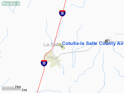
Cotulla-la Salle County Airport |
Location & QuickFacts
| FAA Information Effective: | 2008-09-25 |
| Airport Identifier: | COT |
| Airport Status: | Operational |
| Longitude/Latitude: | 099-13-06.0000W/28-27-24.1000N
-99.218333/28.456694 (Estimated) |
| Elevation: | 474 ft / 144.48 m (Surveyed) |
| Land: | 317 acres |
| From nearest city: | 1 nautical miles NE of Cotulla, TX |
| Location: | La Salle County, TX |
| Magnetic Variation: | 06E (2005) |
Owner & Manager
| Ownership: | Publicly owned |
| Owner: | City Of Cotulla/la Salle Co |
| Address: | 117 N Front St
Cotulla, TX 78014 |
| Phone number: | 830-879-2367 |
| Manager: | E T Page Iii |
| Address: | 550 Airport Road
Cotulla, TX 78014 |
| Phone number: | 830-879-3858 |
Airport Operations and Facilities
| Airport Use: | Open to public |
| Wind indicator: | Yes |
| Segmented Circle: | Yes |
| Control Tower: | No |
| Lighting Schedule: | DUSK-DAWN
MIRL RY 13/31 PRESET LOW INTST; TO INCR INTST ACTVT - CTAF. |
| Beacon Color: | Clear-Green (lighted land airport) |
| Landing fee charge: | Yes |
| Sectional chart: | San Antonio |
| Region: | ASW - Southwest |
| Traffic Pattern Alt: | 1000 ft |
| Boundary ARTCC: | ZHU - Houston |
| Tie-in FSS: | SJT - San Angelo |
| FSS on Airport: | No |
| FSS Toll Free: | 1-800-WX-BRIEF |
| NOTAMs Facility: | COT (NOTAM-d service avaliable) |
| Federal Agreements: | NGY |
Airport Communications
| CTAF: | 122.700 |
| Unicom: | 122.700 |
Airport Services
| Fuel available: | 100LLA
FUEL & SVC AVBL ON CALL AFT HRS 830-879-3858. |
| Airframe Repair: | MAJOR |
| Power Plant Repair: | MINOR |
| Bottled Oxygen: | HIGH |
| Bulk Oxygen: | NONE |
Runway Information
Runway 13/31
| Dimension: | 5005 x 75 ft / 1525.5 x 22.9 m |
| Surface: | ASPH, Good Condition |
| Weight Limit: | Single wheel: 25000 lbs. |
| Edge Lights: | Medium |
| |
Runway 13 |
Runway 31 |
| Longitude: | 099-13-26.0000W | 099-12-46.0100W |
| Latitude: | 28-27-41.4700N | 28-27-06.7300N |
| Elevation: | 474.00 ft | 451.00 ft |
| Alignment: | 127 | 127 |
| Traffic Pattern: | Left | Right |
| Markings: | Non-precision instrument, Good Condition | Non-precision instrument, Good Condition |
| Crossing Height: | 20.00 ft | 20.00 ft |
| VASI: | 2-light PAPI on left side | 2-light PAPI on left side |
| Visual Glide Angle: | 3.00° | 3.00° |
| Obstruction: | 16 ft tree, 775.0 ft from runway, 76 ft right of centerline, 35:1 slope to clear | , 50:1 slope to clear |
|
Radio Navigation Aids
| ID |
Type |
Name |
Ch |
Freq |
Var |
Dist |
| DMD | NDB | Dimmit County | | 343.00 | 07E | 32.4 nm |
| HHH | NDB | Devine | | 359.00 | 07E | 43.5 nm |
| LKX | NDB | La Pryor | | 223.00 | 09E | 44.0 nm |
| PEZ | NDB | Pleasanton | | 275.00 | 07E | 47.5 nm |
| CPZ | NDB | Chaparrosa Ranch | | 385.00 | 10E | 49.7 nm |
| COT | VORTAC | Cotulla | 105X | 115.80 | 09E | 5.3 nm |
Remarks
- ARPT MNGR LIVES ON ARPT.
- RENTAL CARS AVBL.
- OCNL MILITARY ACFT OPERATIONS ON & INVOF ARPT.
Images and information placed above are from
http://www.airport-data.com/airport/COT/
We thank them for the data!
| General Info
|
| Country |
United States
|
| State |
TEXAS
|
| FAA ID |
COT
|
| Latitude |
28-27-29.721N
|
| Longitude |
099-13-12.590W
|
| Elevation |
476 feet
|
| Near City |
COTULLA
|
We don't guarantee the information is fresh and accurate. The data may
be wrong or outdated.
For more up-to-date information please refer to other sources.
|
|


