|
|
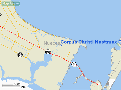
Corpus Christi Nas/truax Field Airport |
Naval Air Station Corpus Christi
Truax Field |
 |
| IATA: NGP – ICAO: KNGP |
| Summary |
| Airport type |
Naval Air Station |
| Operator |
United States Navy |
| Location |
Corpus Christi, Texas |
| Built |
March 12, 1941 |
| In use |
Active |
| Commander |
CAPT Randolph F. Pierson |
| Coordinates |
27°41′33″N 97°17′28″W / 27.6925°N 97.29111°W / 27.6925; -97.29111 |
| Runways |
| Direction |
Length |
Surface |
| ft |
m |
| 4/22 |
4,997 |
1,523 |
Asphalt |
| 17/35 |
5,003 |
1,525 |
Asphalt |
| 13L/31R |
4,998 |
1,523 |
Asphalt |
| 13R/31L |
8,003 |
2,439 |
PEM |
Naval Air Station Corpus Christi (IATA: NGP, ICAO: KNGP), also known as Truax Field, is a naval base located six miles (10 km) southeast of the central business district (CBD) of Corpus Christi, in Nueces County, Texas, USA. History
The official step leading to the construction of the Naval Air Station was initiated by the 75th Congress in 1938. A board found that a lack of training facilities capable of meeting an emergency demand for pilots constituted a grave situation. They recommended the establishment of a second air training station, and further, that it be located on Corpus Christi Bay. NAS Corpus Christi was commissioned by its first Commanding Officer, CAPT Alva Berhard, on March 12, 1941. The first flight training started on May 5, 1941.
 | |
Aviation Ordnanceman stationed at the Naval Air Station Corpus Christi, 1942 |
In 1941, 800 instructors provided training for more than 300 student pilots a month. The training rate nearly doubled after the bombing of Pearl Harbor. By the end of World War II, more than 35,000 naval aviators had earned their wings here. Corpus Christi provided intermediate flight training in World War II, training naval pilots to fly SNJ, SNV, SNB, OS2U, PBY, and N3N type airplanes. In 1944 it was the largest naval aviation training facility in the world. The facility covered 20,000 acres (81 km), and had 997 hangars, shops, barracks, warehouses and other buildings. The Corpus Christi training facility consisted of the main location and six auxiliary air stations at Rodd, Cabaniss, Cuddihy, Kingsville, Waldron and Chase fields.
Former President George H.W. Bush was in the third graduating class, June 1943, and the youngest pilot ever to graduate. NAS Corpus Christi also was home to the Blue Angels from 1951-1954. It also served as a Project Mercury Tracking station in the early 1960s.
A T-34C aircraft with two crewmen, Lieutenant John Joseph Houston, 29, of Houston, and Lieutenant Bret Travis Miller, 30, of East Troy, Wisconsin, from VT-28 on a training mission disappeared on October 28, 2009. Bad weather had initially hampered the subsequent search for the aircraft and crew. Unfortunately both pilots were found dead and were buried with full military honors.
Current operations
Today, the training program is much longer, approximately 18 months, due to the increased complexity of today's aircraft. Currently, Training Air Wing FOUR produces approximately 400 newly qualified aviators each year.
 | |
NAS Corpus Christi in 1946 or 1947 |
Training Air Wing FOUR consists of four squadrons. VT-27 and VT-28 handle primary training in the T-34C Mentor, a single engine turboprop aircraft. VT-31 provides advanced training in the twin engine T-44A and T-44C Pegasus aircraft, while VT-35 flies the twin engine TC-12B Huron aircraft.
The Naval Air Station is also home to Helicopter Mine Countermeasures Squadron FIFTEEN (HM-15), flying the MH-53E Sea Dragon. These massive helicopters search the seas for mines by towing the most advanced minesweeping packages available. Other aircraft found at NAS Corpus Christi include the UH-1N Huey, a helicopter used primarily for search and rescue.
In addition to Navy students, VT-31 and 35 train pilots from the Air Force, Coast Guard, and Marines. The station employs officer, enlisted and civilian personnel serving in the U.S. Navy, U.S. Marine Corps, U.S. Air Force, U.S. Coast Guard, U.S. Army, U.S. Customs and Border Patrol and the military services of numerous NATO/Allied/Coalition partnet nations.
In support of the base’s training mission are two nearby outlying landing fields owned by the Navy: NOLF Waldron, which is 3.5 miles (5.6 km) southwest of the Naval Air Station; and NOLF Cabaniss, which is 8.0 miles (12.9 km) west of the Naval Air Station.
NAS Corpus Christi is also home to the Corpus Christi Army Depot (CCAD), the largest helicopter repair facility in the world (and an unusual arrangement of an Army installation located on a Naval facility). The commanding officer is currently COL Joe D. Dunaway and the Director of Engineering Services is Kresten Cook.
Units
Major Commands
- Chief of Naval Air Training (CNATRA)
Wings
SquadronsOther Tenants
- Navy Operational Support Center (NOSC)
- Naval Health Clinic
- Commander, Mobile Mine Assembly Group (COMOMAG)
- Fleet and Industrial Supply Center Jacksonville Det Corpus Christi (FISC JAX Det Corpus Christi)
- Marine Aviation Training Support Group (MATSG)
- Navy Lodge
Facilities also located on the installation
- Corpus Christi Army Depot
- Coast Guard Air Station Corpus Christi
- Naval Aviation Forecast Detachment Corpus Christi
- Surveillance Support Center (SSC)
The above content comes from Wikipedia and is published under free licenses – click here to read more.
Location & QuickFacts
| FAA Information Effective: | 2008-09-25 |
| Airport Identifier: | NGP |
| Airport Status: | Operational |
| Longitude/Latitude: | 097-17-28.2000W/27-41-33.6000N
-97.291167/27.692667 (Estimated) |
| Elevation: | 19 ft / 5.79 m (Estimated) |
| Land: | 0 acres |
| From nearest city: | 6 nautical miles SE of Corpus Christi, TX |
| Location: | Nueces County, TX |
| Magnetic Variation: | 06E (1990) |
Owner & Manager
| Ownership: | Navy owned |
| Owner: | Us Navy |
| Address: | Oceanographic Ofc-code 3142
Washington, DC 20373 |
| Manager: | Commanding Officer |
| Address: | Naval Air Station
Corpus Christi, TX 78419 |
Airport Operations and Facilities
| Airport Use: | Private |
| Segmented Circle: | No |
| Control Tower: | Yes |
| Lighting Schedule: | DUSK-DAWN
WHEN TWR CLSD ACTIVATE-3 STEP APCH LGT RWY 13R, HIRL RWY 13R-31L AND RWY 04-22-134.85. |
| Beacon Color: | Split-Clear-Green (lighted military airport) |
| Sectional chart: | Brownsville |
| Region: | ASW - Southwest |
| Boundary ARTCC: | ZHU - Houston |
| Tie-in FSS: | SJT - San Angelo |
| FSS on Airport: | No |
| FSS Toll Free: | 1-800-WX-BRIEF |
| NOTAMs Facility: | SJT (NOTAM-d service avaliable) |
Airport Services
| Bottled Oxygen: | HIGH/LOW |
| Bulk Oxygen: | HIGH/LOW |
Runway Information
Runway 04/22
| Dimension: | 4997 x 200 ft / 1523.1 x 61.0 m |
| Surface: | ASPH, |
| Pavement Class: | 33 /F/B/W/T |
| Edge Lights: | High |
| |
Runway 04 |
Runway 22 |
| Longitude: | 097-17-50.7500W | 097-17-11.4160W |
| Latitude: | 27-41-24.1850N | 27-41-59.1560N |
| Elevation: | 17.00 ft | 13.00 ft |
| Alignment: | 45 | 127 |
| Traffic Pattern: | Left | Right |
|
Runway 13L/31R
| Dimension: | 4998 x 200 ft / 1523.4 x 61.0 m |
| Surface: | ASPH, |
| Pavement Class: | 47 /F/B/W/T |
| Weight Limit: | Dual wheel: 140000 lbs.
Dual tandem wheel: 327000 lbs.
Dual dual tandem wheel: 840000 lbs. |
| Edge Lights: | High |
| |
Runway 13L |
Runway 31R |
| Traffic Pattern: | Left | Right |
|
Runway 13R/31L
| Dimension: | 8003 x 200 ft / 2439.3 x 61.0 m |
| Surface: | PEM, |
| Pavement Class: | 55 /R/C/W/T |
| Edge Lights: | High |
| |
Runway 13R |
Runway 31L |
| Longitude: | 097-18-05.7220W | 097-17-02.7350W |
| Latitude: | 27-42-02.6500N | 27-41-06.6300N |
| Elevation: | 9.00 ft | 17.00 ft |
| ILS Type: | LOC/GS
| |
| Traffic Pattern: | Right | Left |
| Approach lights: | SALSF | |
| Runway End Identifier: | Yes | Yes |
|
Runway 17/35
| Dimension: | 5003 x 200 ft / 1524.9 x 61.0 m |
| Surface: | ASPH, |
| Pavement Class: | 41 /F/B/W/T |
| Edge Lights: | High |
| |
Runway 17 |
Runway 35 |
| Longitude: | 097-17-18.4870W | 097-17-18.4660W |
| Latitude: | 27-41-57.1830N | 27-41-07.6410N |
| Elevation: | 13.00 ft | 16.00 ft |
| Traffic Pattern: | Right | Left |
|
Radio Navigation Aids
| ID |
Type |
Name |
Ch |
Freq |
Var |
Dist |
| RKP | NDB | Rockport | | 391.00 | 06E | 27.2 nm |
| MNO | NDB | Mellon Ranch | | 375.00 | 06E | 35.6 nm |
| TKB | NDB | Kleberg County | | 347.00 | 06E | 42.6 nm |
| BEA | NDB | Beeville | | 284.00 | 07E | 48.6 nm |
| NQI | TACAN | Kingsville | 125X | | 09E | 29.8 nm |
| NOG | TACAN | Orange Grove | 063X | | 09E | 41.8 nm |
| ALI | VOR | Alice | | 114.50 | 06E | 39.0 nm |
| NGP | VORTAC | Truax | 087X | 114.00 | 06E | 0.4 nm |
| CRP | VORTAC | Corpus Christi | 102X | 115.50 | 09E | 15.1 nm |
Remarks
- RSTD: PPR ALL TRAN ACFT, DSN 861-2505/2506, C361-961-2505/2506.
- A: ALL R/W AND F/W ACFT LDG/TAXIING TO SEAWALL PPR DSN 861-2006/2007 C361-961-2006/2007.
- A: AVOID FLT OVER POPULATED AREAS BLW 1000' AGL PRIOR TO GULF SHORE LINE.
- TFC PAT: TRAN ACFT EXP APCH TO FULL STOP LDG ONLY WHEN SINGLE RWY OPR ARE BEING CONDUCTED, PRACTICE APCH NOT AUTH. NON-CNATRA TRAN ACFT EXP ONE APCH TO FULL STOP LDG OR DEP WHEN PARL RWY OPR.
- CAUTION: HI MID-AIR POTENTIAL, EXTREME VIGILANCE RQR. EXER EXTREME CAUTION VCNTY WALDRON FLD NALF LCTD 3 NM S.
- BEARING STRENGTH RWY 13L/31R: ST175 SBTT542 TRT585.
- JASU: 2(GTC-85) 1(NCPP-105) 2(NC-8).
- FUEL: J5.
- FLUID: SP PRESAIR LOX LHOXRB.
- OIL: O-128-156.
- CAUTION: EXTV R/W TEST OPR CONDUCTED MON-FRI FR 5 NM S OF THE PORT OF ARANSAS TO 2 NM N OF TRUAX NDB TO 1200'.
- RSTD: REFUEL/TRAN ALERT ARNG STRONGLY RECOMMENDED FOR ALL ACFT TO AVOID EXTV SVCG/TURNAROUND DELAYS OR PRK IN HI FOD RISK AREAS.
- CSTMS/AG/IMG: CSTMS, IMG AVBL FOR ACFT ARR FR OVERSEAS, PLAN ARR BTN 1400-2100Z++. PILOTS RQR TO PROVIDE IDENTA-PLATE NR TO INSPECTOR FOR BILLING.
- A: R/W ACFT DESTINED FOR CORPUS CHRISTI ARMY DEPOT TURN IN WILL REMAIN AT LEAST 1/4 NM OFF SHORE AND 500' PRIOR TO CTC NAVY CORPUS TWR. PPR ALL CCAD TRAN ACFT. TURN IN WILL ONLY BE ACCEPTED DUR NML DUTY HR, 1300-2300Z++ MON-FRI. MON-FRI.
- A: R/W ACFT MAKE APCH TO HELIPAD ADJ HGR 46, CTC ARMY OPS, X-RAY CHARLIE 49.70, 139.2, 386.6 PRIOR TO TAXI ON CCAD RAMP. POC AVN DIV, HGR 44.
- A: AVOID OVFT OF BLDG S OF RAMP AREA AND AMMO DUMP E OF CONTAINMENT AREA.
- A: TRAN AND PARTS PICKUP ACFT PRK/FUEL AT NAVY TRAN RAMP (SEPARATE PPR), DSN 861-2505, C361-961-2505.
- A: ALL ACFT WITH WEAPONS ARR CCAD AFTER NML DUTY HR NOTIFY CCAD SECURITY DSN 861-3314, C361-961-3314.
- A: MAJ MAINT AVBL.
- A: LOADING/UNLOADING OF AIR CARGO - MIL/CIV DESIGNATED FOR CCAD WILL BE SCHED FOR DAYLGT HR ONLY. DUR TIMES OF NATL EMERG EXCEPTIONS APVD BY DRCT, SUPPLY CCAD DSN 861-2557, C361-961-2557.
- CG: SAR UNIT OPR H24.
- CAUTION: BIRD ACTIVITY/BASH - SEE AP-1.
- NO CLSD FLD OPERATIONS 1 HR PRIOR TO SKED FLD OPENING, EXCEPT FOR USCG, SAR AND USCS LAW ENFORCEMENT.
- CAUTION: IF EQUIPPED, ALL ACFT SHALL UTILIZE UHF ATC FREQS UNLESS ASSIGNED VHF.
- CAUTION: NUMEROUS BIRDS VCNTY AFLD.
- JASU: 1(A/U47A-5) 1(NC-10C) 1(AM32A-108).
- MISC: CLOSED FIELD OPS: DEPARTING IFR ACFT SHALL OBTAIN AN IFR CLNC AND RELEASE FROM SAN ANGELO FSS PRIOR TO TKOF WHEN THE FIELD IS IFR VIA GROUND LINK OR LANDLINE 1-800-WXBRIEF. IF THE FIELD IS VFR, A VFR DEPARTURE IS AUTHORIZED. KEY MIKE QUICKLY 2 TIMES FOR SAN ANGELO FSS ON GROUND LINK SYSTEM.
- TFC PAT: ALL ACFT USE LDG OR TAXI LGT WHILE IN ARPT TFC AREA.
- TRAN ALERT: SVC AVBL DUR OPR HRS. TRAN ACFT EXP DELAYS DUE LTD REFUL/SVC. MAINT EXTREMELY LTD DUR NON-WORK HR.
Images and information placed above are from
http://www.airport-data.com/airport/NGP/
We thank them for the data!
| General Info
|
| Country |
United States
|
| State |
TEXAS
|
| FAA ID |
NGP
|
| Latitude |
27-41-35.119N
|
| Longitude |
097-17-28.964W
|
| Elevation |
19 feet
|
| Near City |
CORPUS CHRISTI
|
We don't guarantee the information is fresh and accurate. The data may
be wrong or outdated.
For more up-to-date information please refer to other sources.
|
|