 |
|
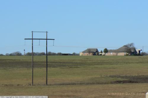 |
(Click on the photo to enlarge) |
Location & QuickFacts
| FAA Information Effective: | 2008-09-25 |
| Airport Identifier: | TX95 |
| Airport Status: | Operational |
| Longitude/Latitude: | 097-31-56.0780W/32-24-50.5070N
-97.532244/32.414030 (Estimated) |
| Elevation: | 1010 ft / 307.85 m (Estimated) |
| Land: | 0 acres |
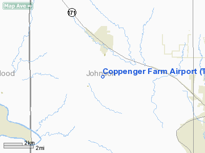
| From nearest city: | 2 nautical miles S of Godley, TX |
| Location: | Johnson County, TX |
| Magnetic Variation: | 07E (1985) |
Owner & Manager
| Ownership: | Privately owned |
| Owner: | J E Coppenger |
| Address: | Box 309
Lampasas, TX 76550 |
| Phone number: | 512-556-5448 |
| Address: |
|
Airport Operations and Facilities
| Airport Use: | Private |
| Wind indicator: | Yes |
| Segmented Circle: | No |
| Control Tower: | No |
| Landing fee charge: | No |
| Sectional chart: | Dallas-ft Worth |
| Region: | ASW - Southwest |
| Boundary ARTCC: | ZFW - Fort Worth |
| Tie-in FSS: | FTW - Fort Worth |
| FSS on Airport: | No |
| FSS Phone: | 817-541-3474 |
| FSS Toll Free: | 1-800-WX-BRIEF |
Airport Services
| Airframe Repair: | NONE |
| Power Plant Repair: | NONE |
Runway Information
Runway 01/19
| Dimension: | 2150 x 40 ft / 655.3 x 12.2 m |
| Surface: | TURF, |
| |
Runway 01 |
Runway 19 |
| Traffic Pattern: | Left | Left |
|
Radio Navigation Aids
| ID |
Type |
Name |
Ch |
Freq |
Var |
Dist |
| XQH | NDB | Cedar Hill | | 353.00 | 08E | 30.1 nm |
| MWL | NDB | Mineral Wells | | 266.00 | 06E | 34.7 nm |
| RBD | NDB | Redbird | | 287.00 | 06E | 37.0 nm |
| LNC | NDB | Lancaster | | 239.00 | 06E | 42.3 nm |
| NFW | TACAN | Nas Jrb Fort Worth | 024X | | 07E | 22.0 nm |
| TTT | VOR/DME | Maverick | 078X | 113.10 | 06E | 37.0 nm |
| CVE | VOR/DME | Cowboy | 109X | 116.20 | 06E | 42.8 nm |
| JEN | VORTAC | Glen Rose | 097X | 115.00 | 06E | 23.3 nm |
| MQP | VORTAC | Millsap | 124X | 117.70 | 09E | 30.1 nm |
| FUZ | VORTAC | Ranger | 104X | 115.70 | 06E | 33.7 nm |
| ACT | VORTAC | Waco | 100X | 115.30 | 09E | 47.1 nm |
| FTW | VOT | Fort Worth Meacham | | 108.20 | | 25.8 nm |
| DAL | VOT | Dallas Love Field | | 113.30 | | 43.2 nm |
Remarks
- BLDGS AND PLINES ON WEST APCH END.
Images and information placed above are from
http://www.airport-data.com/airport/TX95/
We thank them for the data!
| General Info
|
| Country |
United States
|
| State |
TEXAS
|
| FAA ID |
TX95
|
| Latitude |
32-24-50.507N
|
| Longitude |
097-31-56.078W
|
| Elevation |
1010 feet
|
| Near City |
GODLEY
|
We don't guarantee the information is fresh and accurate. The data may
be wrong or outdated.
For more up-to-date information please refer to other sources.
|
|


