 |
|
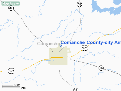
Comanche County-city Airport |
Location & QuickFacts
| FAA Information Effective: | 2008-09-25 |
| Airport Identifier: | MKN |
| Airport Status: | Operational |
| Longitude/Latitude: | 098-36-01.1700W/31-55-00.5270N
-98.600325/31.916813 (Estimated) |
| Elevation: | 1388 ft / 423.06 m (Estimated) |
| Land: | 85 acres |
| From nearest city: | 2 nautical miles NE of Comanche, TX |
| Location: | Comanche County, TX |
| Magnetic Variation: | 06E (2005) |
Owner & Manager
| Ownership: | Publicly owned |
| Owner: | City Of Comanche/comanche Co |
| Address: | 301 Industrial Dr
Comanche, TX 76442 |
| Phone number: | 325-356-2175 |
| Manager: | Bill Flannery
CITY MANAGER. |
| Address: | 301 Industrial Dr
Comanche, TX 76442 |
| Phone number: | 325-356-2175 |
Airport Operations and Facilities
| Airport Use: | Open to public |
| Wind indicator: | Yes |
| Segmented Circle: | Yes |
| Control Tower: | No |
| Lighting Schedule: | DUSK-DAWN
MIRL RY 17/35 PRESET LOW INTST; TO INCR INTST ACTVT - 122.8. |
| Beacon Color: | Clear-Green (lighted land airport) |
| Landing fee charge: | No |
| Sectional chart: | San Antonio |
| Region: | ASW - Southwest |
| Boundary ARTCC: | ZFW - Fort Worth |
| Tie-in FSS: | FTW - Fort Worth |
| FSS on Airport: | No |
| FSS Phone: | 817-541-3474 |
| FSS Toll Free: | 1-800-WX-BRIEF |
| NOTAMs Facility: | MKN (NOTAM-d service avaliable) |
| Federal Agreements: | NY1 |
Airport Communications
| CTAF: | 123.075 |
| Unicom: | 123.075 |
Airport Services
| Fuel available: | 100LLA
SELF SERVICE FUEL AVBL 24 HRS WITH MAJOR CREDIT CARD. |
Runway Information
Runway 17/35
| Dimension: | 4500 x 75 ft / 1371.6 x 22.9 m |
| Surface: | ASPH, Good Condition |
| Weight Limit: | Single wheel: 12500 lbs. |
| Edge Lights: | Medium |
| |
Runway 17 |
Runway 35 |
| Traffic Pattern: | Left | Right |
| Markings: | Non-precision instrument, Good Condition | Non-precision instrument, Good Condition |
| Crossing Height: | 33.00 ft | 35.00 ft |
| VASI: | 2-light PAPI on left side | 2-light PAPI on left side |
| Visual Glide Angle: | 4.00° | 4.00° |
| Obstruction: | , 50:1 slope to clear | 44 ft tree, 980.0 ft from runway, 75 ft left of centerline, 17:1 slope to clear |
|
Radio Navigation Aids
| ID |
Type |
Name |
Ch |
Freq |
Var |
Dist |
| MNZ | NDB | Hamilton | | 251.00 | 07E | 29.2 nm |
| OIP | NDB | Old Rip | | 410.00 | 07E | 30.9 nm |
| COM | NDB | Coleman | | 385.00 | 07E | 41.4 nm |
| BWD | VOR/DME | Brownwood | 023X | 108.60 | 08E | 18.3 nm |
| JEN | VORTAC | Glen Rose | 097X | 115.00 | 06E | 39.6 nm |
| LZZ | VORTAC | Lampasas | 072X | 112.50 | 08E | 49.8 nm |
Remarks
- COURTESY CAR AVBL UPON REQUEST.
Images and information placed above are from
http://www.airport-data.com/airport/MKN/
We thank them for the data!
| General Info
|
| Country |
United States
|
| State |
TEXAS
|
| FAA ID |
MKN
|
| Time |
UTC-6(-5DT)
|
| Latitude |
31.916813
31° 55' 00.53" N
|
| Longitude |
-98.600325
098° 36' 01.17" W
|
| Elevation |
1388 feet
423 meters
|
| Magnetic Variation |
005° E (01/06)
|
| Beacon |
Yes
|
| Operating Agency |
U.S.CIVIL AIRPORT WHEREIN PERMIT COVERS USE BY TRANSIT MILITARY AIRCRAFT
|
| Operating Hours |
SEE REMARKS FOR OPERATING HOURS OR COMMUNICATIONS FOR POSSIBLE HOURS
|
| Daylight Saving Time |
Second Sunday in March at 0200 to first Sunday in November at 0200 local time (Exception Arizona and that portion of Indiana in the Eastern Time Zone)
|
We don't guarantee the information is fresh and accurate. The data may
be wrong or outdated.
For more up-to-date information please refer to other sources.
|
|


