|
|
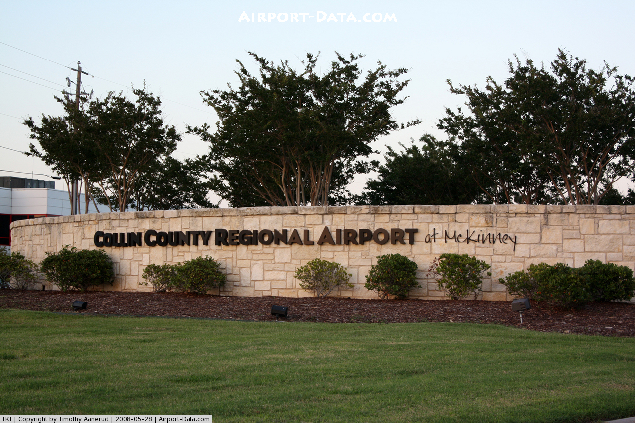
Collin County Rgnl At Mc Kinney Airport |
| Collin County Regional Airport at McKinney |
 |
| FAA airport diagram |
| IATA: none – ICAO: KTKI – FAA LID: TKI |
| Summary |
| Airport type |
Public |
| Owner |
City of McKinney |
| Serves |
McKinney, Texas |
| Elevation AMSL |
585 ft / 178 m |
| Coordinates |
33°10′41″N 096°35′26″W / 33.17806°N 96.59056°W / 33.17806; -96.59056 |
| Runways |
| Direction |
Length |
Surface |
| ft |
m |
| 17/35 |
7,001 |
2,134 |
Concrete |
| Statistics (2009) |
| Aircraft operations |
103,810 |
| Based aircraft |
208 |
| Source: Federal Aviation Administration |
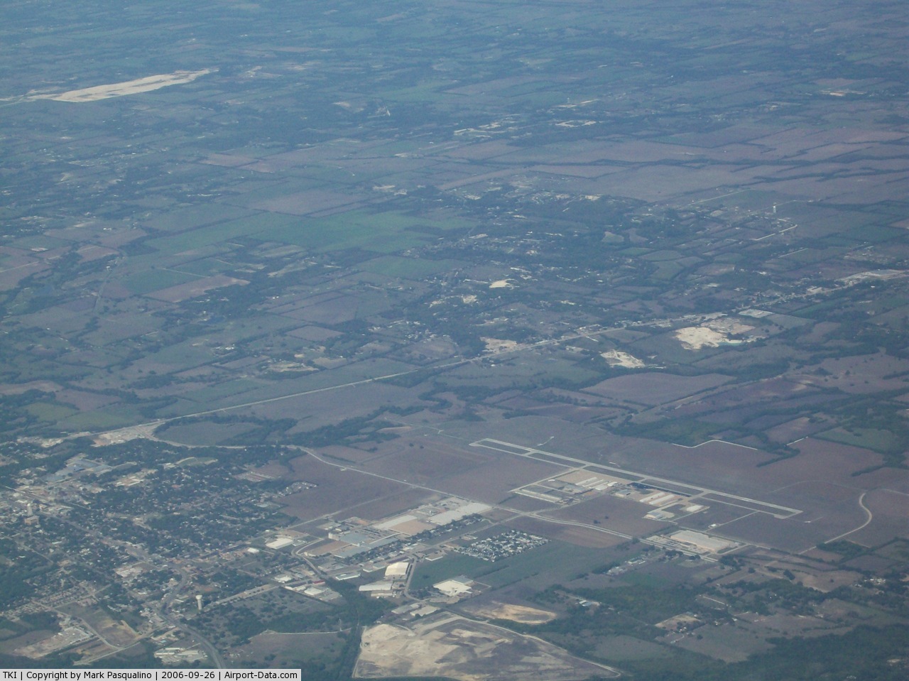
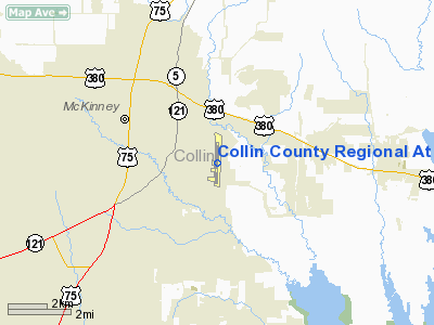
Collin County Regional Airport at McKinney (ICAO: KTKI, FAA LID: TKI) is a public use airport located two nautical miles (4 km) southeast of the central business district of McKinney, a city in Collin County, Texas, United States.
Although most U.S. airports use the same three-letter location identifier for the FAA and IATA, this airport is assigned TKI by the FAA but has no designation from the IATA (which assigned TKI to Tokeen Seaplane Base in Alaska).
The airport is used entirely for general aviation purposes and serves as a reliever airport for Dallas Love Field. The airport is owned by the City of McKinney and is home to many business aircraft including the fleet of Texas Instruments. The only fixed based operator (FBO) on the field is Cutter Aviation. There are several places to receive flight training on the field. These include Monarch Air, the North Texas Flying Club, the Texins Flying Club, BJM Aviation, as well as many other independent flight instructors.
The airport currently has an aggressive Master Plan which calls for the construction of a replacement runway by 2012, a new control tower by 2009, and three more taxiways to allow various new connections around the airport.
Facilities and aircraft
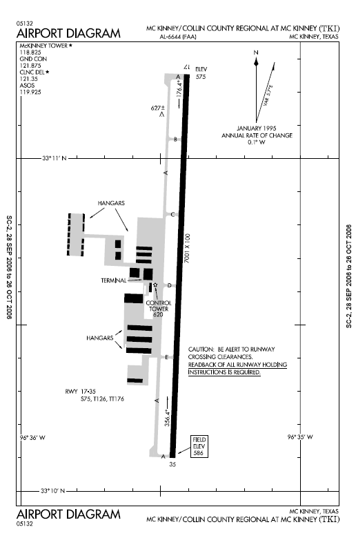
Collin County Regional Airport at McKinney Airport covers an area of 661 acres (267 ha) at an elevation of 585 feet (178 m) above mean sea level. The only runway at the field is runway 17/35, with a concrete surface 7,001 feet (2,134 m) long by 100 feet (30 m) wide. It is equipped with medium intensity runway lights, MALSR approach lights, runway 17 PAPI, and runway 35 VASI. Runway 17 is equipped with a Category I ILS approach.
For the 12-month period ending March 6, 2009, the airport had 103,810 aircraft operations, an average of 284 per day: 99% general aviation, 1% air taxi and <1% military. At that time there were 208 aircraft based at this airport: 77% single-engine, 17% multi-engine, 5% jet, 1% helicopter.
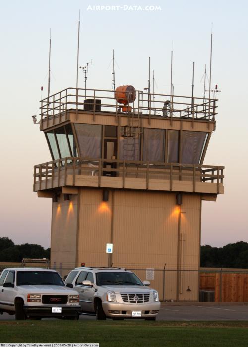
The airport is a controlled field with an FAA control tower open between 6:00 AM and 11:00 PM.
The above content comes from Wikipedia and is published under free licenses – click here to read more.
 |
(Click on the photo to enlarge) |
 |
(Click on the photo to enlarge) |
 |
(Click on the photo to enlarge) |
Location & QuickFacts
| FAA Information Effective: | 2008-09-25 |
| Airport Identifier: | TKI |
| Airport Status: | Operational |
| Longitude/Latitude: | 096-35-25.9000W/33-10-40.6000N
-96.590528/33.177944 (Estimated) |
| Elevation: | 585 ft / 178.31 m (Surveyed) |
| Land: | 661 acres |
| From nearest city: | 2 nautical miles SE of Mc Kinney, TX |
| Location: | Collin County, TX |
| Magnetic Variation: | 06E (1995) |
Owner & Manager
| Ownership: | Publicly owned |
| Owner: | City Of Mc Kinney |
| Address: | Po Box 517
Mc Kinney, TX 75070 |
| Phone number: | 972-562-4214 |
| Manager: | Kenneth F. Wiegand |
| Address: | Po Box 517
Mc Kinney, TX 75070 |
| Phone number: | 972-562-4214 |
Airport Operations and Facilities
| Airport Use: | Open to public |
| Wind indicator: | Yes |
| Segmented Circle: | Yes |
| Control Tower: | Yes |
| Lighting Schedule: | DUSK-DAWN
ACTVT MIRL RY 17/35; MALSR RY 17; PAPI RY 17 & VASI RY 35 - CTAF. |
| Beacon Color: | Clear-Green (lighted land airport) |
| Landing fee charge: | No |
| Sectional chart: | Dallas-ft Worth |
| Region: | ASW - Southwest |
| Boundary ARTCC: | ZFW - Fort Worth |
| Tie-in FSS: | FTW - Fort Worth |
| FSS on Airport: | No |
| FSS Phone: | 817-541-3474 |
| FSS Toll Free: | 1-800-WX-BRIEF |
| NOTAMs Facility: | TKI (NOTAM-d service avaliable) |
| Federal Agreements: | NGY |
Airport Communications
| CTAF: | 118.825 |
| Unicom: | 122.950 |
Airport Services
| Fuel available: | 100LLA |
| Airframe Repair: | MAJOR |
| Power Plant Repair: | MAJOR |
| Bottled Oxygen: | HIGH |
Runway Information
Runway 17/35
| Dimension: | 7001 x 100 ft / 2133.9 x 30.5 m |
| Surface: | CONC, Good Condition |
| Weight Limit: | Single wheel: 75000 lbs.
Dual wheel: 150000 lbs.
Dual tandem wheel: 176000 lbs. |
| Edge Lights: | Medium |
| |
Runway 17 |
Runway 35 |
| Longitude: | 096-35-24.3788W | 096-35-27.4190W |
| Latitude: | 33-11-15.2179N | 33-10-06.0057N |
| Elevation: | 575.00 ft | 585.00 ft |
| Alignment: | 127 | 2 |
| ILS Type: | ILS/DME
| |
| Traffic Pattern: | Left | Right |
| Markings: | Precision instrument, Good Condition | Precision instrument, Good Condition |
| Crossing Height: | 28.00 ft | 52.00 ft |
| VASI: | 4-light PAPI on left side | 4-box on left side |
| Visual Glide Angle: | 3.00° | 3.00° |
| Approach lights: | MALSR | |
| Runway End Identifier: | | No |
| Obstruction: | 36 ft tree, 1528.0 ft from runway, 778 ft right of centerline, 37:1 slope to clear | 106 ft tree, 1915.0 ft from runway, 70 ft left of centerline, 16:1 slope to clear |
|
Radio Navigation Aids
| ID |
Type |
Name |
Ch |
Freq |
Var |
Dist |
| MII | NDB | Caddo Mills | | 316.00 | 06E | 19.1 nm |
| PQF | NDB | Mesquite | | 248.00 | 06E | 22.4 nm |
| SYW | NDB | Cash | | 428.00 | 05E | 28.9 nm |
| AVZ | NDB | Travis | | 260.00 | 06E | 30.4 nm |
| JUG | NDB | Jecca | | 388.00 | 06E | 30.8 nm |
| RBD | NDB | Redbird | | 287.00 | 06E | 33.3 nm |
| HJM | NDB | Rayburn | | 415.00 | 06E | 33.5 nm |
| LNC | NDB | Lancaster | | 239.00 | 06E | 36.7 nm |
| DNI | NDB | Denison | | 341.00 | 06E | 39.0 nm |
| XQH | NDB | Cedar Hill | | 353.00 | 08E | 40.3 nm |
| GLE | NDB | Gainesville | | 330.00 | 06E | 44.6 nm |
| DUA | NDB | Durant | | 359.00 | 05E | 46.9 nm |
| MJF | TACAN | Arvilla | 033X | | 05E | 27.5 nm |
| NFW | TACAN | Nas Jrb Fort Worth | 024X | | 07E | 49.3 nm |
| CVE | VOR/DME | Cowboy | 109X | 116.20 | 06E | 23.4 nm |
| TTT | VOR/DME | Maverick | 078X | 113.10 | 06E | 29.3 nm |
| URH | VOR/DME | Texoma | 090X | 114.30 | 05E | 47.1 nm |
| BYP | VORTAC | Bonham | 093X | 114.60 | 06E | 28.1 nm |
| FUZ | VORTAC | Ranger | 104X | 115.70 | 06E | 34.4 nm |
| DAL | VOT | Dallas Love Field | | 113.30 | | 23.8 nm |
| FTW | VOT | Fort Worth Meacham | | 108.20 | | 44.4 nm |
Remarks
- NOISE SENSITIVE AREA OVER TOWN OF FAIRVIEW IMMEDIATELY S/SW OF ARPT. ALL ACFT MAINTAIN MIN ALT OF 1000 FT AGL.
- BIRD ACTIVITY INVOF ARPT.
Images and information placed above are from
http://www.airport-data.com/airport/TKI/
We thank them for the data!
| General Info
|
| Country |
United States
|
| State |
TEXAS
|
| FAA ID |
TKI
|
| Latitude |
33-10-40.600N
|
| Longitude |
096-35-25.900W
|
| Elevation |
585 feet
|
| Near City |
MC KINNEY
|
We don't guarantee the information is fresh and accurate. The data may
be wrong or outdated.
For more up-to-date information please refer to other sources.
|
|