 |
|
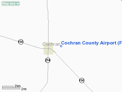
Location & QuickFacts
| FAA Information Effective: | 2008-09-25 |
| Airport Identifier: | F85 |
| Airport Status: | Operational |
| Longitude/Latitude: | 102-44-01.7460W/33-43-45.3500N
-102.733818/33.729264 (Estimated) |
| Elevation: | 3746 ft / 1141.78 m (Surveyed) |
| Land: | 160 acres |
| From nearest city: | 2 nautical miles E of Morton, TX |
| Location: | Cochran County, TX |
| Magnetic Variation: | 09E (1985) |
Owner & Manager
| Ownership: | Publicly owned |
| Owner: | Cochran County |
| Address: | Cochran Co Courthouse
Morton, TX 79346 |
| Phone number: | 806-266-5508 |
| Manager: | James St Clair
COUNTY JUDGE. |
| Address: | Cochran Co. Courthouse
Morton, TX 79346 |
| Phone number: | 806-266-5508 |
Airport Operations and Facilities
| Airport Use: | Open to public |
| Wind indicator: | Yes |
| Segmented Circle: | Yes |
| Control Tower: | No |
| Lighting Schedule: | DUSK-DAWN |
| Beacon Color: | Clear-Green (lighted land airport) |
| Landing fee charge: | No |
| Sectional chart: | Albuquerque |
| Region: | ASW - Southwest |
| Boundary ARTCC: | ZFW - Fort Worth |
| Tie-in FSS: | FTW - Fort Worth |
| FSS on Airport: | No |
| FSS Phone: | 817-541-3474 |
| FSS Toll Free: | 1-800-WX-BRIEF |
| NOTAMs Facility: | FTW (NOTAM-d service avaliable) |
| Federal Agreements: | N1 |
Airport Communications
Airport Services
| Bottled Oxygen: | NONE |
| Bulk Oxygen: | NONE |
Runway Information
Runway 04/22
| Dimension: | 2710 x 60 ft / 826.0 x 18.3 m |
| Surface: | ASPH, Good Condition |
| Weight Limit: | Single wheel: 12000 lbs. |
| Edge Lights: | Medium |
| |
Runway 04 |
Runway 22 |
| Traffic Pattern: | Left | Left |
| Markings: | Basic, Fair Condition | Basic, Good Condition |
| Crossing Height: | 0.00 ft | 11.00 ft |
| Displaced threshold: | 160.00 ft | 0.00 ft |
| VASI: | | 2-box on left side |
| Visual Glide Angle: | 0.00° | 3.00° |
| Obstruction: | 15 ft road, 200.0 ft from runway, 100 ft left of centerline
APCH RATIO 24:1 FM DSPLCD THLD TO 15 FT ROAD 360 FT FM DSPLCD THLD 100 FT R.
ROAD AT 190 FT FROM END, 110 FT LEFT OF CENTERLINE. | 10 ft road, 615.0 ft from runway, 41:1 slope to clear |
|
Runway 17/35
| Dimension: | 1775 x 39 ft / 541.0 x 11.9 m |
| Surface: | ASPH, Fair Condition |
| Weight Limit: | Single wheel: 12000 lbs. |
| |
Runway 17 |
Runway 35 |
| Traffic Pattern: | Left | Left |
| Markings: | Basic, Good Condition | Basic, Good Condition |
| Obstruction: | , 50:1 slope to clear | 15 ft road, 300.0 ft from runway, 6:1 slope to clear |
|
Radio Navigation Aids
| ID |
Type |
Name |
Ch |
Freq |
Var |
Dist |
| LIU | NDB | Littlefield | | 212.00 | 10E | 20.8 nm |
| LLN | NDB | Levelland | | 266.00 | 09E | 20.8 nm |
| PRZ | NDB | Portales | | 407.00 | 09E | 42.0 nm |
| BFE | NDB | Brownfield | | 311.00 | 09E | 42.8 nm |
| CVS | TACAN | Cannon | 053X | | 10E | 48.9 nm |
| LBB | VORTAC | Lubbock | 029X | 109.20 | 11E | 41.0 nm |
| TXO | VORTAC | Texico | 059X | 112.20 | 11E | 46.3 nm |
Remarks
- 350' ANTENNA TWO MILES SW ON EXTDD CNTRLN RWY 04/22.
- PAEW ADJ RYS 04/22 & 17/35.
Images and information placed above are from
http://www.airport-data.com/airport/F85/
We thank them for the data!
| General Info
|
| Country |
United States
|
| State |
TEXAS
|
| FAA ID |
F85
|
| Latitude |
33-43-45.350N
|
| Longitude |
102-44-01.746W
|
| Elevation |
3746 feet
|
| Near City |
MORTON
|
We don't guarantee the information is fresh and accurate. The data may
be wrong or outdated.
For more up-to-date information please refer to other sources.
|
|


