 |
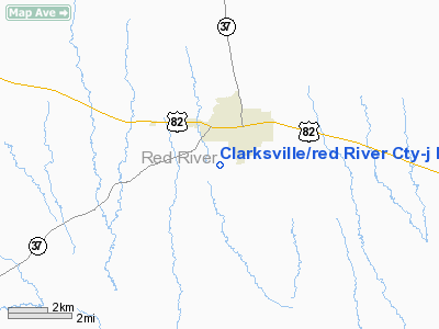
|
Clarksville/red River Cty-j D Trissell Fld Airport |
Clarksville/Red River County Airport
J. D. Trissell Field |
| IATA: none – ICAO: KLBR – FAA LID: LBR |
| Summary |
| Airport type |
Public |
| Owner |
Clarksville / Red River County |
| Serves |
Red River County |
| Location |
Clarksville, Texas |
| Elevation AMSL |
440 ft / 134 m |
| Coordinates |
33°35′35″N 095°03′49″W / 33.59306°N 95.06361°W / 33.59306; -95.06361 |
| Runways |
| Direction |
Length |
Surface |
| ft |
m |
| 17/35 |
3,000 |
914 |
Asphalt |
| Statistics (2007) |
| Aircraft operations |
3,300 |
| Source: Federal Aviation Administration |
Clarksville/Red River County Airport (ICAO: KLBR, FAA LID: LBR), also known as J. D. Trissell Field, is a public use airport located three nautical miles (6 km) southwest of the central business district of Clarksville, in Red River County, Texas, United States. It is owned by Clarksville and Red River County.
Although most U.S. airports use the same three-letter location identifier for the FAA and IATA, this airport is assigned LBR by the FAA but has no designation from the IATA (which assigned LBR to Lábrea Airport in Lábrea, Amazonas, Brazil).
Facilities and aircraft
The airport covers an area of 78 acres (32 ha) at an elevation of 440 feet (134 m) above mean sea level. It has one runway designated 17/35 with an asphalt surface measuring 3,000 by 50 feet (914 x 15 m). For the 12-month period ending April 30, 2007, the airport had 3,300 general aviation aircraft operations, an average of 275 per month.
The above content comes from Wikipedia and is published under free licenses – click here to read more.
Location & QuickFacts
| FAA Information Effective: | 2008-09-25 |
| Airport Identifier: | LBR |
| Airport Status: | Operational |
| Longitude/Latitude: | 095-03-48.7990W/33-35-35.3930N
-95.063555/33.593165 (Estimated) |
| Elevation: | 440 ft / 134.11 m (Estimated) |
| Land: | 78 acres |
| From nearest city: | 3 nautical miles SW of Clarksville, TX |
| Location: | Red River County, TX |
| Magnetic Variation: | 05E (1985) |
Owner & Manager
| Ownership: | Publicly owned |
| Owner: | Clarksville-red River Co
COUNTY JUDGE, MORRIS HARVILLE. |
| Address: | 400 N. Walnut
Clarksville, TX 75426 |
| Phone number: | 903-427-2680 |
| Manager: | Josef Hansler, County Commissioner
TOMMY TRISSELL, AIRPORT MANAGER, 903-427-4106 (EVENINGS & WEEKENDS). |
| Address: | 400 N. Walnut
|
| Phone number: | 903-427-2680 |
Airport Operations and Facilities
| Airport Use: | Open to public |
| Wind indicator: | Yes |
| Segmented Circle: | Yes |
| Control Tower: | No |
| Lighting Schedule: | DUSK-DAWN |
| Beacon Color: | Clear-Green (lighted land airport) |
| Landing fee charge: | No |
| Sectional chart: | Dallas-ft Worth |
| Region: | ASW - Southwest |
| Boundary ARTCC: | ZFW - Fort Worth |
| Tie-in FSS: | FTW - Fort Worth |
| FSS on Airport: | No |
| FSS Phone: | 817-541-3474 |
| FSS Toll Free: | 1-800-WX-BRIEF |
| NOTAMs Facility: | LBR (NOTAM-d service avaliable) |
| Federal Agreements: | NGY |
Airport Communications
Airport Services
| Bottled Oxygen: | NONE |
| Bulk Oxygen: | NONE |
Runway Information
Runway 17/35
| Dimension: | 3000 x 50 ft / 914.4 x 15.2 m |
| Surface: | ASPH, Good Condition |
| Weight Limit: | Single wheel: 10000 lbs. |
| Edge Lights: | Medium |
| |
Runway 17 |
Runway 35 |
| Traffic Pattern: | Left | Left |
| Markings: | Basic, Good Condition | Basic, Good Condition |
| Obstruction: | 32 ft trees, 202.0 ft from runway, 103 ft right of centerline | 36 ft trees, 625.0 ft from runway, 166 ft left of centerline, 11:1 slope to clear |
|
Radio Navigation Aids
| ID |
Type |
Name |
Ch |
Freq |
Var |
Dist |
| IBO | NDB | Idabel | | 271.00 | 03E | 21.8 nm |
| HHW | NDB | Hugo | | 323.00 | 05E | 35.8 nm |
| DEQ | NDB | De Queen | | 281.00 | 04E | 42.9 nm |
| LST | NDB | Lone Star | | 305.00 | 05E | 43.1 nm |
| AEE | NDB | Antlers | | 391.00 | 05E | 46.4 nm |
| PRX | VOR/DME | Paris | 083X | 113.60 | 07E | 19.5 nm |
| SLR | VOR/DME | Sulphur Springs | 027X | 109.00 | 08E | 33.8 nm |
| UIM | VOR/DME | Quitman | 087X | 114.00 | 08E | 45.5 nm |
| TXK | VORTAC | Texarkana | 110X | 116.30 | 07E | 49.8 nm |
Images and information placed above are from
http://www.airport-data.com/airport/LBR/
We thank them for the data!
| General Info
|
| Country |
United States
|
| State |
TEXAS
|
| FAA ID |
LBR
|
| Latitude |
33.593164
33° 35' 35.39" N
|
| Longitude |
-95.063556
095° 03' 48.80" W
|
| Elevation |
440 feet
134 meters
|
| Magnetic Variation |
003° E (01/06)
|
| Beacon |
Yes
|
| Operating Agency |
U.S.CIVIL AIRPORT WHEREIN PERMIT COVERS USE BY TRANSIT MILITARY AIRCRAFT
|
| Daylight Saving Time |
Second Sunday in March at 0200 to first Sunday in November at 0200 local time (Exception Arizona and that portion of Indiana in the Eastern Time Zone)
|
We don't guarantee the information is fresh and accurate. The data may
be wrong or outdated.
For more up-to-date information please refer to other sources.
|
|


