 |
|
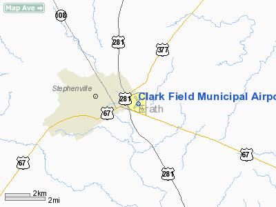
Location & QuickFacts
| FAA Information Effective: | 2008-09-25 |
| Airport Identifier: | SEP |
| Airport Status: | Operational |
| Longitude/Latitude: | 098-10-39.6000W/32-12-55.2000N
-98.177667/32.215333 (Estimated) |
| Elevation: | 1321 ft / 402.64 m (Surveyed) |
| Land: | 160 acres |
| From nearest city: | 1 nautical miles E of Stephenville, TX |
| Location: | Erath County, TX |
| Magnetic Variation: | 07E (1990) |
Owner & Manager
| Ownership: | Publicly owned |
| Owner: | City Of Stephenville |
| Address: | 298 W. Washington
Stephenville, TX 76401 |
| Phone number: | 254-918-1294 |
| Manager: | Bill Smith |
| Address: | P O Box 1552
Stephenville, TX 76401
STEPHENVILLE AVIATION |
| Phone number: | 254-965-2795 |
Airport Operations and Facilities
| Airport Use: | Open to public |
| Wind indicator: | Yes |
| Segmented Circle: | Yes |
| Control Tower: | No |
| Lighting Schedule: | DUSK-DAWN |
| Beacon Color: | Clear-Green (lighted land airport) |
| Landing fee charge: | No |
| Sectional chart: | Dallas-ft Worth |
| Region: | ASW - Southwest |
| Boundary ARTCC: | ZFW - Fort Worth |
| Tie-in FSS: | FTW - Fort Worth |
| FSS on Airport: | No |
| FSS Phone: | 817-541-3474 |
| FSS Toll Free: | 1-800-WX-BRIEF |
| NOTAMs Facility: | SEP (NOTAM-d service avaliable) |
| Federal Agreements: | NGY |
Airport Communications
| CTAF: | 122.800 |
| Unicom: | 122.800 |
Airport Services
| Fuel available: | 100LLA
FOR FUEL AFTER HRS CALL 254-965-6102 OR 254-968-6445. |
| Airframe Repair: | MAJOR |
| Power Plant Repair: | MAJOR |
| Bottled Oxygen: | NONE |
| Bulk Oxygen: | NONE |
Runway Information
Runway 14/32
| Dimension: | 4209 x 75 ft / 1282.9 x 22.9 m |
| Surface: | ASPH, Good Condition |
| Edge Lights: | Medium |
| |
Runway 14 |
Runway 32 |
| Longitude: | 098-10-52.1880W | 098-10-27.0879W |
| Latitude: | 32-13-13.0494N | 32-12-37.2818N |
| Elevation: | 1321.00 ft | 1289.00 ft |
| Alignment: | 127 | 127 |
| Traffic Pattern: | Left | Left |
| Markings: | Non-precision instrument, Poor Condition
MARKINGS FADED. | Non-precision instrument, Poor Condition
MARKINGS FADED. |
| VASI: | 2-light PAPI on left side | 2-light PAPI on left side |
| Obstruction: | 30 ft tree, 630.0 ft from runway, 50 ft right of centerline, 14:1 slope to clear | 18 ft trees, 203.0 ft from runway, 35 ft left of centerline
6-8 FT BRUSH 190 FT FM THLD 0B. |
|
Radio Navigation Aids
| ID |
Type |
Name |
Ch |
Freq |
Var |
Dist |
| OIP | NDB | Old Rip | | 410.00 | 07E | 34.0 nm |
| MWL | NDB | Mineral Wells | | 266.00 | 06E | 34.8 nm |
| MNZ | NDB | Hamilton | | 251.00 | 07E | 35.8 nm |
| GZV | NDB | Brazos River | | 280.00 | 07E | 45.8 nm |
| BKD | NDB | Breckenridge | | 245.00 | 07E | 48.3 nm |
| BWD | VOR/DME | Brownwood | 023X | 108.60 | 08E | 44.2 nm |
| JEN | VORTAC | Glen Rose | 097X | 115.00 | 06E | 15.6 nm |
| MQP | VORTAC | Millsap | 124X | 117.70 | 09E | 32.0 nm |
Images and information placed above are from
http://www.airport-data.com/airport/SEP/
We thank them for the data!
| General Info
|
| Country |
United States
|
| State |
TEXAS
|
| FAA ID |
SEP
|
| Latitude |
32-12-55.164N
|
| Longitude |
098-10-39.602W
|
| Elevation |
1321 feet
|
| Near City |
STEPHENVILLE
|
We don't guarantee the information is fresh and accurate. The data may
be wrong or outdated.
For more up-to-date information please refer to other sources.
|
|


