 |
|
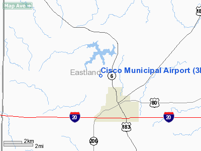
Location & QuickFacts
| FAA Information Effective: | 2008-09-25 |
| Airport Identifier: | 3F2 |
| Airport Status: | Operational |
| Longitude/Latitude: | 099-00-01.2440W/32-25-00.4660N
-99.000346/32.416796 (Estimated) |
| Elevation: | 1612 ft / 491.34 m (Estimated) |
| Land: | 186 acres |
| From nearest city: | 3 nautical miles N of Cisco, TX |
| Location: | Eastland County, TX |
| Magnetic Variation: | 07E (1985) |
Owner & Manager
| Ownership: | Publicly owned |
| Owner: | City Of Cisco |
| Address: | Po Box 110
Cisco, TX 76437 |
| Phone number: | 254-442-2111 |
| Manager: | Jim Baker
INTERIM CITY MANAGER. |
| Address: | Box 110
Cisco, TX 76437 |
| Phone number: | 254-442-2111 |
Airport Operations and Facilities
| Airport Use: | Open to public |
| Wind indicator: | Yes |
| Segmented Circle: | Yes |
| Control Tower: | No |
| Lighting Schedule: | DUSK-DAWN |
| Beacon Color: | Clear-Green (lighted land airport) |
| Landing fee charge: | No |
| Sectional chart: | Dallas-ft Worth |
| Region: | ASW - Southwest |
| Boundary ARTCC: | ZFW - Fort Worth |
| Tie-in FSS: | FTW - Fort Worth |
| FSS on Airport: | No |
| FSS Phone: | 817-541-3474 |
| FSS Toll Free: | 1-800-WX-BRIEF |
| NOTAMs Facility: | FTW (NOTAM-d service avaliable) |
Airport Communications
Airport Services
| Airframe Repair: | MAJOR |
| Power Plant Repair: | MAJOR |
Runway Information
Runway 17/35
| Dimension: | 3700 x 60 ft / 1127.8 x 18.3 m |
| Surface: | ASPH, Fair Condition |
| Weight Limit: | Single wheel: 12000 lbs. |
| Edge Lights: | Medium |
| |
Runway 17 |
Runway 35 |
| Traffic Pattern: | Left | Left |
| Markings: | Basic, Fair Condition | Basic, Fair Condition |
| Obstruction: | 30 ft tree, 570.0 ft from runway, 135 ft left of centerline, 12:1 slope to clear | 12 ft brush, 303.0 ft from runway, 49 ft left of centerline, 8:1 slope to clear
3 FT BRUSH 50-200 FT FM END AND 50 FT EAST AND WEST OF EXTENDED CENTERLINE. |
|
Radio Navigation Aids
| ID |
Type |
Name |
Ch |
Freq |
Var |
Dist |
| OIP | NDB | Old Rip | | 410.00 | 07E | 9.7 nm |
| BKD | NDB | Breckenridge | | 245.00 | 07E | 20.6 nm |
| COM | NDB | Coleman | | 385.00 | 07E | 40.3 nm |
| GZV | NDB | Brazos River | | 280.00 | 07E | 43.8 nm |
| TMV | NDB | Stamford | | 290.00 | 08E | 46.0 nm |
| DYS | TACAN | Dyess | 063X | | 08E | 43.5 nm |
| BWD | VOR/DME | Brownwood | 023X | 108.60 | 08E | 31.6 nm |
| TQA | VOR/DME | Tuscola | 053X | 111.60 | 10E | 42.9 nm |
| ABI | VORTAC | Abilene | 084X | 113.70 | 10E | 44.0 nm |
Remarks
Images and information placed above are from
http://www.airport-data.com/airport/3F2/
We thank them for the data!
| General Info
|
| Country |
United States
|
| State |
TEXAS
|
| FAA ID |
3F2
|
| Latitude |
32-25-00.466N
|
| Longitude |
099-00-01.244W
|
| Elevation |
1612 feet
|
| Near City |
CISCO
|
We don't guarantee the information is fresh and accurate. The data may
be wrong or outdated.
For more up-to-date information please refer to other sources.
|
|


