 |
|
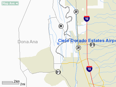
Cielo Dorado Estates Airport |
Location & QuickFacts
| FAA Information Effective: | 2008-09-25 |
| Airport Identifier: | TA50 |
| Airport Status: | Operational |
| Longitude/Latitude: | 106-38-27.9720W/31-54-33.3720N
-106.641103/31.909270 (Estimated) |
| Elevation: | 3750 ft / 1143.00 m (Estimated) |
| Land: | 0 acres |
| From nearest city: | 1 nautical miles N of Santa Teresa/el Paso, TX |
| Location: | Dona Ana County, NM |
| Magnetic Variation: | 11E (1985) |
Owner & Manager
| Ownership: | Privately owned |
| Owner: | Cielo Dorado Homeowners Assoc |
| Address: | 6070 Gateway East, Suite 500
El Paso, TX 79905 |
| Phone number: | 915-772-5005 |
| Manager: | Hiatt & Associates |
| Address: | 2211 East Missouri Ave Suite N221
El Paso, TX 79903 |
| Phone number: | 915-760-4533 |
Airport Operations and Facilities
| Airport Use: | Private |
| Wind indicator: | Yes |
| Segmented Circle: | No |
| Control Tower: | No |
| Lighting Schedule: | RDO-CTL
ACTVT ROTG BCN - 122.9. |
| Beacon Color: | Clear-Green (lighted land airport) |
| Landing fee charge: | No |
| Sectional chart: | El Paso |
| Region: | ASW - Southwest |
| Boundary ARTCC: | ZAB - Albuquerque |
| Tie-in FSS: | ABQ - Albuquerque |
| FSS on Airport: | No |
| FSS Toll Free: | 1-800-WX-BRIEF |
Airport Communications
Runway Information
Runway NE/SW
| Dimension: | 4000 x 50 ft / 1219.2 x 15.2 m |
| Surface: | ASPH, |
| Edge Lights: | Medium |
| |
Runway NE |
Runway SW |
| Traffic Pattern: | Right | Left |
|
Radio Navigation Aids
| ID |
Type |
Name |
Ch |
Freq |
Var |
Dist |
| EL | NDB | Valtr | | 242.00 | 11E | 16.8 nm |
| CJS | VOR/DME | Ciudad Juarez | 114X | 116.70 | 11E | 19.7 nm |
| CUS | VOR/DME | Columbus | 049X | 111.20 | 12E | 48.0 nm |
| EWM | VORTAC | Newman | 071X | 112.40 | 12E | 19.0 nm |
| ELP | VORTAC | El Paso | 099X | 115.20 | 12E | 19.2 nm |
| ELP | VOT | El Paso Intl | | 111.00 | | 14.3 nm |
Images and information placed above are from
http://www.airport-data.com/airport/TA50/
We thank them for the data!
| General Info
|
| Country |
United States
|
| State |
TEXAS
|
| FAA ID |
TA50
|
| Latitude |
31-54-33.372N
|
| Longitude |
106-38-27.972W
|
| Elevation |
3750 feet
|
| Near City |
SANTA TERESA/EL PASO
|
We don't guarantee the information is fresh and accurate. The data may
be wrong or outdated.
For more up-to-date information please refer to other sources.
|
|


