|
|
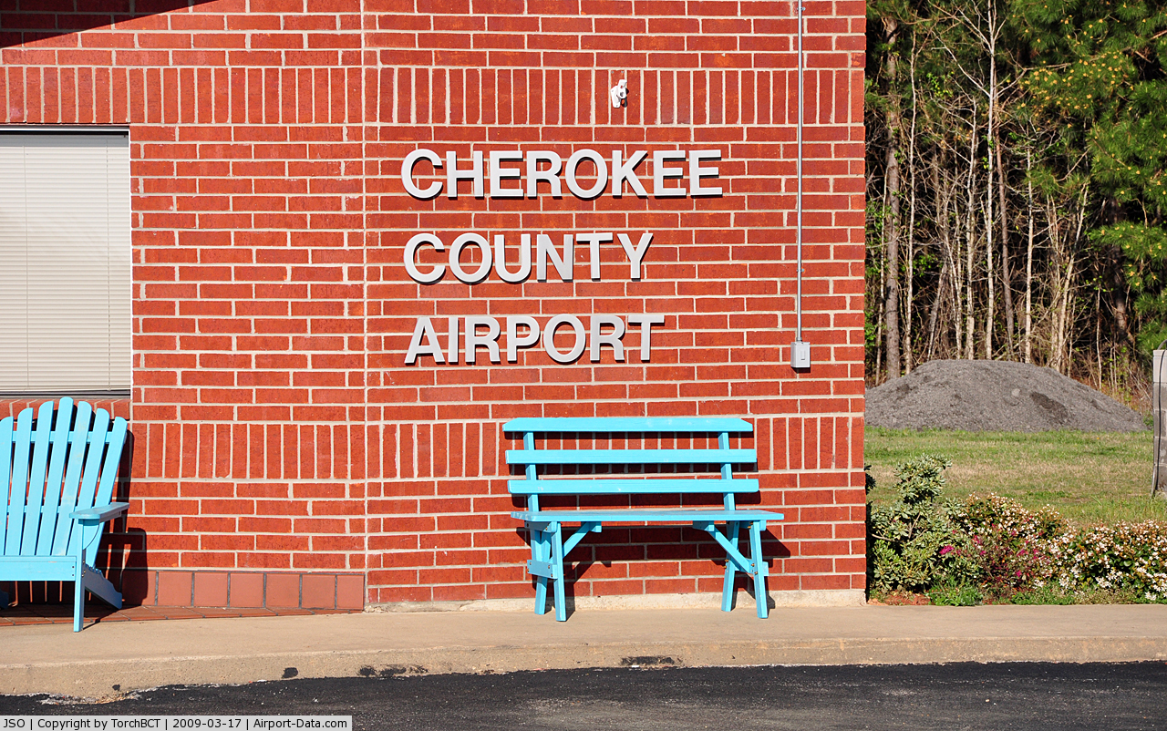
| Cherokee County Airport |
| IATA: JKV – ICAO: KJSO – FAA LID: JSO |
| Summary |
| Airport type |
Public |
| Owner |
Cherokee County |
| Serves |
Jacksonville, Texas |
| Elevation AMSL |
677 ft / 206 m |
| Coordinates |
31°52′10″N 095°13′03″W / 31.86944°N 95.2175°W / 31.86944; -95.2175 |
| Website |
CherokeeCountyAirport.com |
| Runways |
| Direction |
Length |
Surface |
| ft |
m |
| 14/32 |
5,011 |
1,527 |
Asphalt |
| Statistics (2008) |
| Aircraft operations |
12,350 |
| Based aircraft |
8 |
| Source: Federal Aviation Administration |
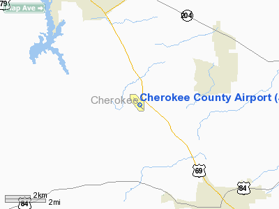
Cherokee County Airport (IATA: JKV, ICAO: KJSO, FAA LID: JSO) is a county-owned public use airport in Cherokee County, Texas, United States. It is located six nautical miles (11 km) southeast of the central business district of Jacksonville, Texas.
Although most U.S. airports use the same three-letter location identifier for the FAA and IATA, this airport is assigned JSO by the FAA and JKV by the IATA (which assigned JSO to a heliport in Södertälje, Sweden).
Facilities and aircraft
Cherokee County Airport covers an area of 224 acres (91 ha) at an elevation of 677 feet (206 m) above mean sea level. It has one asphalt paved runway designated 14/32 which measures 5,011 by 75 feet (1,527 x 23 m).
For the 12-month period ending September 16, 2008, the airport had 12,350 aircraft operations, an average of 33 per day: 99.6% general aviation and 0.4% military. At that time there were 8 aircraft based at this airport: 88% single-engine and 13% multi-engine.
The above content comes from Wikipedia and is published under free licenses – click here to read more.
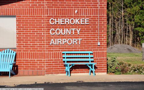 |
(Click on the photo to enlarge) |
Location & QuickFacts
| FAA Information Effective: | 2008-09-25 |
| Airport Identifier: | JSO |
| Airport Status: | Operational |
| Longitude/Latitude: | 095-13-02.6050W/31-52-09.6120N
-95.217390/31.869337 (Estimated) |
| Elevation: | 677 ft / 206.35 m (Surveyed) |
| Land: | 224 acres |
| From nearest city: | 6 nautical miles SE of Jacksonville, TX |
| Location: | Cherokee County, TX |
| Magnetic Variation: | 05E (1995) |
Owner & Manager
| Ownership: | Publicly owned |
| Owner: | Cherokee County |
| Address: | County Courthouse 3rd Floor, 135 S. Main
Rusk, TX 75785 |
| Phone number: | 903-683-2324 |
| Manager: | Clint Goff |
| Address: | County Courthouse 3rd Floor, 135 S. Main
Rusk, TX 75785 |
| Phone number: | 903-586-8219 |
Airport Operations and Facilities
| Airport Use: | Open to public |
| Wind indicator: | Yes |
| Segmented Circle: | Yes |
| Control Tower: | No |
| Lighting Schedule: | DUSK-DAWN
MIRL RY 14/32 PRESET LOW INTST; TO INCR INTST ACTVT - CTAF. |
| Beacon Color: | Clear-Green (lighted land airport) |
| Landing fee charge: | No |
| Sectional chart: | Houston |
| Region: | ASW - Southwest |
| Boundary ARTCC: | ZFW - Fort Worth |
| Tie-in FSS: | FTW - Fort Worth |
| FSS on Airport: | No |
| FSS Phone: | 817-541-3474 |
| FSS Toll Free: | 1-800-WX-BRIEF |
| NOTAMs Facility: | JSO (NOTAM-d service avaliable) |
| Federal Agreements: | NGY |
Airport Communications
| CTAF: | 122.700 |
| Unicom: | 122.700 |
Airport Services
| Fuel available: | 100LLA |
| Airframe Repair: | MINOR |
| Power Plant Repair: | MINOR |
| Bottled Oxygen: | NONE |
| Bulk Oxygen: | NONE |
Runway Information
Runway 14/32
| Dimension: | 5011 x 75 ft / 1527.4 x 22.9 m |
| Surface: | ASPH, Good Condition |
| Weight Limit: | Single wheel: 30000 lbs. |
| Edge Lights: | Medium |
| |
Runway 14 |
Runway 32 |
| Longitude: | 095-13-21.2910W | 095-12-43.9940W |
| Latitude: | 31-52-28.5810N | 31-51-50.5630N |
| Elevation: | 677.00 ft | 657.00 ft |
| Alignment: | 127 | 127 |
| Traffic Pattern: | Left | Left |
| Markings: | Non-precision instrument, Good Condition | Non-precision instrument, Good Condition |
| Crossing Height: | 30.00 ft | 28.00 ft |
| VASI: | 4-light PAPI on left side | 4-light PAPI on left side |
| Visual Glide Angle: | 3.00° | 3.00° |
| Runway End Identifier: | Yes | |
| Obstruction: | 14 ft trees, 400.0 ft from runway, 72 ft left of centerline, 14:1 slope to clear | 30 ft trees, 201.0 ft from runway, 240 ft left of centerline
TREES FM THLD TO 200 FT, 117-250 FT LEFT 5-30 FT TALL. |
|
Radio Navigation Aids
| ID |
Type |
Name |
Ch |
Freq |
Var |
Dist |
| JSO | NDB | Cherokee County | | 263.00 | 05E | 0.1 nm |
| PSN | NDB | Palestine | | 375.00 | 04E | 25.3 nm |
| HNO | NDB | Henderson | | 371.00 | 06E | 26.4 nm |
| GXD | NDB | Nacogdoches | | 391.00 | 05E | 29.3 nm |
| OC | NDB | Nados | | 253.00 | 05E | 34.3 nm |
| TY | NDB | Tyler | | 320.00 | 06E | 35.3 nm |
| AHX | NDB | Athens | | 269.00 | 06E | 35.8 nm |
| LIQ | NDB | Lochridge Ranch | | 335.00 | 09E | 38.5 nm |
| CSZ | NDB | Crossroads | | 215.00 | 08E | 39.5 nm |
| ABG | NDB | Ambassador | | 404.00 | 07E | 43.4 nm |
| FZT | VOR/DME | Frankston | 051X | 111.40 | 06E | 20.2 nm |
| TYR | VOR/DME | Tyler | 089X | 114.20 | 06E | 30.7 nm |
| GGG | VORTAC | Gregg County | 070X | 112.30 | 07E | 40.6 nm |
| LFK | VORTAC | Lufkin | 058X | 112.10 | 05E | 49.6 nm |
Images and information placed above are from
http://www.airport-data.com/airport/JSO/
We thank them for the data!
| General Info
|
| Country |
United States
|
| State |
TEXAS
|
| FAA ID |
JSO
|
| Latitude |
31-52-09.612N
|
| Longitude |
095-13-02.605W
|
| Elevation |
677 feet
|
| Near City |
JACKSONVILLE
|
We don't guarantee the information is fresh and accurate. The data may
be wrong or outdated.
For more up-to-date information please refer to other sources.
|
|