 |
|
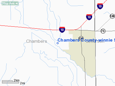
Chambers County-winnie Stowell Airport |
| Chambers County-Winnie Stowell Airport |
| IATA: none – ICAO: none – FAA LID: T90 |
| Summary |
| Airport type |
Public |
| Owner |
Chambers County Commissioners Court |
| Serves |
Winnie / Stowell, Texas |
| Elevation AMSL |
25 ft / 8 m |
| Coordinates |
29°49′09″N 094°25′51″W / 29.81917°N 94.43083°W / 29.81917; -94.43083 |
| Runways |
| Direction |
Length |
Surface |
| ft |
m |
| 17/35 |
3,600 |
1,097 |
Asphalt |
| Statistics (2007) |
| Aircraft operations |
3,000 |
| Based aircraft |
10 |
| Source: Federal Aviation Administration |
Chambers County-Winnie Stowell Airport (FAA LID: T90) is a county-owned public-use airport located in Chambers County, Texas, United States. The airport is named after the unincorporated communities of Winnie and Stowell, both located east of the airport. It is also known as Tom Jenkins Memorial Airport.
Facilities and aircraft
Chambers County-Winnie Stowell Airport covers an area of 112 acres (45 ha) at an elevation of 25 feet (8 m) above mean sea level. It has one runway designated 17/35 with a 3,600 by 75 ft (1,097 x 23 m) asphalt pavement.
For the 12-month period ending September 20, 2007, the airport had 3,000 aircraft operations, an average of 250 per month, all of which were general aviation. At that time there were 10 aircraft based at this airport: 80% single-engine and 20% multi-engine.
The above content comes from Wikipedia and is published under free licenses – click here to read more.
Location & QuickFacts
| FAA Information Effective: | 2008-09-25 |
| Airport Identifier: | T90 |
| Airport Status: | Operational |
| Longitude/Latitude: | 094-25-51.6830W/29-48-14.7960N
-94.431023/29.804110 (Estimated) |
| Elevation: | 25 ft / 7.62 m (Surveyed) |
| Land: | 112 acres |
| From nearest city: | 3 nautical miles W of Winnie/stowell, TX |
| Location: | Chambers County, TX |
| Magnetic Variation: | 05E (1985) |
Owner & Manager
| Ownership: | Publicly owned |
| Owner: | Chambers Co Commissioners Ct |
| Address: | 404 Washington St Po Box 939
Anahuac, TX 77514 |
| Phone number: | 409-267-3671 |
| Manager: | Ron Jackson |
| Address: | Po Box 938
Anahuac, TX 77514 |
| Phone number: | 409-267-8358 |
Airport Operations and Facilities
| Airport Use: | Open to public |
| Wind indicator: | Yes |
| Segmented Circle: | Yes |
| Control Tower: | No |
| Lighting Schedule: | DUSK-DAWN
MIRL RY 17/35 PRESET LOW INTST DUSK-2330; TO INCR INTST ACTVT - CTAF. AFT 2330 ACTVT - CTAF. |
| Beacon Color: | Clear-Green (lighted land airport)
ROTG BCN OTS INDEFLY. |
| Sectional chart: | Houston |
| Region: | ASW - Southwest |
| Boundary ARTCC: | ZHU - Houston |
| Tie-in FSS: | CXO - Montgomery County |
| FSS Toll Free: | 1-800-WX-BRIEF
FOR FP FILING CALL CXO FSS 1-800-992-7433. |
| NOTAMs Facility: | CXO (NOTAM-d service avaliable) |
| Federal Agreements: | NGY |
Airport Communications
Airport Services
| Fuel available: | 100LL
FUEL SELF-SERVICE; MAJOR CREDIT CARDS ACCEPTED. |
| Airframe Repair: | MAJOR |
| Power Plant Repair: | MAJOR |
Runway Information
Runway 17/35
| Dimension: | 3600 x 75 ft / 1097.3 x 22.9 m |
| Surface: | ASPH, Fair Condition |
| Edge Lights: | Medium |
| |
Runway 17 |
Runway 35 |
| Traffic Pattern: | Left | Left |
| Markings: | Non-precision instrument, Fair Condition | Non-precision instrument, Fair Condition |
| Crossing Height: | 40.00 ft | 0.00 ft |
| VASI: | 2-light PAPI on left side | |
| Visual Glide Angle: | 3.00° | 0.00° |
| Obstruction: | 57 ft trees, 1340.0 ft from runway, 125 ft left of centerline, 20:1 slope to clear | 52 ft trees, 1948.0 ft from runway, 140 ft left of centerline, 34:1 slope to clear |
|
Radio Navigation Aids
| ID |
Type |
Name |
Ch |
Freq |
Var |
Dist |
| CBC | NDB | Anahuac | | 413.00 | 05E | 12.2 nm |
| GDE | NDB | Goodhue | | 368.00 | 07E | 19.9 nm |
| GLS | NDB | Galveston | | 206.00 | 08E | 33.0 nm |
| HRD | NDB | Hardin County | | 524.00 | 04E | 33.3 nm |
| JPA | NDB | Sanjac | | 347.00 | 05E | 34.3 nm |
| ORG | NDB | Orange | | 211.00 | 05E | 36.8 nm |
| BVP | NDB | Nixin | | 326.00 | 05E | 42.4 nm |
| EFD | TACAN | Ellington | 031X | | 05E | 39.9 nm |
| SBI | VOR/DME | Sabine Pass | 101X | 115.40 | 07E | 21.7 nm |
| MHF | VOR/DME | Trinity | 083X | 113.60 | 07E | 22.7 nm |
| BPT | VOR/DME | Beaumont | 092X | 114.50 | 07E | 23.2 nm |
| HUB | VOR/DME | Hobby | 118X | 117.10 | 05E | 45.0 nm |
| DAS | VORTAC | Daisetta | 116X | 116.90 | 05E | 25.7 nm |
| VUH | VORTAC | Scholes | 077X | 113.00 | 06E | 39.4 nm |
| IAH | VORTAC | Humble | 113X | 116.60 | 05E | 48.5 nm |
| HOU | VOT | Houston Wm P Hobby | | 108.40 | | 45.3 nm |
Remarks
- FOR CLEARANCE DELIVERY CTC HOUSTON APCH CTL AT 409-720-5136.
Images and information placed above are from
http://www.airport-data.com/airport/T90/
We thank them for the data!
| General Info
|
| Country |
United States
|
| State |
TEXAS
|
| FAA ID |
T90
|
| Latitude |
29-48-14.796N
|
| Longitude |
094-25-51.683W
|
| Elevation |
25 feet
|
| Near City |
WINNIE/STOWELL
|
We don't guarantee the information is fresh and accurate. The data may
be wrong or outdated.
For more up-to-date information please refer to other sources.
|
|


