 |
|
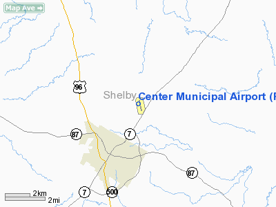
Location & QuickFacts
| FAA Information Effective: | 2008-09-25 |
| Airport Identifier: | F17 |
| Airport Status: | Operational |
| Longitude/Latitude: | 094-09-23.1000W/31-49-53.7000N
-94.156417/31.831583 (Estimated) |
| Elevation: | 319 ft / 97.23 m (Surveyed) |
| Land: | 150 acres |
| From nearest city: | 3 nautical miles NE of Center, TX |
| Location: | Shelby County, TX |
| Magnetic Variation: | 04E (1995) |
Owner & Manager
| Ownership: | Publicly owned |
| Owner: | City Of Center |
| Address: | Po Box 1744
Center, TX 75935 |
| Phone number: | 936-598-2941 |
| Manager: | Allen Penick |
| Address: | 397 Fm 1656
Center, TX 75935 |
| Phone number: | 936-598-8119
EMERGENCY PHONE: 936-598-2788. |
Airport Operations and Facilities
| Airport Use: | Open to public |
| Wind indicator: | Yes |
| Segmented Circle: | Yes |
| Control Tower: | No |
| Lighting Schedule: | DUSK-DAWN |
| Beacon Color: | Clear-Green (lighted land airport) |
| Landing fee charge: | No |
| Sectional chart: | Houston |
| Region: | ASW - Southwest |
| Boundary ARTCC: | ZFW - Fort Worth |
| Tie-in FSS: | CXO - Montgomery County |
| FSS on Airport: | No |
| FSS Toll Free: | 1-800-WX-BRIEF |
| NOTAMs Facility: | CXO (NOTAM-d service avaliable) |
| Federal Agreements: | NGY |
Airport Communications
| CTAF: | 122.800 |
| Unicom: | 122.800 |
Airport Services
| Fuel available: | 100LLA+ |
| Airframe Repair: | MINOR |
| Power Plant Repair: | MAJOR |
| Bottled Oxygen: | NONE |
| Bulk Oxygen: | NONE |
Runway Information
Runway 17/35
| Dimension: | 5501 x 75 ft / 1676.7 x 22.9 m |
| Surface: | ASPH, Good Condition |
| Weight Limit: | Single wheel: 30000 lbs. |
| Edge Lights: | Medium |
| |
Runway 17 |
Runway 35 |
| Longitude: | 094-09-28.3696W | 094-09-17.8820W |
| Latitude: | 31-50-20.5849N | 31-49-26.8940N |
| Elevation: | 319.00 ft | 291.00 ft |
| Alignment: | 127 | 127 |
| Traffic Pattern: | Left | Left |
| Markings: | Non-precision instrument, Good Condition | Non-precision instrument, Good Condition |
| Crossing Height: | 30.00 ft | 44.00 ft |
| VASI: | 4-box on left side | 4-box on left side |
| Visual Glide Angle: | 4.00° | 3.00° |
| Obstruction: | 105 ft trees, 1360.0 ft from runway, 460 ft right of centerline, 11:1 slope to clear | 15 ft trees, 200.0 ft from runway, 190 ft left of centerline |
|
Radio Navigation Aids
| ID |
Type |
Name |
Ch |
Freq |
Var |
Dist |
| CZJ | NDB | Amason | | 341.00 | 04E | 0.2 nm |
| RPF | NDB | Carthage | | 332.00 | 04E | 22.1 nm |
| MSD | NDB | Mansfield | | 414.00 | 04E | 24.4 nm |
| GXD | NDB | Nacogdoches | | 391.00 | 05E | 30.1 nm |
| MMY | NDB | Many | | 272.00 | 04E | 35.1 nm |
| OC | NDB | Nados | | 253.00 | 05E | 35.6 nm |
| HNO | NDB | Henderson | | 371.00 | 06E | 41.8 nm |
| BAD | TACAN | Barksdale | 105X | | 05E | 47.4 nm |
| DTN | VOR | Downtown | | 108.60 | 07E | 47.5 nm |
| EMG | VORTAC | Elm Grove | 049X | 111.20 | 07E | 44.5 nm |
| GGG | VORTAC | Gregg County | 070X | 112.30 | 07E | 46.5 nm |
| LFK | VORTAC | Lufkin | 058X | 112.10 | 05E | 49.4 nm |
| SHV | VOT | Shreveport Regional | | 108.20 | | 49.8 nm |
Remarks
- DEER ON & INVOF RY.
- +60 FT TREES 300 FT LEFT OF RY 17 CENTERLINE.
Images and information placed above are from
http://www.airport-data.com/airport/F17/
We thank them for the data!
| General Info
|
| Country |
United States
|
| State |
TEXAS
|
| FAA ID |
F17
|
| Latitude |
31-49-53.700N
|
| Longitude |
094-09-23.100W
|
| Elevation |
319 feet
|
| Near City |
CENTER
|
We don't guarantee the information is fresh and accurate. The data may
be wrong or outdated.
For more up-to-date information please refer to other sources.
|
|


