 |
|
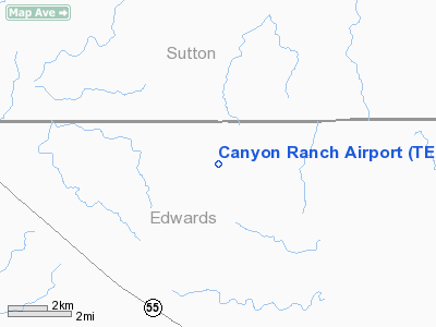
Location & QuickFacts
| FAA Information Effective: | 2008-09-25 |
| Airport Identifier: | TE37 |
| Airport Status: | Operational |
| Longitude/Latitude: | 100-27-03.3150W/30-16-08.7030N
-100.450921/30.269084 (Estimated) |
| Elevation: | 2306 ft / 702.87 m (Estimated) |
| Land: | 0 acres |
| From nearest city: | 28 nautical miles SE of Sonora, TX |
| Location: | Sutton County, TX |
| Magnetic Variation: | 08E (1995) |
Owner & Manager
| Ownership: | Privately owned |
| Owner: | Meridan Oil |
| Address: | 17650 Chanute Rd
Houston, TX 77032 |
| Phone number: | 713-821-2585
EXT 405. |
| Manager: | Jewel Aiken |
| Address: |
|
| Phone number: | 713-821-2585 |
Airport Operations and Facilities
| Airport Use: | Private |
| Segmented Circle: | No |
| Control Tower: | No |
| Sectional chart: | San Antonio |
| Region: | ASW - Southwest |
| Boundary ARTCC: | ZHU - Houston |
| Tie-in FSS: | SJT - San Angelo |
| FSS Toll Free: | 1-800-WX-BRIEF |
Runway Information
Runway 15/33
| Dimension: | 6200 x 60 ft / 1889.8 x 18.3 m |
| Surface: | ASPH, |
| |
Runway 15 |
Runway 33 |
| Traffic Pattern: | Left | Left |
|
Radio Navigation Aids
| ID |
Type |
Name |
Ch |
Freq |
Var |
Dist |
| SOA | NDB | Sonora | | 371.00 | 08E | 21.4 nm |
| RSG | VORTAC | Rocksprings | 049X | 111.20 | 10E | 17.2 nm |
| JCT | VORTAC | Junction | 107X | 116.00 | 08E | 38.3 nm |
Images and information placed above are from
http://www.airport-data.com/airport/TE37/
We thank them for the data!
| General Info
|
| Country |
United States
|
| State |
TEXAS
|
| FAA ID |
TE37
|
| Latitude |
30-16-08.703N
|
| Longitude |
100-27-03.315W
|
| Elevation |
2306 feet
|
| Near City |
SONORA
|
We don't guarantee the information is fresh and accurate. The data may
be wrong or outdated.
For more up-to-date information please refer to other sources.
|
|


