 |
|
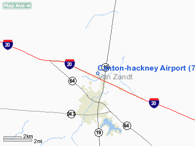
Location & QuickFacts
| FAA Information Effective: | 2008-09-25 |
| Airport Identifier: | 7F5 |
| Airport Status: | Operational |
| Longitude/Latitude: | 095-51-45.8770W/32-35-10.4820N
-95.862744/32.586245 (Estimated) |
| Elevation: | 500 ft / 152.40 m (Estimated) |
| Land: | 19 acres |
| From nearest city: | 2 nautical miles N of Canton, TX |
| Location: | Van Zandt County, TX |
| Magnetic Variation: | 06E (1985) |
Owner & Manager
| Ownership: | Publicly owned |
| Owner: | City Of Canton |
| Address: | Po Box 245
Canton, TX 75103 |
| Phone number: | 903-567-2826 |
| Manager: | Julie Seymore
CITY CLERK. |
| Address: | Po Box 245
Canton, TX 75103 |
| Phone number: | 903-567-2826
EMERGENCY PHONE: 903-567-4991. |
Airport Operations and Facilities
| Airport Use: | Open to public |
| Wind indicator: | Yes |
| Segmented Circle: | No |
| Control Tower: | No |
| Lighting Schedule: | DUSK-DAWN |
| Landing fee charge: | No |
| Sectional chart: | Dallas-ft Worth |
| Region: | ASW - Southwest |
| Boundary ARTCC: | ZFW - Fort Worth |
| Tie-in FSS: | FTW - Fort Worth |
| FSS on Airport: | No |
| FSS Phone: | 817-541-3474 |
| FSS Toll Free: | 1-800-WX-BRIEF |
| NOTAMs Facility: | FTW (NOTAM-d service avaliable) |
Airport Communications
Airport Services
| Airframe Repair: | NONE |
| Power Plant Repair: | NONE |
| Bottled Oxygen: | NONE |
| Bulk Oxygen: | NONE |
Runway Information
Runway 18/36
| Dimension: | 3750 x 50 ft / 1143.0 x 15.2 m |
| Surface: | ASPH,
RY HAS RUTS, HOLES, AND LOOSE ROCKS. |
| Weight Limit: | Single wheel: 5500 lbs. |
| Edge Lights: | Non-standard lighting system
NSTD LIRL; ONLY SOUTH 3585 FT OF RY LGTD. |
| |
Runway 18 |
Runway 36 |
| Traffic Pattern: | Left | Left |
| Markings: | Nonstandard, Fair Condition
RYS 18 & 36 NSTD SMALL RY NRS; ONLY 35 FT HIGH. | Nonstandard, Fair Condition
NSTD SMALL RY NRS; ONLY 35 FT HIGH. |
| Displaced threshold: | 103.00 ft | 70.00 ft |
| Obstruction: | 30 ft tree, 201.0 ft from runway, 124 ft right of centerline
APCH SLOPE 13:1 AT DSPLCD THLD.
+30 FT TREE AT THLD 75 FT R CNTRLN; 5 FT FENCE ACROSS APCH AT THLD. | 15 ft pline, 200.0 ft from runway
APCH SLOPE 18:1 AT DSPLCD THLD.
+15 FT OBSTN LGT POLES 176 FT FM THLD 65 FT R OF CNTRLN; ROAD 80 FT RIGHT AND LEFT OF CNTRLN AT THLD; +35 FT TREE AT THLD 100 FT L OF CNTRLN. |
|
Radio Navigation Aids
| ID |
Type |
Name |
Ch |
Freq |
Var |
Dist |
| AVZ | NDB | Travis | | 260.00 | 06E | 22.2 nm |
| TY | NDB | Tyler | | 320.00 | 06E | 22.4 nm |
| AHX | NDB | Athens | | 269.00 | 06E | 25.7 nm |
| SYW | NDB | Cash | | 428.00 | 05E | 25.9 nm |
| CSZ | NDB | Crossroads | | 215.00 | 08E | 31.8 nm |
| MII | NDB | Caddo Mills | | 316.00 | 06E | 33.5 nm |
| JUG | NDB | Jecca | | 388.00 | 06E | 34.2 nm |
| LIQ | NDB | Lochridge Ranch | | 335.00 | 09E | 34.9 nm |
| PQF | NDB | Mesquite | | 248.00 | 06E | 36.3 nm |
| ABG | NDB | Ambassador | | 404.00 | 07E | 38.0 nm |
| CGQ | NDB | Powell | | 344.00 | 06E | 42.5 nm |
| CRS | NDB | Corsicana | | 396.00 | 06E | 43.1 nm |
| LNC | NDB | Lancaster | | 239.00 | 06E | 43.5 nm |
| PYF | NDB | Pyramid | | 418.00 | 06E | 46.7 nm |
| PSN | NDB | Palestine | | 375.00 | 04E | 49.1 nm |
| MJF | TACAN | Arvilla | 033X | | 05E | 30.5 nm |
| TYR | VOR/DME | Tyler | 089X | 114.20 | 06E | 27.1 nm |
| UIM | VOR/DME | Quitman | 087X | 114.00 | 08E | 30.7 nm |
| FZT | VOR/DME | Frankston | 051X | 111.40 | 06E | 35.1 nm |
| SLR | VOR/DME | Sulphur Springs | 027X | 109.00 | 08E | 40.2 nm |
| CQY | VORTAC | Cedar Creek | 095X | 114.80 | 06E | 30.1 nm |
Remarks
- ARPT CLSD TO ACFT OVER 4000 LBS.
- RY 18/36 +2 FT POSTS AND CABLE 75 FT FM RY CNTRLN WEST SIDE OF RY.
- RY 18/36 NO LINE OF SIGHT BTN THLDS.
Images and information placed above are from
http://www.airport-data.com/airport/7F5/
We thank them for the data!
| General Info
|
| Country |
United States
|
| State |
TEXAS
|
| FAA ID |
7F5
|
| Latitude |
32-35-10.482N
|
| Longitude |
095-51-45.877W
|
| Elevation |
500 feet
|
| Near City |
CANTON
|
We don't guarantee the information is fresh and accurate. The data may
be wrong or outdated.
For more up-to-date information please refer to other sources.
|
|


