 |
|
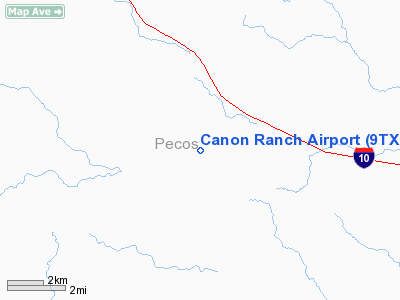
Location & QuickFacts
| FAA Information Effective: | 2008-09-25 |
| Airport Identifier: | 9TX9 |
| Airport Status: | Operational |
| Longitude/Latitude: | 101-57-55.4660W/30-44-53.5860N
-101.965407/30.748218 (Estimated) |
| Elevation: | 2380 ft / 725.42 m (Estimated) |
| Land: | 0 acres |
| From nearest city: | 7 nautical miles NW of Sheffield, TX |
| Location: | Pecos County, TX |
| Magnetic Variation: | 09E (1985) |
Owner & Manager
| Ownership: | Privately owned |
| Owner: | R H Canon |
| Address: | Po Box 1209; Nr 154 La Fonda
Santa Fe, NM 87501 |
| Phone number: | 505-983-4680 |
| Manager: | Richard Canon |
| Address: | Po Box 1209; Nr 154 La Fonda
Santa Fe, NM 87501 |
| Phone number: | 915-395-2247 |
Airport Operations and Facilities
| Airport Use: | Private |
| Wind indicator: | Yes |
| Segmented Circle: | No |
| Control Tower: | No |
| Sectional chart: | San Antonio |
| Region: | ASW - Southwest |
| Boundary ARTCC: | ZHU - Houston |
| Tie-in FSS: | SJT - San Angelo |
| FSS Toll Free: | 1-800-WX-BRIEF |
Runway Information
Runway 06/24
| Dimension: | 3500 x 90 ft / 1066.8 x 27.4 m |
| Surface: | TURF, |
| |
Runway 06 |
Runway 24 |
| Traffic Pattern: | Left | Left |
|
Radio Navigation Aids
| ID |
Type |
Name |
Ch |
Freq |
Var |
Dist |
Images and information placed above are from
http://www.airport-data.com/airport/9TX9/
We thank them for the data!
| General Info
|
| Country |
United States
|
| State |
TEXAS
|
| FAA ID |
9TX9
|
| Latitude |
30-44-53.586N
|
| Longitude |
101-57-55.466W
|
| Elevation |
2380 feet
|
| Near City |
SHEFFIELD
|
We don't guarantee the information is fresh and accurate. The data may
be wrong or outdated.
For more up-to-date information please refer to other sources.
|
|


