 |
|
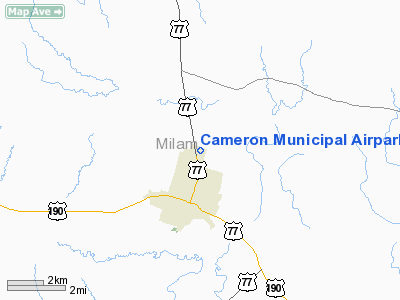
Cameron Muni Airpark Airport |
Location & QuickFacts
| FAA Information Effective: | 2008-09-25 |
| Airport Identifier: | T35 |
| Airport Status: | Operational |
| Longitude/Latitude: | 096-58-15.9490W/30-52-45.6800N
-96.971097/30.879356 (Estimated) |
| Elevation: | 402 ft / 122.53 m (Estimated) |
| Land: | 33 acres |
| From nearest city: | 2 nautical miles N of Cameron, TX |
| Location: | Milam County, TX |
| Magnetic Variation: | 06E (1985) |
Owner & Manager
| Ownership: | Publicly owned |
| Owner: | City Of Cameron |
| Address: | 100 Houston St Po Drawer 833
Cameron, TX 76520 |
| Phone number: | 254-697-6646 |
| Manager: | Rick Tow |
| Address: | 100 Houston St Po Drawer 833
Cameron, TX 76520 |
| Phone number: | 254-697-6646
CITY HALL PHONE. |
Airport Operations and Facilities
| Airport Use: | Open to public |
| Wind indicator: | Yes |
| Segmented Circle: | Yes |
| Control Tower: | No |
| Lighting Schedule: | DUSK-DAWN
MIRL RY 16/34 PRESET LOW INTST; TO INCR INTST ACTVT - 122.8. |
| Beacon Color: | Clear-Green (lighted land airport) |
| Landing fee charge: | No |
| Sectional chart: | Houston |
| Region: | ASW - Southwest |
| Boundary ARTCC: | ZHU - Houston |
| Tie-in FSS: | FTW - Fort Worth |
| FSS on Airport: | No |
| FSS Phone: | 817-541-3474 |
| FSS Toll Free: | 1-800-WX-BRIEF
FOR FP FILING CALL CXO FSS 1-800-833-5602 |
| NOTAMs Facility: | FTW (NOTAM-d service avaliable) |
| Federal Agreements: | NGY |
Airport Communications
Airport Services
| Fuel available: | 100LL |
| Airframe Repair: | NONE |
| Power Plant Repair: | NONE |
| Bottled Oxygen: | NONE |
| Bulk Oxygen: | NONE |
Runway Information
Runway 16/34
| Dimension: | 3200 x 50 ft / 975.4 x 15.2 m |
| Surface: | ASPH, Good Condition |
| Weight Limit: | Single wheel: 19000 lbs. |
| Edge Lights: | Medium |
| |
Runway 16 |
Runway 34 |
| Traffic Pattern: | Left | Left |
| Markings: | Basic, Good Condition | Basic, Good Condition |
| Obstruction: | , 50:1 slope to clear | 52 ft tree, 1492.0 ft from runway, 100 ft right of centerline, 24:1 slope to clear |
|
Radio Navigation Aids
| ID |
Type |
Name |
Ch |
Freq |
Var |
Dist |
| ROB | NDB | Robinson | | 400.00 | 07E | 37.9 nm |
| GUO | NDB | Georgetown | | 332.00 | 06E | 38.4 nm |
| IL | NDB | Iresh | | 278.00 | 07E | 39.0 nm |
| HLR | NDB | Hood | | 347.00 | 07E | 41.0 nm |
| GYB | NDB | Lee County | | 385.00 | 07E | 42.7 nm |
| GR | NDB | Starn | | 323.00 | 07E | 49.8 nm |
| TPL | VOR/DME | Temple | 041X | 110.40 | 09E | 30.7 nm |
| GRK | VOR/DME | Gray | 055X | 111.80 | 07E | 44.4 nm |
| GNL | VOR/DME | Groesbeck | 025X | 108.80 | 05E | 47.5 nm |
| CLL | VORTAC | College Station | 080X | 113.30 | 08E | 32.9 nm |
| CWK | VORTAC | Centex | 075X | 112.80 | 06E | 41.7 nm |
| ACT | VORTAC | Waco | 100X | 115.30 | 09E | 49.5 nm |
Remarks
- RY 16 HAS A 15 FT DROP 155 FT BYD THLD.
- RY 34 HAS A 8 FT DROP 150 FT BYD THLD.
Images and information placed above are from
http://www.airport-data.com/airport/T35/
We thank them for the data!
| General Info
|
| Country |
United States
|
| State |
TEXAS
|
| FAA ID |
T35
|
| Latitude |
30-52-45.680N
|
| Longitude |
096-58-15.949W
|
| Elevation |
402 feet
|
| Near City |
CAMERON
|
We don't guarantee the information is fresh and accurate. The data may
be wrong or outdated.
For more up-to-date information please refer to other sources.
|
|


