 |
|
| Calhoun County Airport |
| IATA: none – ICAO: KPKV – FAA LID: PKV |
| Summary |
| Airport type |
Public |
| Owner |
County of Calhoun |
| Serves |
Port Lavaca, Texas |
| Elevation AMSL |
30 ft / 9 m |
| Coordinates |
28°39′15″N 096°40′53″W / 28.65417°N 96.68139°W / 28.65417; -96.68139 |
| Runways |
| Direction |
Length |
Surface |
| ft |
m |
| 14/32 |
5,004 |
1,525 |
Asphalt |
| 5/23 |
2,700 |
823 |
Turf |
| Statistics (2005) |
| Aircraft operations |
6,600 |
| Based aircraft |
18 |
| Source: Federal Aviation Administration |
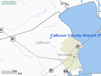
Calhoun County Airport (ICAO: KPKV, FAA LID: PKV) is a county-owned public-use airport located three miles (5 km) northwest of the central business district of Port Lavaca, a city in Calhoun County, Texas, United States.
Although most U.S. airports use the same three-letter location identifier for the FAA and IATA, Calhoun County Airport is assigned PKV by the FAA but has no designation from the IATA.
Facilities and aircraft
Calhoun County Airport covers an area of 200 acres (81 ha) which contains two runways: 14/32 with an asphalt pavement measuring 5,004 x 75 ft (1,525 x 23 m) and 5/23 with a turf surface measuring 2,700 x 60 ft (823 x 18 m). The airport has two concrete helipads, twenty-four hour self service fuel tanks with AvGas and JetA.
The only fixed base operator at the airport is Calhoun Air Center which is a full service FBO. Flight instruction is available on the field from Calhoun Air Center.
For the 12-month period ending May 9, 2005, the airport had 6,600 aircraft operations, an average of 18 per day: 77% general aviation and 23% military. At that time there were 18 aircraft based at this airport: 83% single-engine, 11% multi-engine and 6% helicopter.
The above content comes from Wikipedia and is published under free licenses – click here to read more.
Location & QuickFacts
| FAA Information Effective: | 2008-09-25 |
| Airport Identifier: | PKV |
| Airport Status: | Operational |
| Longitude/Latitude: | 096-40-57.8000W/28-39-11.9000N
-96.682722/28.653306 (Estimated) |
| Elevation: | 32 ft / 9.75 m (Surveyed) |
| Land: | 200 acres |
| From nearest city: | 3 nautical miles NW of Port Lavaca, TX |
| Location: | Calhoun County, TX |
| Magnetic Variation: | 05E (1985) |
Owner & Manager
| Ownership: | Publicly owned |
| Owner: | County Of Calhoun |
| Address: | Calhoun Co Courthouse
Port Lavaca, TX 77979 |
| Phone number: | 361-553-4600 |
| Manager: | Vern Lyssy |
| Address: | Po Box 676
Port Lavaca, TX 77979 |
| Phone number: | 361-552-9656
MGR'S RESIDENCE CALL 512-212-9656. |
Airport Operations and Facilities
| Airport Use: | Open to public |
| Wind indicator: | Yes |
| Segmented Circle: | Yes |
| Control Tower: | No |
| Lighting Schedule: | DUSK-DAWN
ACTVT MIRL RY 14/32 - CTAF. |
| Beacon Color: | Clear-Green (lighted land airport) |
| Landing fee charge: | No |
| Sectional chart: | Houston |
| Region: | ASW - Southwest |
| Traffic Pattern Alt: | 800 ft |
| Boundary ARTCC: | ZHU - Houston |
| Tie-in FSS: | CXO - Montgomery County |
| FSS on Airport: | No |
| FSS Toll Free: | 1-800-WX-BRIEF
FOR FP FILING CALL CXO FSS 1-800-992-7433. |
| NOTAMs Facility: | PKV (NOTAM-d service avaliable) |
| Federal Agreements: | NGY |
Airport Communications
| CTAF: | 122.800 |
| Unicom: | 122.800 |
Airport Services
| Fuel available: | 100LLA |
| Airframe Repair: | MAJOR |
| Power Plant Repair: | MAJOR |
| Bottled Oxygen: | NONE |
| Bulk Oxygen: | NONE |
Runway Information
Runway 05/23
| Dimension: | 2432 x 60 ft / 741.3 x 18.3 m |
| Surface: | TURF, |
| |
Runway 05 |
Runway 23 |
| Longitude: | 096-41-19.2498W | 096-40-57.0554W |
| Latitude: | 28-38-59.4751N | 28-39-13.4867N |
| Elevation: | 32.00 ft | 30.00 ft |
| Alignment: | 54 | 127 |
| Traffic Pattern: | Left | Left |
| Displaced threshold: | 0.00 ft | 428.00 ft |
| Obstruction: | 15 ft tree, 10.0 ft from runway, 61 ft left of centerline | , 50:1 slope to clear |
|
Runway 14/32
| Dimension: | 5004 x 75 ft / 1525.2 x 22.9 m |
| Surface: | ASPH, Good Condition |
| Weight Limit: | Single wheel: 26000 lbs. |
| Edge Lights: | Medium |
| |
Runway 14 |
Runway 32 |
| Longitude: | 096-41-09.0676W | 096-40-36.4058W |
| Latitude: | 28-39-34.6533N | 28-38-54.3490N |
| Elevation: | 30.00 ft | 28.00 ft |
| Alignment: | 127 | 127 |
| Traffic Pattern: | Left | Right |
| Markings: | Non-precision instrument, Good Condition | Non-precision instrument, Good Condition |
| Crossing Height: | 53.00 ft | 0.00 ft |
| VASI: | 4-light PAPI on left side | |
| Visual Glide Angle: | 4.00° | 0.00° |
| Obstruction: | 13 ft road, 560.0 ft from runway, 27:1 slope to clear | 13 ft road, 475.0 ft from runway, 21:1 slope to clear |
|
Radio Navigation Aids
| ID |
Type |
Name |
Ch |
Freq |
Var |
Dist |
| PKV | NDB | Port Lavaca | | 515.00 | 05E | 0.2 nm |
| MNO | NDB | Mellon Ranch | | 375.00 | 06E | 35.6 nm |
| RKP | NDB | Rockport | | 391.00 | 06E | 38.9 nm |
| ARM | NDB | Wharton | | 245.00 | 06E | 45.7 nm |
| OKT | NDB | Yoakum | | 350.00 | 06E | 46.3 nm |
| BYY | NDB | Bay City | | 344.00 | 06E | 47.4 nm |
| VCT | VOR/DME | Victoria | 027X | 109.00 | 06E | 21.5 nm |
| PSX | VORTAC | Palacios | 120X | 117.30 | 08E | 20.9 nm |
Images and information placed above are from
http://www.airport-data.com/airport/PKV/
We thank them for the data!
| General Info
|
| Country |
United States
|
| State |
TEXAS
|
| FAA ID |
PKV
|
| Time |
UTC-6(-5DT)
|
| Latitude |
28.654028
28° 39' 14.50" N
|
| Longitude |
-96.681317
096° 40' 52.74" W
|
| Elevation |
30 feet
9 meters
|
| Type |
Civil
|
| Magnetic Variation |
004° E (01/06)
|
| Beacon |
Yes
|
| Operating Agency |
U.S.CIVIL AIRPORT WHEREIN PERMIT COVERS USE BY TRANSIT MILITARY AIRCRAFT
|
| Operating Hours |
SEE REMARKS FOR OPERATING HOURS OR COMMUNICATIONS FOR POSSIBLE HOURS
|
| Daylight Saving Time |
Second Sunday in March at 0200 to first Sunday in November at 0200 local time (Exception Arizona and that portion of Indiana in the Eastern Time Zone)
|
We don't guarantee the information is fresh and accurate. The data may
be wrong or outdated.
For more up-to-date information please refer to other sources.
|
|


