 |
|
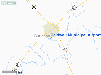
| Caldwell Municipal Airport |
| IATA: none – ICAO: KRWV – FAA LID: RWV |
| Summary |
| Airport type |
Public |
| Owner |
City of Caldwell |
| Serves |
Caldwell, Texas |
| Elevation AMSL |
391 ft / 119 m |
| Coordinates |
30°30′56″N 096°42′15″W / 30.51556°N 96.70417°W / 30.51556; -96.70417 |
| Runways |
| Direction |
Length |
Surface |
| ft |
m |
| 15/33 |
3,252 |
991 |
Asphalt |
| Statistics (2006) |
| Aircraft operations |
2,700 |
| Source: Federal Aviation Administration |
Caldwell Municipal Airport (ICAO: KRWV, FAA LID: RWV, formerly 14R) is a city-owned, public-use airport located 1 nautical mile (2 km) southwest of the central business district of Caldwell, a city in Burleson County, Texas, United States.
Although most U.S. airports use the same three-letter location identifier for the FAA and IATA, this airport is assigned RWV by the FAA but has no designation from the IATA.
Facilities and aircraft
Caldwell Municipal Airport covers an area of 49 acres (20 ha) and has one runway (15/33) with an asphalt surface measuring 3,252 x 50 feet (991 x 15 m). For the 12-month period ending March 24, 2006, the airport had 2,700 general aviation aircraft operations, an average of 225 per month.
The above content comes from Wikipedia and is published under free licenses – click here to read more.
Location & QuickFacts
| FAA Information Effective: | 2008-09-25 |
| Airport Identifier: | RWV |
| Airport Status: | Operational |
| Longitude/Latitude: | 096-42-14.7088W/30-30-55.7074N
-96.704086/30.515474 (Estimated) |
| Elevation: | 391 ft / 119.18 m (Surveyed) |
| Land: | 49 acres |
| From nearest city: | 1 nautical miles SW of Caldwell, TX |
| Location: | Burleson County, TX |
| Magnetic Variation: | 06E (1990) |
Owner & Manager
| Ownership: | Publicly owned |
| Owner: | City Of Caldwell |
| Address: | 107 S Hill
Caldwell, TX 77836 |
| Phone number: | 979-567-3271 |
| Manager: | Billy Clemons |
| Address: | 107 S Hill
Caldwell, TX 77836 |
| Phone number: | 979-567-3271 |
Airport Operations and Facilities
| Airport Use: | Open to public |
| Wind indicator: | Yes |
| Segmented Circle: | Yes |
| Control Tower: | No |
| Lighting Schedule: | DUSK-DAWN
MIRL RY 15/33 PRESET LOW INTST; TO INCR INTST ACTVT - CTAF. |
| Beacon Color: | Clear-Green (lighted land airport) |
| Landing fee charge: | No |
| Sectional chart: | Houston |
| Region: | ASW - Southwest |
| Boundary ARTCC: | ZHU - Houston |
| Tie-in FSS: | CXO - Montgomery County |
| FSS on Airport: | No |
| FSS Toll Free: | 1-800-WX-BRIEF
FOR FP FILING CALL CXO FSS 1-800-833-5602 |
| NOTAMs Facility: | RWV (NOTAM-d service avaliable) |
| Federal Agreements: | GY |
Airport Communications
Airport Services
| Fuel available: | 100LL |
| Airframe Repair: | NONE |
| Power Plant Repair: | NONE |
| Bottled Oxygen: | NONE |
| Bulk Oxygen: | NONE |
Runway Information
Runway 15/33
| Dimension: | 3252 x 50 ft / 991.2 x 15.2 m |
| Surface: | ASPH, Good Condition |
| Weight Limit: | Single wheel: 4000 lbs. |
| Edge Lights: | Medium |
| |
Runway 15 |
Runway 33 |
| Longitude: | 096-42-23.3346W | 096-42-06.0837W |
| Latitude: | 30-31-09.9640N | 30-30-41.4506N |
| Elevation: | 391.00 ft | 363.00 ft |
| Alignment: | 127 | 127 |
| Traffic Pattern: | Left | Left |
| Markings: | Basic, Good Condition | Basic, Good Condition |
| Displaced threshold: | 0.00 ft | 242.00 ft |
| VASI: | pulsating/steady burning on left side | |
| Visual Glide Angle: | 3.00° | 0.00° |
| Obstruction: | 32 ft tree, 200.0 ft from runway, 180 ft left of centerline | 42 ft tree, 581.0 ft from runway, 100 ft left of centerline, 9:1 slope to clear
APCH SLOPE 19:1 TO DSPLCD THLD FM 42 FT TREE 823 FT FM DSPLCD THLD 100 FT L.
8 FT FENCE AT 122 FT FM RY END ACROSS APCH. |
|
Radio Navigation Aids
| ID |
Type |
Name |
Ch |
Freq |
Var |
Dist |
| BNH | NDB | Brenham | | 362.00 | 06E | 24.6 nm |
| GYB | NDB | Lee County | | 385.00 | 07E | 25.2 nm |
| CLL | VORTAC | College Station | 080X | 113.30 | 08E | 15.6 nm |
| IDU | VORTAC | Industry | 039X | 110.20 | 08E | 34.4 nm |
| TNV | VORTAC | Navasota | 106X | 115.90 | 08E | 36.2 nm |
| CWK | VORTAC | Centex | 075X | 112.80 | 06E | 43.6 nm |
Images and information placed above are from
http://www.airport-data.com/airport/RWV/
We thank them for the data!
| General Info
|
| Country |
United States
|
| State |
TEXAS
|
| FAA ID |
RWV
|
| Latitude |
30.515475
30° 30' 55.71" N
|
| Longitude |
-96.704086
096° 42' 14.71" W
|
| Elevation |
391 feet
119 meters
|
| Magnetic Variation |
004° E (01/06)
|
| Beacon |
Yes
|
| Operating Agency |
U.S.CIVIL AIRPORT WHEREIN PERMIT COVERS USE BY TRANSIT MILITARY AIRCRAFT
|
| Daylight Saving Time |
Second Sunday in March at 0200 to first Sunday in November at 0200 local time (Exception Arizona and that portion of Indiana in the Eastern Time Zone)
|
We don't guarantee the information is fresh and accurate. The data may
be wrong or outdated.
For more up-to-date information please refer to other sources.
|
|


